RIEGL MINIVUX-1UAV USED TO SCAN ESTADIO NACIONAL STADIUM
Posted by RIEGL on August 20, 2019
The joint effort between companies was done while using the RIEGL miniVUX-1UAV to scan and collect data of the Estadio Nacional Stadium in Santiago, Chile!
The 360° data capture field of view of the miniVUX-1UAV allows complete acquisition of the environment.
» Read MoreFIELD SURVEY OF THE ROUTE OF THE LIFT UP TO LANGKOFELSCHARTE
Posted by RIEGL on July 29, 2019
Without this scanner, it would not be possible to work so fast, efficiently, precisely and cost-effectively,” he exclaimed about his miniVUX-1UAV.
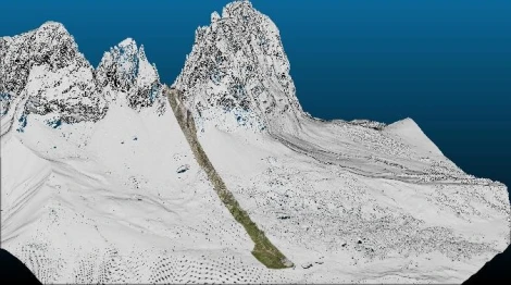
The following project at the Sella Pass in Val Gardena, South Tyrol, was to be implemented for a customer as quickly as possible. The lift route on the Langkofelscharte (2,685m) is approximately 1.4 km and a height difference of 500m. The terrain survey covers about a width of 80m.
» Read MoreNV5 PROVIDES INTEGRATED UAV LIDAR MAPPING SERVICES
Posted by RIEGL on July 22, 2019
One of our well established customers NV5, was featured in an interview with LiDAR News. The article “NV5 Provides Integrated UAV Lidar Mapping Services” was conducted with Lukas Fraser, LiDAR Specialist and Matt O’Brien, UAV Director, at the NV5 office in San Diego, CA.
» Read MoreRIEGL: MOBILE LASER SCANNING THROUGH THE BLUE MOUNTAINS RAIL CORRIDOR
Posted by RIEGL on July 16, 2019
One of our valued RIEGL mobile customers, Michael Finlay who is a Geospatial Engineer with Jacobs, recently shared an amazing railroad video that he worked on with his team.
This project took the RIEGL VMX-450 mobile system scanning through the Blue Mountains rail corridor. The length of the project extended from Springwood to Lithgow to scan some of the most challenging conditions for an MLS system, happening even between the regular train services!
» Read MoreANCIENT LANDFORMS OF THE AUSTRALIAN RAINFOREST REVEALED BY AIRBORNE LIDAR
Posted by RIEGL on May 28, 2019
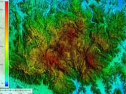
LiDAR remote sensing technology has been used in many archaeological applications around the world, such as finding Mayan pyramids in Central America and trenches dug during an historic siege of Vienna in Austria.
Australia has no pyramids to be discovered, but there are places left where the landforms are all but unknown. LiDAR is ideal to shed light on these areas – literally.
» Read MoreInfrastructure Inspection – UAS Are All Over It
Posted by RIEGL on May 7, 2019
The infrastructure inspection sector has been quick to adopt unmanned aerial systems as a powerful new tool offering new ways to capture and process data and cut costs and safety risks.
» Read MoreLeading Edge Geomatics Leverages Lidar Technology
Posted by RIEGL on May 28, 2019
Leading Edge Geomatics (LEG) was founded in 2008 in Lincoln, New Brunswick, Canada. The founders of LEG have a combined 40 years of practice in the geomatics industry, working on projects throughout North America and internationally in Afghanistan, conducting national level survey projects. LEG offers customized solutions to clients across a number of industries including energy, forestry, mining, and bathymetry.
» Read MorePrecisionHawk Featured on History Channel’s Lost Gold of World War II
Posted by RIEGL on March 27, 2019
One of our authorized ULS distributors, PrecisionHawk, was featured this week on the History Channel’s “Lost Gold of World War II,”, using LiDAR to help find ways into the mountain.
» Read MoreSCRIPPS Institution Scientists Study Imperial Beach As Sea Level Rises
Posted by RIEGL on March 22, 2019
Editor’s Note: One of our RIEGL customers, SCRIPPS Institution, was featured in the local news in San Diego for using their RIEGL VZ-2000 terrestrial laser scanner to help monitor rising sea levels in the Imperial Beach community. Check out the article and video below to learn more about SCRIPPS is using RIEGL terrestrial LiDAR to monitor sea levels and climate change.
» Read MoreNew UAV Partner for RIEGL USA: RIEGL Further Strengthens ULS / UAS Market Presence
Posted by RIEGL on March 19, 2019
With strong support from RIEGL, GreenValley International will further promote RIEGL UAS-based LiDAR innovations. This is accomplished through expanding their unique LiAir series UAS solutions, making use of RIEGL miniVUX-1 or VUX-1 series sensors inside the LiAir 250, LiAir 1000, and LiEagle systems, respectively.
» Read MoreHow PrecisionHawk Helped History Hunt for Buried Treasure in the Philippine Jungle
Posted by RIEGL on March 18, 2019
In a remote region of the Philippines lies a mystery as deep as the jungle it inhabits. Legend has it that, in 1945, Japanese General Tomoyuki Yamashita buried billions worth of stolen treasure in tunnels deep within the jungle, leaving behind only a series of mysterious symbols.
» Read MoreLidar Data Collection for Southwest Florida Water Management District
Posted by RIEGL on February 19, 2019
The Southwest Florida Water Management District has released an fascinating video showing how they collect and use LiDAR data to form their watershed plans. Al Karlin with the Southwest Florida Water Management District explains in this video what LIDAR is and why they choose to use it. Dowe Gallagher Aerospace’s VQ-1560i is featured in this video for data capture.
» Read MoreComplete Mobile Surveying of Amtrak's New York PENN Station
Posted by RIEGL on February 18, 2019
This article was originally posted on LiDAR News and features a mobile surveying project done by HNTB and SSI on Amtrak’s New York Penn Station. This project is one of the first extended mobile LiDAR projects completed underground. Amtrak’s New York Penn Station (NYPS) mobile surveying project was one of the first extended mobile LiDAR projects completed underground. Mobile LiDAR technology was requested to provide a seamless 3D survey data set across the station’s rail infrastructure systems and to locate all visible ancillary features throughout the underground facility where GPS data isn’t available and do so without disrupting passenger train service.
» Read MoreMapping and Monitoring the Carbon Content of Earth’s Forests
Posted by RIEGL on February 16, 2019
Tan Nguyen, Terrestrial Business Development Manager with RIEGL USA, gave a live demonstration today of the RIEGL VZ-400i terrestrial laser scanner in conjunction with a presentation from Laura Duncanson, Assistant Professor at the University of Maryland, on the Global Ecosystems Dynamics Investigation (GEDI) and their contributions to mapping global forest biomass.
» Read MoreNovel Lidar Data Improves Our Understanding of Tropical Forest
Posted by RIEGL on October 11, 2018
Dr. Kim Calders and his team have just completed 2 months of field work in Australian tropical forests collecting both terrestrial and UAS lidar data to support a novel LiDAR data fusion methodology. Forest ecosystems contain more biomass than any other ecosystem. However, estimating biomass without cutting down trees is difficult. Traditional methods of estimating aboveground biomass (ABG) are based on correlations between destructive estimates of volume and diameter and/or height, which can be measured more easily in the field.
» Read MoreSAM, LLC: Using Technology to Enhance Solutions
Posted by RIEGL on September 26, 2018
Editor Note: This article features one of our customers, Surveying and Mapping, LLC (SAM, LLC) and how technology has helped them become the largest geospatial service company in the United States. They utilize RIEGL airborne and unmanned LiDAR sensors and systems as a part of their technology toolbox.
Surveying and Mapping, LLC (SAM) was founded in 1994 with a core guiding principle of leveraging the latest technologies to maximize value for clients. Today, SAM is the largest geospatial service company in the U.S. and has a reputation for being a technology leader in the AEC industry.
» Read MoreDowe Gallagher Adds Textron Cessna Caravan Ex to Lidar Offerings
Posted by RIEGL on September 24, 2018
Editor Note: This article features one of our customers, Surveying and Mapping, LLC (SAM, LLC) and how technology has helped them become the largest geospatial service company in the United States. They utilize RIEGL airborne and unmanned LiDAR sensors and systems as a part of their technology toolbox.
Surveying and Mapping, LLC (SAM) was founded in 1994 with a core guiding principle of leveraging the latest technologies to maximize value for clients. Today, SAM is the largest geospatial service company in the U.S. and has a reputation for being a technology leader in the AEC industry.
» Read MoreDrone LiDAR Components Present Data Quality Challenges
Posted by RIEGL on September 11, 2018
The use of drone LiDAR requires significant training and expertise especially when using inexpensive systems.
(Editor Note – This is a cautionary tale told in the author’s words about the perils of self-proclaimed drone LiDAR experts.)
» Read MoreLiDAR Helps Reveal Lost Roman Road
Posted by RIEGL on August 28, 2018
Analysis of LiDAR and aerial photography, conducted by Historic England for the Secrets of the High Woods Project and commissioned from Fugro BV, has led to the rediscovery of a long-speculated route from Roman times between Chichester and Arundel in England.
» Read MoreThe RIEGL miniVUX-1UAV: Charting the Evolution of RIEGL Sensors and Systems
Posted by RIEGL on June 20, 2018
Jamie Young, Director- Data/LiDAR Services with PrecisionHawk, wrote an article for LiDAR Magazine on the evolution of RIEGL sensors and systems and how PrecisionHawk is utilizing the RIEGL miniVUX-1UAV miniaturized UAV LiDAR sensor to not only meet but exceed their expectations. Read more below or at the LiDAR Magazine website!
Over the last five decades, few can claim to have devoted more to the development of lidar technology than Dr. Johannes Riegl, founder and CEO of the RIEGL group. The miniVUX-1UAV is a recent example of his team’s unique insight and ability. Prior to founding his namesake firm, Dr. Riegl focused on research and development work at the Vienna University of Technology from 1968-78. He started by developing high performance Avalanche Pulse Generators that are in principle still used in thousands of RIEGL instruments today for driving the semiconductor laser transmitter. In this article, I’ve opted to highlight some of RIEGL’s key milestones and innovations that led to the development of the miniVUX-1UAV:
» Read MoreSCANX3D – THE NAME SAYS IT ALL
Posted by RIEGL on June 14, 2018
Editor Note: The original article appears on the LiDAR News website. It is a feature on one of our customers, ScanX3D, who utilize a RIEGL VZ-400i terrestrial laser scanner for a multitude of surveying and building documentation jobs. Read more about the company and the projects they are working on below or at the LiDAR News website!
To many people, selecting a name for their new business can be one of the most important decisions they can make. Company names are a key part of branding, which makes you wonder about some of the big names like Uber, Airbnb and Google; versus Autodesk, Intel and Facebook, for instance. The latter, by the way, was the nickname for the “Photo Address Book” which all students at Phillips Exeter, a prep school in Exeter, NH received when they arrived at school, as did Mark Zuckerberg who spent two years there before moving onto Harvard and well, I think you know the rest of the story.
It certainly seems that ScanX3D also chose an appropriate company name as they are quickly becoming a highly respected player in the 3D laser scanning marketplace. Based in Cromwell, Connecticut, the company has 18 employees who are focused on solving a wide range of customer problems that all have one thing in common: applying LiDAR technology to provide an efficient solution.
» Read MoreDewberry Selected to Update High-Resolution LiDAR for Puerto Rico and U.S. Virgin Islands
Posted by RIEGL on June 12, 2018
Dewberry, a privately held professional services firm, has been selected by the U.S. Geological Survey (USGS) to collect and process Quality level 1 topographic LiDAR data of Puerto Rico and the U.S. Virgin Islands to identify the impact of Category 5 Hurricane Maria, which struck the territories in September 2017.
The firm’s subconsultant, Leading Edge Geomatics, will be performing the LiDAR data acquisition using two RIEGL VQ-1560i dual channel waveform processing airborne LiDAR mapping systems. Dewberry will perform all ground surveys and its geospatial team will complete the processing and creation of digital elevation models and other ancillary products.
» Read MoreNAKANIHON and RIEGL to Give Joint Presentation on Helicopter-based Airborne Bathymetric LiDAR Systems
Posted by RIEGL on June 12, 2018
Nakanihon is a Japanese general aviation company and a long-time valued RIEGL customer with over 40 years of experience in the airborne research and survey field. In 2017, the 5th generation of the helicopter-based airborne LiDAR system, which is referred to as SAKURA (stands for “Cherry Blossom”), was launched.
The 5th SAKURA iteration (called “SAKURA-GH”) utilizes the Airborne Laser Scanning System, the VQ-880-GH, which was developed by RIEGL in the same year, to address the industry’s need for helicopter operations. Find more detailed information on this Waveform-LiDAR system especially designed for helicopter integration and its special features for combined hydrographic and topographic surveying at: www.riegl.com/vq-880-gh
In the presentation, Mr. Wakamatsu will highlight the benefits of helicopter-based airborne bathymetric LiDAR systems in terms of the topographic characteristics of Japan. Additionally, the installation carried out by Nakanihon and the technical realizations of a helicopter integration will be covered. Preliminary data examples and results will also be discussed.
» Read MoreGPI Geospatial Purchases RIEGL VQ-1560i Ultra High Performance Airborne LiDAR System!
Posted by RIEGL on May 7, 2018
RIEGL is pleased to announce that GPI Geospatial, Inc. has purchased the VQ-1560i ultra high performance airborne LiDAR system!
GPI, an established user of RIEGL airborne, mobile, and terrestrial sensors and systems, has chosen to add the VQ-1560i to their toolbox of advanced digital sensors to further expand their capabilities. As a highly progressive company that uses proven technologies to satisfy their client’s needs, this cutting edge RIEGL airborne sensor will further allow GPI to provide advanced mapping solutions to meet and exceed their client’s expectations.
» Read MoreQuantum Spatial - Setting the Standard
Posted by RIEGL on April 4, 2018
Russ Faux is currently Sr. Vice President for Growth Initiatives at Quantum Spatial, Inc. He has spent most of his 30-year career working with some form of airborne remote sensing and geospatial technologies. In 1998, he founded a small remote sensing company named Watershed Sciences, Inc. (WSI) that focused on water resource applications using thermal infrared imagery and newly emerging digital cameras.
Russ recalls, “WSI purchased its first airborne LiDAR sensor in 2003 after recognizing the tremendous potential the technology offered to the natural resource and engineering communities. WSI introduced 3D laser scanning to many clients that quickly included the Puget Sound and Oregon LiDAR Consortiums.”
» Read MoreGeodynamics Honored at Esri Federal GIS Conference for Excellence in Location Intelligence
Posted by RIEGL on March 21, 2018
Geodynamics, a RIEGL customer, won the Collaboration Partner of the Year award for the Federal Small Business Specialty at the 2018 Esri Federal GIS conference last night!
This award recognizes companies that use Esri’s technology to help the U.S. government run more efficiently and transparently through innovation.
Geodynamics, utilizing a RIEGL VZ-400i laser scanner, is a woman-owned small business providing state-of-the-art coastal and ocean mapping and geospatial analysis to the private, governmental, and academic sectors for engineering and natural resource management.
» Read MoreSSI: INVESTING IN 3D TECHNOLOGY
Posted by RIEGL on March 12, 2018
Editor Note: One of our customers, Surveying Solutions, Inc., is currently being featured on LiDAR News. Check out the post below or at the LiDAR News website to learn more about SSI and the fantastic projects they’re doing with RIEGL LiDAR!
Andrew Semenchuk was an early adopter of laser scanning technology. As a professional surveyor, licensed in multiple states, he has over twenty years of experience in the transportation industry. Andy served for 15 years in state government and held the position of Automation Specialist where he was responsible for developing and successfully operating the first statewide CORS network and the purchase of the Michigan DOT’s first terrestrial LiDAR unit in 2000.
Andy served as the Supervising Surveyor for the Michigan DOT until he decided to further his career on the private sector side, later joining forces with Surveying Solutions, Inc (SSI). SSI was founded in 2001 and now has four offices in Michigan. SSI provides a variety of geospatial services and technology to solve their client’s problems nationwide.
» Read MoreESP ASSOCIATES, P.A. USING THEIR RIEGL VMX-1HA FOR ROAD SURVEYING IN LOUISIANA
Posted by RIEGL on February 27, 2018
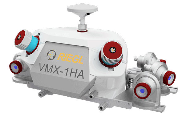
ESP Associates, P.A. took delivery of their RIEGL VMX-1HA high speed, high performance dual scanner mobile mapping system and immediately put it to work!
ESP took their scanner up to Baton Rouge, Louisiana to work on the LaDOTD 1-10 widening project with NTB Associates. Utilizing the VMX-1HA hardware and RIEGL software suite to scan and survey the roads allows the state of Louisiana to save money by reducing the number of crews needed, reduces the need for road closures as the crew can scan while driving at highway speeds, and increases safety for both the surveying crews, as well as the drivers on the road.
“The functionality and ability to see the data collected in RiACQUIRE makes managing the data capture of a large-scale project such as this one in Baton Rouge very easy. My team was able to assess the project’s needs, see our coverage and review the records to ensure the completeness of the collection mission. The new automated target detection functions in RiPROCESS ensures that tie objects are accurately placed, making point cloud registration much more streamlined.” said Ryan Swingley, P.S., Geospatial Manager with ESP Associates, P.A.
» Read MoreUAS-BORNE LIDAR FOR MAPPING COMPLEX TERRAIN AND VEGETATION STRUCTURE
Posted by RIEGL on January 11, 2018
GIM International has posted a new article featuring a project done using the RIEGL RiCOPTER remotely piloted aircraft system and RIEGL VUX-1UAV lightweight UAV laser scanner for mapping complex terrain and vegetation structure.
The article, written by Dr. Gottfried Mandelburger, Philipp Glira, and Norbert Pfeifer of TU Wien, conducted an experiment with the RIEGL RiCOPTER and RIEGL VUX-1UAV to test the potential of UAS-borne laser scanning for 3D mapping of complex natural landscapes in high resolution.
“The field experiment employing the RIEGL VUX sensor system mounted on the RiCOPTER UAS provided a homogeneous, ultra-high-resolution 3D point cloud of a complex alluvial area comprising both topography and vegetation. With a point density of more than 1,500 points/m2, a vertical strip-fitting precision of less than 2cm and a comprehensive 3D capturing of the terrain shape and vegetation structure, the experiment demonstrated the high potential of UAS-borne laser scanning for different environmental sciences and applications.”
» Read MoreRIEGL Partner Spotlight: Phoenix LiDAR
Posted by RIEGL on January 8, 2018
GIM International has posted a new article featuring a project done using the RIEGL RiCOPTER remotely piloted aircraft system and RIEGL VUX-1UAV lightweight UAV laser scanner for mapping complex terrain and vegetation structure.
The article, written by Dr. Gottfried Mandelburger, Philipp Glira, and Norbert Pfeifer of TU Wien, conducted an experiment with the RIEGL RiCOPTER and RIEGL VUX-1UAV to test the potential of UAS-borne laser scanning for 3D mapping of complex natural landscapes in high resolution.
“The field experiment employing the RIEGL VUX sensor system mounted on the RiCOPTER UAS provided a homogeneous, ultra-high-resolution 3D point cloud of a complex alluvial area comprising both topography and vegetation. With a point density of more than 1,500 points/m2, a vertical strip-fitting precision of less than 2cm and a comprehensive 3D capturing of the terrain shape and vegetation structure, the experiment demonstrated the high potential of UAS-borne laser scanning for different environmental sciences and applications.”
» Read MoreUnderground Cave Scanning Using the RIEGL VZ-400i Terrestrial Laser Scanner!
Posted by RIEGL on December 6, 2017
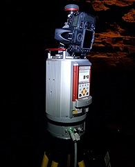
We have a new video up on the RIEGL YouTube featuring the VZ-400i ultra high performance 3D laser scanner and its outstanding qualities of capturing underground data for large areas!
To showcase the outstanding qualities of the RIEGL VZ-400i for underground data acquisition of large areas, a special 3D laser scanning project was executed in the summer of 2017.
Data of the famous Eisriesenwelt, a cave labyrinth with a total length of more than 40 kilometers in Werfen, Austria, was captured in 370 scan positions within two days.
Only four hours were necessary for registration and post processing of the data. Based on RIEGL‘s Waveform-LiDAR technology, additional scan data attributes are provided with each measurement. Using the reflectance value -for example- allows surface material detection and e.g. visualization of all surfaces covered with ice.
» Read MoreGEOLOGIST WILL UPGRADE MONITORING OF GREENLAND GLACIER CRITICAL TO SEA-LEVEL RISE
Posted by RIEGL on November 30, 2017
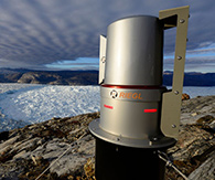
Leigh Stearns, a geologist with the University of Kansas, is working with a RIEGL VZ-6000 ultra long range terrestrial laser scanner, incorporated into an ATLAS (Autonomous Terrestrial Laser Scanning) system to monitor rates of ice loss on the Helheim Glacier, a tidewater glacier undergoing large-scale changes due to global climate change.
RIEGL VZ-6000 Ultra Long Range Terrestrial Laser Scanner
“LiDAR is an emerging technology for the earth sciences because it produces an incredibly detailed 3-D view of features,” said the KU researcher. “Repeat LiDAR scanning reveals small-scale changes with very high precision. These systems are now used to measure how bridges are sagging, how tectonic faults propagate and now how glaciers flow. The ATLAS systems are unique because they’re designed to scan the glacier terminus every six hours, year-round. That’s not a trivial task when there’s no sunlight in the winter, winds are high and it’s very cold.”
RIEGL HELPS SAM O. HIROTA DEVELOP COMPETITIVE ADVANTAGE
Posted by RIEGL on November 29, 2017
Gene Roe from LiDAR News has done a fantastic write-up on Sam O. Hirota, Inc., their use of RIEGL laser scanning equipment, and how their use of RIEGL Smart-Waveform technology gives them a competitive advantage in the field.
Dr. Hirota explained, “When you purchase highly technical equipment that is sometimes in the early development phases, you evaluate as many of the current products as possible. A small company like ours cannot afford to make purchase mistakes. You need to have confidence in the quality of design, manufacture, software and maintenance.
All RIEGL hardware is designed and assembled to the highest possible quality and reliability standards. The software is designed to be used specifically with the hardware.” Dr. Hirota recalls, “On a visit to the RIEGL factory, I saw printed circuit boards being assembled, systems integrated and tested. I knew that these were quality measurement products that would work in the field for a long time.”
» Read MoreCUSTOMER SPOTLIGHT: AMERICAN ENGINEERS, INC.
Posted by RIEGL on November 15, 2017
This customer spotlight features American Engineers, Inc., headquartered in Glasgow, Kentucky, and their work with the RIEGL VZ-400 terrestrial laser scanner. We hope that you enjoy this fascinating look into their company and the work they do!
American Engineers, Inc. (AEI) is a full-service, award-winning, surveying and mapping firm established more than thirty-five years ago headquartered in Glasgow, Kentucky with 2 additional locations in Kentucky (Louisville and Owensboro) and one in Georgia.
AEI is committed to staying ahead of the technology wave and has added RIEGL LiDAR to complement their traditional boundary, topographic, and land title survey capabilities. They are confident in the level of accuracy RIEGL LiDAR provides and that translates from their surveyors to their engineers and ultimately to the quality of the designs they deliver.
» Read MoreTulloch Mapping Purchases the FIRST RIEGL VMX-2HA!
Posted by RIEGL on October 24, 2017
RIEGL is pleased to announce that Tulloch Mapping, based in Canada, has become the first company in the world to purchase the RIEGL VMX-2HA high speed, high performance dual scanner mobile mapping system!
Tulloch Mapping was one of the early adopters of RIEGL’s VMX system and technology, purchasing a VMX-250 in 2011. Since that time, the company has deployed the unit on hundreds of projects throughout North America, with outstanding results across the board. It was natural then, for the firm to explore the option of purchasing a next generation VMX system when the time was right. After seeing the VMX-1HA system in action and evaluating results, Tulloch decided a VMX-HA series system would enhance their survey and mapping offering, and decided to proceed with the purchase of a new system in September 2017.
“We are excited to announce our first customer for the RIEGL VMX-2HA only weeks after introduction at INTERGEO. Tulloch has helped grow the mobile mapping market by providing excellent data to their clients. We are thrilled to continue working with such an innovative company like Tulloch.” said Joshua France, Mobile Systems Segment Manager of RIEGL USA.
» Read MoreChustz Surveying Drone + LiDAR
Posted by RIEGL on October 2, 2017
One of our customers, Chustz Surveying, has posted a fantastic video on YouTube highlighting a corridor survey of a 3-mile US Army Corps of Engineers levee project.
This project was done with their RIEGL RiCOPTER with VUX-SYS (VUX-1UAV, 2x Sony A6000 cameras, Applanix AP20 IMU). The data was processed using RiPROCESS, Global Mapper, and ArcGIS.
With the data captured and processed in-house, this allows for a quick turn-around time and reduces the risk of data compromise.
Check out the video below and check out details on the project HERE
» Read MoreRIEGL Scanners Used for Collision Investigation in Australia
Posted by RIEGL on September 14, 2017
After serious road traffic collisions, it is standard practice to accurately document forensic evidence in an objective and timely manner. This evidence recovery process can be stressful and time-consuming, especially in conditions where hundreds or thousands of vehicles are lined up and waiting.
The Victoria police force, Australia, are using two RIEGL VZ-400i terrestrial laser scanners with Nikon D810 cameras to measure and map fatal collision scenes throughout Victoria with millimeter accuracy in less than half the time. They have been using their new scanners since March 2017.
Victoria police benefitted from the extensive experience RIEGL has gathered with numerous police forces around the world, including the Met Police in the UK. These experiences have resulted in a tailored, extremely fast, and easy-to-use field to office workflow that is unmatched in the industry, making the RIEGL VZ-400i the premiere choice for investigators worldwide.
The New South Wales police force are also utilizing a RIEGL VZ-400i for collision investigation in their state.
» Read MoreRIEGL IS MAKING THE DIFFERENCE – INTERVIEW WITH KIEWIT CORPORATION'S JONATHAN BEATY
Posted by RIEGL on August 29, 2017
Gene Roe from LiDAR News interviewed Jonathan Beaty, Field Inspection Services Manager, from Kiewit Corporation.
» Read MoreCCLD Takes Delivery of the RIEGL VUX-SYS!
Posted by RIEGL on August 22, 2017
CCLD Technologies Inc., headquartered just north of Atlanta, Georgia, has taken delivery of the RIEGL VUX-SYS for unmanned applications!
The RIEGL VUX-SYS is comprised of a VUX-1UAV with an Applanix AP20 integrated with CCLD’s DJI M600 Pro.
The VUX-SYS is a completely integrated laser scanning system of low weight and compact size to meet the challenges of emerging survey solutions by UAS/UAV/RPAS both in measurement performance as well as in system integration.
The excellent measurement performance of the VUX-1UAV, in combination with the precise inertial measurement unit and the associated GPS/GLONASS receiver results in survey-grade measurement accuracy.
» Read MoreNSS and the RIEGL VZ-400i in Australia!
Posted by RIEGL on August 17, 2017
National Survey Solutions (NSS), formerly known as Northern Surveying Services, have been in the surveying and construction industry for over 40 years.
Based in Tasmania, Australia, NSS has typically been involved in large civil construction projects across the state.
NSS has always invested in state of the art equipment and 3D laser scanners have been no exception.
When Rod Brumby, Registered Land Surveyor and 3D Scanning Specialist previously from Sinclair Knight Merz, joined NSS in early 2014, he had seen the benefits of 3D laser scanning and its deliverables for many years. Since then, NSS have been carrying out many 3D scanning projects across Tasmania and the East Coast of Australia.
» Read MoreInvesting in Airborne LiDAR
Posted by RIEGL on August 10, 2017
Gene Roe from LiDAR News did a fantastic write-up on SurvTech Solutions and their use of the RIEGL LMS-Q1560 for airborne laser scanning!
“Since the RIEGL LMS-Q1560 has the capacity to collect full waveform data, we are investing in R&D efforts to take advantage of this capability in order to benefit our clients and provide a more complete three-dimensional description of the point cloud data, specifically within the vegetation canopy” said Carlos
» Read MoreCustomer Spotlight: Maser Consulting, P.A.
Posted by RIEGL on August 1, 2017
This customer spotlight focuses on Maser Consulting, P.A. and their use of RIEGL mobile and unmanned LiDAR solutions. Enjoy this customer spotlight!
Maser Consulting P.A., an industry forerunner in LiDAR data acquisition, is a privately owned, multi-discipline, engineering firm with a unique balance of public and private sector experience. As trusted advisors to their clients, they offer comprehensive consulting services, cultivate opportunities for strategic and sustainable growth and embrace leading-edge technologies. Committed to providing professional services with superior value and responsiveness, their culture of excellence is promoted through advancing staff development, fostering a safe work environment, and creating a rewarding team atmosphere.
Maser Consulting has always been a progressive firm looking to harness the power of technology. Their survey team saw LiDAR as a competitive advantage early on and a technology that would stimulate growth in new industries.
» Read MoreNo Ordinary View: Mathias Disney
Posted by RIEGL on July 19, 2017
Dr. Mathias (Mat) Disney is a Reader in Remote Sensing in the UCL Department of Geography and member of the Environmental Monitoring and Modelling Group. Dr. Disney has been kind enough to allow us to guest post one of his blogs featuring RIEGL VZ terrestrial laser scan data. You can contact Dr. Disney at his webpage or his Twitter. Visit his blog at http://disneytls.blogspot.com/! Enjoy!
Phil and I (and my put-upon son, on his birthday no less) spent a day last week scanning part of the Queen Elizabeth Olympic Park, to characterise the 3D structure of the vegetation in the park. The park is a legacy of the 2012 Olympics, and provides the first new parkland in London in over a century. Extensive landscaping has resulted in “…. over 35km of pathways and cycleways, 6.5km of waterways, over 100 hectares (ha) of land capable of designation as Metropolitan Open Land, 45ha of Biodiversity Action Plan Habitat, 4000 trees, playgrounds and a Park suitable for year-round events and sporting activities.” (Legacy Communities SchemeBiodiversity Action Plan 2014-2019, LCS-GLB-S106-APP-BAP-001-V01, 2013). UCL has ambitious plans for expansion into UCL East. As part of this, our colleague Prof. Kate Jones and her team have been doing some amazing work using in situ sensors to map bat populations in the area, in real time. See more details of the project here.
» Read MoreCustomer Spotlight: SSI
Posted by RIEGL on July 11, 2017
This customer spotlight features SSI and their use of RIEGL mobile LiDAR systems. Enjoy!
As an industry leader, SSI has remained committed to investing in both their people and their technology. Their talented staff understands that successful projects are a result of providing clients with the tools and innovative solutions to get projects done Better, Smarter, Faster, and Safer: That is the SSI Advantage.
For over fifteen years, that philosophy, combined with the very latest in geospatial technology, has allowed SSI to provide clients with a comprehensive range of services and solutions to help them make the most accurate and informed decisions.
Choosing to use RIEGL LIDAR was SSI simply responding to their clients’ needs. There was a demand for highly accurate datasets to be acquired and delivered faster and more efficiently. Mobile LiDAR accomplished that goal while also providing an array of additional benefits.
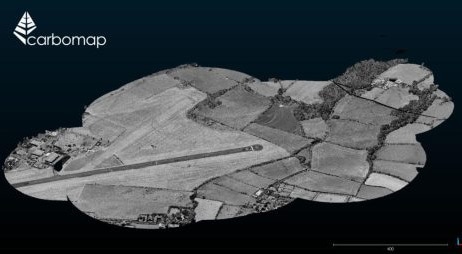
» Read MoreCarbomap Ready to Map the World with Advanced LiDAR on Fixed-Wing UAV
Posted by RIEGL on July 7, 2017
Carbomap Ready to Map the World with Advanced LiDAR on Fixed-Wing UAV
Carbomap, an environmental survey company, in collaboration with high performance LiDAR manufacturer RIEGL, UAVE and The University of Edinburgh, today announced the first successful demonstration flight of a RIEGL VUX-1LR survey-grade waveform laser scanner on a fixed wing, long range unmanned aerial vehicle (UAV). This is likely the first time that such a high-performance scanner has ever flown on a fixed wing UAV with such an advanced specification for long duration (8 hrs) and long range (1,000 km).
With centimetre-scale 3-dimensional accuracy, this breakthrough development will greatly increase the worldwide accessibility to high quality laser scanning (known as LiDAR). Throughout the world, LiDAR data is used for mapping infrastructure, conducting forest inventory, and determining flood risk in river basins, for example. However, obtaining such high quality 3D data can be very expensive to obtain using conventional airborne surveys. It is difficult to process without specialised software, and as a consequence, it is rarely available in most developing nations. By bringing such instruments together into a single UAV system (named Forest-Lux or F-Lux, for short), together with its own solution-focused software, it is now possible to get a system that can be a local asset, under local stakeholder control, and be operated at an affordable price in any country in the world.
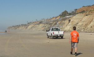
» Read MoreCustomer Spotlight: Scripps Institution of Oceanography at University of California San Diego
Posted by RIEGL on June 28, 2017
This customer features the Scripps Institution of Oceanography at University of California San Diego and their use of the RIEGL VMZ-2000 hybrid mobile laser mapping system to study coastal erosion. Enjoy!
Scripps Institution of Oceanography at University of California San Diego is one of the oldest, largest, and most important centers for ocean, earth, and atmospheric science research in the world.
The Scripps mission is to seek, teach, and communicate scientific understanding of the oceans, atmosphere, Earth, and other planets for the benefit of society and the environment.
Scripps scientists and engineers are using the RIEGL VMZ-2000 hybrid mobile laser mapping system to study coastal erosion. The VMZ-2000 was selected for high performance and good value, and is performing up to expectations.
» Read MoreCPE Tecnologia Seminars in Brazil!
Posted by RIEGL on June 20, 2017
RIEGL distribution partner for Brazil, CPE Tecnologia, has been and is hosting seminars in this summer!
The first seminar took place on June 8, 2017 in Belo Horizonte at Federal University of Minas Gerais (UFMG). Over sixty-five participants were in attendance to see the RIEGL VMQ-1HA high speed, single scanner mobile mapping system in action! The RIEGL VMQ-1HA is a compact, economically priced, high speed single scanner mobile mapping system, well suited for a variety of mobile mapping applications.
During the seminar, the attendees were shown the functionality of the system, applications it can be used for, how the system is mounted and operated in the field, as well as case studies comparing the productivity and data quality between the VMQ-1HA and traditional methods used in Brazil.
» Read MoreMASER CONSULTING P.A. HIRES CHRISTOPHER M. SIEBERN AS SENIOR GEOSPATIAL SURVEY MANAGER
Posted by RIEGL on June 13, 2017
Maser Consulting P.A., a national multidiscipline consulting and engineering design firm is pleased to announce Christopher M. Siebern has joined the team as a Senior Survey Manager with the Geospatial service division.
Maser Consulting has been expanding its geospatial survey services, having added a new Unmanned Aerial System (UAS) service and most recently a second RIEGL mobile mapper which adds to the versatility and quantity of the department’s workload. These exciting new investments have enabled the firm to stay ahead of the industry curve and continue moving its services forward.
“The rapid pace of our firm’s growth in geospatial technology has resulted in an increase in LiDAR field teams”, explained Leonardo E. Ponzio, Executive Vice President and COO of Maser Consulting. “Chris was hired in a unique capacity to gain efficiencies in the workflow, moving raw field data through the process in the office, and performing analytics to ensure the highest level of accuracy is maintained.”
» Read MorePushing LiDAR to the Limits
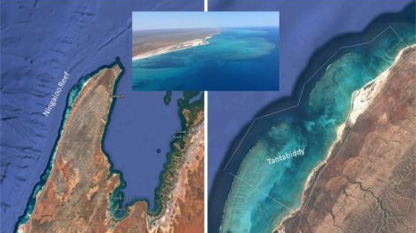
Posted by RIEGL on June 7, 2017
High-resolution Bathymetric Lidar from Slow-flying Aircraft
Airborne bathymetric Lidar is an ideal tool to study underwater features in the usually rather clear waters along the coast of Australia. Due to the remoteness of many of the continent’s coastlines, this is often the only economically viable option for large-scale bathymetric mapping at high resolution. A new toolkit consisting of two airborne Lidar systems flown on a small and slow-flying research motorglider was trialled in NW Western Australia.
The same technology will be used over the next three years in the context of a comprehensive study of submerged archaeological landscapes of the so-called ‘Sea Country’, more than 1,000km along the NW Western Australian coast.
» Read MoreQuantum Spatial Continues to Explore Innovative Solutions for Riverine Mapping with RIEGL
Posted by RIEGL on June 6, 2017
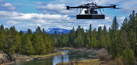
Teaming with experts from LiDAR manufacturer RIEGL, Quantum Spatial, Inc. was recently involved in an exciting new test of RIEGL’s newest sUAS technology innovation for hydrographic applications – the RIEGL BathyCopter – on three different stream restoration sites in Oregon. The BathyCopter is a unique, small unmanned aerial system (sUAS) equipped with a green wavelength laser designed for generating depth profiles of inland rivers and lakes.
Companion flights were conducted using the popular RIEGL VUX-1 survey grade sensor to collect highly detailed terrestrial data within the immediate riparian zone. This sensor combination allowed our team to create a seamless 3D topographic and bathymetric surface model for each site in amazingly high resolution. The goal was to evaluate the BathyCopter’s performance and practicality in providing baseline elevation data to support hydrologic and hydraulic (H&H) modeling, habitat assessments, and other riverine applications. The series of sUAS missions was successfully conducted over three days and included involvement of several Quantum Spatial client stakeholders. This project illustrates QSI’s commitment to providing new and innovative solutions for clients in need of detailed mapping of inland waters. Quantum Spatial and RIEGL will present the preliminary results of these missions at the 18th Annual JALBTCX Airborne Coastal Mapping and Charting Technical Workshop in Savannah, GA on June 7, at 3:30pm.
» Read MoreSwiss-Based UAV Pioneer Aeroscout Introduced its New Scout B-330 UAV Helicopter at AUVSI XPONENTIAL
Posted by RIEGL on May 24, 2017
Aeroscout, a long term partner of performance leading LiDAR manufacturer RIEGL, is excited to present the Scout B-330 UAV helicopter, which is built with a high payload capacity of up to 50 kg (110 lbs), a very long flight endurance (at least three hours) and the capability of flying at very high altitudes (up to 3,000m above sea level) in a typical mission scenario. This includes a full autonomous take-off sequence, a mission flight at variable speed, and a landing sequence.
The beautiful Scout B-330 is specifically designed for LiDAR-based powerline mapping missions. It sets a new benchmark in the long endurance UAV class with its combination of flexibility, world-renowned Swiss quality, and very competitive pricing.
» Read MoreAll In A Day's Work
Posted by RIEGL on May 23, 2017
Developments in the field of laser scanners and laser scanning systems have increased in the past few years. Physical size has decreased while performance has increased. The number of laser pulses per second has reached a million and the measurement distance is in the hundreds of metres.
RIEGL has implemented these and other features in a variety of compact, powerful, and precise scanners. Attached IMU/GNSS units, governing control units and optional cameras collect/record a multitude of additional properties during each scan. Due to the straightforward attachment system, a quick and easy installation is possible onto helicopters, vehicles and even UAVs – the modern tools of choice to accurately surveying road infrastructure in the highest possible quality.
» Read MoreDEWBERRY TO COLLECT AND PROCESS LIDAR DATA FOR SOUTHWEST FLORIDA WATER MANAGEMENT DISTRICT
Posted by RIEGL on May 17, 2017
Data will support district’s mission of preserving and protecting water resources for the community in Hillsborough County.
Dewberry has been selected to collect, process, and assess airborne topographic lidar data for Hillsborough County, Florida, covering approximately 1,200 square miles within the Southwest Florida Water Management District (SWFWMD).
Dewberry performed airborne topographic lidar mapping for this project in early 2017 using the new, fully integrated and calibrated Dual Channel Airborne Mapping System, the RIEGL VQ-1560i sensor. The VQ-1560i’s laser pulse repetition rate provides more than 1.3 million measurements per second on the ground and offers data acquisition at a wide range of point densities, making it ideal for aerial surveys of ultra-wide areas and complex urban environments.
» Read MoreThe Diary of LiDAR
Posted by RIEGL on April 12, 2017
Did you know that the RIEGL VZ has now been featured in a comic about LiDAR? Click the link here to check it out!
This amazing comic was done by ERCcOMICS, a creative and ambitious project that exploits the power of visual storytelling to innovate the way European science is communicated.
The content of the comic comes from Ghent University in Belgium where they are using LiDAR for their research in the tropical forests of Panama, Guyana, and Brazil. You can learn more about their projects here!
» Read MoreTerra Drone Corporation Announces New Concept UAV, Terra Powerlifter Series
Posted by RIEGL on March 16, 2017
Terra Drone Corporation has announced the launch of the new ‘Terra Powerlifter’ unmanned aerial vehicle (UAV) series, continuing its focus of bringing the best of Japanese innovation for the benefit of Australia’s agriculture, construction and resource sectors.
Offering up to two hours’ continuous flight time and capable of carrying a heavy payload of up to 10 kilograms (approx 22 pounds), the unique UAV is fully integrated with the world-leading RIEGL LiDAR (light detection and ranging) laser measurement systems for an unsurpassed standard in 3D mapping.
» Read MoreSurveying at the South Pole
Posted by RIEGL on March 7, 2017
In January, Adam LeWinter and Dave Finnegan, U.S. Army Corps of Engineers of the Cold Regions Research and Engineering Laboratory (CRREL), traveled to the Amundsen-Scott South Pole Station to conduct a terrestrial lidar/thermal infrared survey of the elevated station as part of a National Science Foundation-funded project.
They used a Riegl VZ-1000 with integrated InfraTec VarioCAM high-definition thermal camera to capture a three-dimensional thermal map of the building, to assess the building envelope for thermal efficiency.
» Read MoreCustomer Spotlight: US Army Corps of Engineers Cold Regions Research and Engineering Laboratory
Posted by RIEGL on March 1, 2017
Editor’s Note: This customer spotlight features the US Army Corps of Engineers Cold Regions Research and Engineering Laboratory (CRREL) and their creation of a HeliPod system, which utilizes RIEGL airborne scanners to allow for terrain-following surveys in high-relief areas. Enjoy!
he US Army Corps of Engineers Cold Regions Research and Engineering Laboratory (CRREL), in collaboration with the National Center for Airborne Laser Mapping (NCALM), has developed a helicopter pod-based airborne LiDAR system to allow for terrain-following surveys in high-relief areas. The HeliPod System accepts either a RIEGL VQ-480i or VQ-580 scanner, integrated with an iXBlue ATLANS-C IMU and a NexTrack 2 Flight Management System.
» Read MoreRIEGL VZ-4000 Supporting the NASA SnowEx Campaig
Posted by RIEGL on February 16, 2017
Peter Gadomski, of the US Army Corps of Engineers Cold Regions Research and Engineering Laboratory, and Jeffery Deems, of the National Snow and Ice Data Center and the University of Colorado, Boulder, used a RIEGL VZ-4000 TLS in February 2017 to support the NASA SnowEx campaign
The VZ-4000 was used to measure snow depths in the Senator Beck basin in southwestern Colorado, collecting data in areas that are unsafe to sample directly due to avalanche hazard. Two other teams collected TLS data at Grand Mesa, Colorado.
» Read MoreFly Through a Huge Volcanic Cave With These Stunning 3-D Scans
Posted by RIEGL on February 16, 2017
The detailed animations will help NASA scientists figure out how to use natural caves as shelter on future missions to the moon or Mars.
When humans at last reach the surface of Mars, one of the first things they may need to do is dive beneath it.
That’s why a team of NASA researchers gathered in August at Craters of the Moon National Monument in Idaho: The intrepid explorers created the first complete three-dimensional scan of Indian Tunnel, one of the largest and most accessible lava tubes at the monument.
» Read MoreThe VZ-1000 at the South Pole!
Posted by RIEGL on February 9th, 2017
Adam LeWinter and Dave Finnegan (US Army Corps of Engineers Cold Regions Research and Engineering Laboratory) traveled to the Amundsen-Scott South Pole Station to conduct a terrestrial LiDAR/Thermal Infrared survey of the Elevated Station as part of a National Science Foundation funded project.
The system utilizes the Riegl VZ-1000 with integrated InfraTec VarioCAM HD thermal camera to capture a 3-dimensional thermal map of the building, used to assess the building envelope for thermal efficiency. Working in temperatures down to -30 degree C, CRREL designed a heated thermal jacket to keep both scanner and camera warm.
» Read MoreFHP's New Laser Scanner Cuts Down Time at Crash Scene
Posted by RIEGL on January 20, 2017
The RIEGL 3-D laser scanner spins 360 degrees and collects raw data up to 500,000 points per second, using laser and light. (Julie Gargotta, Staff)
It’s a device that’s revolutionizing how local law enforcement investigate crash scenes, and Florida Highway Patrol is only the second state agency in the entire country to use it.
» Read MoreCaltrans Takes Delivery of the RIEGL VMX-1HA
Posted by RIEGL on January 11, 2017
Caltrans, the California state agency responsible for highway, bridge, and rail transportation planning, construction, and maintenance, has taken delivery of the NEW RIEGL VMX-1HA mobile mapping system!
The RIEGL VMX-1HA is a high speed, high performance dual scanner mobile mapping system. It provides industry-leading performance and dense, accurate, and feature-rich data at highway speeds.
» Read MoreResearchers, snow safety experts develop new techniques for mapping snow and avalanches
Posted by RIEGL on January 4, 2017
A researcher prepares to use a laser scanning (lidar) unit to scan snow depth at the Arapahoe Ski Basin Ski area in Keystone, Colorado. Credit: J. Deems, NSIDC/CIRES/CU
In 2014, two Colorado avalanche control workers were whisked to the hospital after an avalauncher accident near the Continental Divide. They had been using the avalauncher, a compressed gas cannon, to shoot small charges into snowy slopes that posed a serious avalanche risk to motorists below.
» Read MoreOHIO SURVEY FIRM ACQUIRES INDUSTRY'S MOST PRODUCTIVE LASER SCANNING SYSTEM
Posted by RIEGL on December 29, 2016
If you have been searching for a 3D laser scanning system that would justify the required six figure investment, then this article is for you.
With over 35 years of experience serving the oil and gas industry in eastern Ohio, David Bodo and Associates, Inc. has built a strong reputation as a traditional, full service 16 – person surveying firm.
» Read MoreNASA Goddard G-LiHT: Images and Articles
Posted by RIEGL on December 13, 2016
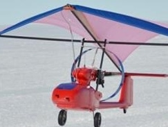
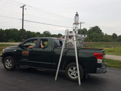
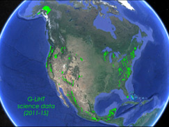
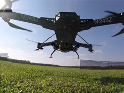
These articles have been provided to us here at RIEGL by NASA Goddard, who are currently utilizing the VQ-480 in their G-LiHT (Goddard’s LiDAR, Hyperspectral, and Thermal) airborne imager.
Please note that “references to any specific commercial products, processes or services or the use of any trade, firm or corporation name are for the information and convenience of the reader and do not constitute endorsement, recommendation or favoring by the US government or National Aeronautics and Space Administration”.
» Read MoreMaser Consulting P.A. Perspective: Mobile LiDAR and data collection
Posted by RIEGL on December 6, 2016
Original article written by Francis Miller III, PE, director of rail engineering services.
Maser Consulting, a forerunner in the industry using Mobile Light Detection and Ranging (Mobile LiDAR), employs the use of Mobile LiDAR, 3D hi-definition laser scanners and other methods to assist in the implementation of PTC.
A PTC system must be able to reliably determine the precise location, direction and speed of trains; warn operators of potential issues; and automatically take immediate action to safely stop a train if an operator does not or cannot respond to the warning provided by the system.
» Read MoreFOCUSED ON 3D
Posted by RIEGL on October 10, 2016
Since its inception in 1995, Chustz Surveying, Inc. has continued to grow through hard work and client satisfaction. They began by providing surveying and mapping services as a sub-contractor for a U.S. Army Corps of Engineers (New Orleans District) project with only a pickup truck and a single boat.
From that point on, Chustz has invested in the most knowledgeable and qualified employees, along with state-of-the-art technology, in order to assure the highest caliber of service. This has allowed them to expand into other surveying areas including hydrographic, GPS, singlebeam and multibeam sonar technology, terrestrial LiDAR acquisition and more recently low altitude, UAS LiDAR acquisition.
» Read MoreCustomer Spotlight: Leading Edge Geomatics
Posted by RIEGL on September 20, 2016
Leading Edge Geomatics is a New Brunswick based company that provides aerial survey and geomatics services across North America.
To date, they have flown over 100,000 km² of LiDAR data acquisition, and more than 90,000 km² of aerial photography.
Utilizing a fleet of five aircraft and seven digital sensors, including the RIEGL LMS-Q680i, LMS-Q780, and VP-1 airborne systems, Leading Edge offers customized solutions to clients across a number of industries including forestry.
» Read MoreSMALL FIRM – BIG INNOVATIONS
Posted by RIEGL on July 26, 2016
In Airborne, Airborne LiDAR, Airborne LiDAR Suite, Airborne Mapping, ALS, LIDAR, LiDAR News, Mapping, Mining, RIEGL, Riegl Current Events, RIEGL Customers, RIEGL Hardware, Riegl Software, RIEGL USA, Tuck Mapping, Uncategorized.
The Early Days
One of the pioneers in the airborne LiDAR industry is Robert, “Bobby” Tuck. His firm Tuck Mapping Solutions, Inc. is a leader in the use of helicopters and fixed wing aircraft to collect highly accurate LiDAR data for a number of industries.
» Read More3D COMPETITIVE ADVANTAGE
Posted by RIEGL on June 22, 2016
The Firm
Kapur and Associates, is a multi-discipline, consulting engineering firm with four offices in Wisconsin and one in Chicago, Illinois. Founded in 1981, the firm ranges in size from 150 – 200 people and is partially employee owned with approximately 1/3 being involved with survey.
Kapur has been growing steadily over the past couple of years performing heavy construction layout, road topos, DOT work, site survey and energy – related projects, not just in the Midwest, but all over the country. In addition, they have become known for their 3D laser scanning capability. Here’s some insight in how they were able to accomplish that.
» Read MoreMERGING TERRESTRIAL AND HYDROGRAPHIC SCANNING
Posted by RIEGL on June 7, 2016
Back in the late 1980’s John F. Sawyer saw the need for a surveying services company that could provide accurate hydrographic surveying and quantity calculations. Mr. Sawyer had a background in dredging and in 1989 Arc Surveying and Mapping (Arc) was born. The company is family – owned and operated with three brothers running the day – to – day operations.
A good portion of their work is hydrographic – related. They perform work in all of the Caribbean Islands and have completed projects from Panama to New York. Arc currently has a main office in Jacksonville, Florida, with satellite offices in Memphis, Tennessee and Melbourne, Florida.
» Read MoreAXIS GeoSpatial Takes Delivery of the RIEGL LMS-Q1560!
Posted by RIEGL on February 2, 2016
RIEGL USA is pleased to announce that AXIS GeoSpatial LLC, through their purchase and delivery of the LMS-Q1560 dual LiDAR channel airborne laser scanning system, has become the latest U.S. based commercial firm to own this sensor, adding to their LiDAR and camera system fleet!
With the addition of the LMS-Q1560 to their fleet, AXIS is empowering their clients with the latest technology to meet their topographic/LiDAR needs, delivering both classified and unclassified Hi-Definition LiDAR datasets to them quickly and efficiently. This cutting-edge system will allow AXIS to fly higher and faster on large scale mapping projects and corridor work, which will provide clients with more dense point clouds, high precision data, faster acquisition, and more responsive service.
» Read MoreRME Geomatics Purchases and Takes Delivery of Two RIEGL VUX-1's in Two Months!
Posted by RIEGL on June 17, 2015
RIEGL USA is excited to announce that RME Geomatics purchased and took delivery of two RIEGL VUX-1 UAS laser scanners in two months!
The addition of the second VUX-1 to RME Geomatics will allow the company to aggressively expand their capacity through the installation of a permanent crew in Calgary. This crew will consolidate and expand the West Coast Canadian operations of RME Geomatics.
RME Geomatics is a subsidized division of a large publically traded company, Rocky Mountain Equipment, and with the influx of projects the company is receiving, the need for the highest quality and best capability is constantly growing. RME’s Renegade™, combined with the RIEGL VUX-1, will allow the company to continue to expand operations while providing the highest quality services to their customers.
» Read MoreNASA's Jet Propulsion Laboratory Recently Deploys the RIEGL LMS-Q1560
Posted by RIEGL on April 7, 2014
RIEGL USA is proud to announce that NASA’s Jet Propulsion Laboratory (JPL) has recently deployed their RIEGL LMS-Q1560 airborne laser scanner system!
NASA JPL is utilizing their RIEGL LMS-Q1560 to more completely and accurately measure snowpack depth of major mountain watersheds. This will be accomplished through the use of innovative airborne LiDAR from RIEGL. NASA JPL’s use of the RIEGL LMS-Q1560 will allow them to better gauge the volume of water that travels down rivers and streams as runoff from snowpack. The data is then made accessible to state officials, water districts, power plant managers, and farmers to alert them to the possibility of flooding and water allocation.
» Read MoreFirst VMX-450-RAIL delivered to SNCF
Posted by RIEGL on September 12, 2013
SNCF, the national French railway society, has taken delivery of a RIEGL VMX-450-RAIL intended for the sole purpose of railway mapping. The complete scanning platform is either installed onto a mounting rack in the rear of a wagon or right into the engine cart.
he main tasks of railway mapping include geo-referencing of railway infrastructure, clearance monitoring in order to detect natural obstacles like vegetation, or determine infrastructural limits for special load transportation. Other applications of railway scanning include track and base terrain inspection, as well as supervision and registration of changes in train station structures, such as thresholds between platform and wagon due to renovation works in train stations. All these different tasks serve the enhancement of railway safety.
» Read MoreAeroMetric-Maser mobile LiDAR
Posted by RIEGL on September 5, 2013
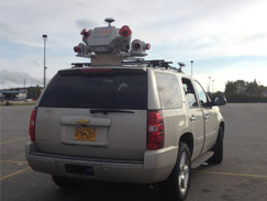
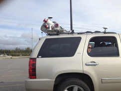
This is a Reigl VMX-450 Mobile LiDAR being used for DOT work in Alaska.
» Read MoreAerial Cartographics of America, Inc. Purchases Riegl VMX 450 Mobile Laser Scanning System
Posted by RIEGL on June 3, 2013
Aerial Cartographics of America, Inc. (ACA) of Orlando, FL in conjunction with its parent company, Greenman-Pedersen, Inc. (GPI), announced today the purchase of a RIEGL VMX 450 Mobile Laser Scanning System. ACA now offers our clients the latest in high accuracy mapping technology, Mobile LiDAR Data Collection, with this system we can capture high-accuracy, high-density range and intensity data as well as digital imagery simultaneously at highway speeds for transportation projects and within navigable waterways and railroad corridors.
The RIEGL VMX scanning system is self-contained and designed to easily transfer between multiple working platforms. These include trucks or SUV’s for transportation project; boats and barges for scanning and mapping structures, bridges, piers, shorelines and coastlines; and high-rail vehicles for precision scanning within railroad corridors. The system’s dual laser scanners send over a million pulses per second and collect 2000-5000 points per square meter, resulting in an extremely dense 3-D point cloud data base providing accurate and detailed as-found conditions of structures and topographic features.
» Read MorePerformance Considerations for Small-Footprint Topobathymetric LiDAR
Posted by RIEGL on April 12, 2013
A new suite of commercial small-footprint, green-wavelength airborne LiDAR systems are being developed to enable topobathymetric mapping in coastal and riverine environments. These sensors can provide seamless topography across the land-water interface at very high spatial resolution (five to six points per square meter).
The new LiDAR systems enable numerous applications in coastal and aquatic ecosystems, including floodplain mapping, fisheries management, marine resource and coral reef ecosystem management, storm surge modeling, and storm damage assessment
» Read MoreRIEGL USA and Maser Consulting Expands Into Mobile Mapping Market with Delivery of RIEGL VMX-450
Posted by RIEGL on April 11, 2013
RIEGL USA continues to set new milestones within the mobile mapping market with their second VMX-450 Mobile Mapping System sale in 2013. Maser Consulting P.A. will be taking delivery of two RIEGL systems: the VMX-450 CS-6 with four cameras and a new dual antenna system, and a VZ-400 Terrestrial Laser Scanner. These systems help satisfy the need for high-quality mapping projects in all of their areas of service.
RIEGL USA is excited to partner with Maser Consulting in this endeavor as this exciting new business opportunity will complete Maser Consulting’s high resolution 3D data acquisition services. Keeping on the leading edge of technology will enable Maser Consulting to continue to introduce new types of projects to mobile mapping services, and to offer their clients high-quality, innovative, and cost effective mapping solutions.
» Read MoreEMC, Inc. Selects State-of-the-Art Complete Mobile Mapping System, the RIEGL VMX-450
Posted by RIEGL on February 12, 2013
RIEGL USA has started off 2013 with a bang by completing its first VMX-450 sale within the first quarter of the year. EMC, Inc. is expanding their line of RIEGL products with this addition of the mobile mapping system to their already established terrestrial and marine LIDAR scanning services. The RIEGL VMX-450 was chosen by EMC, Inc. for its high collection speeds with the highest measurement accuracy and the most comprehensive workflow in the industry.
EMC will utilize their RIEGL VMX-450 for survey and mapping of highways, railways, bridges, and for volumetric surveys. The system is also going to be used for as-built surveying, road and bridge modeling and any civil engineering projects where clients need fast and reliable data.
» Read More

![[SCS] Estadio Nacional LiDAR [SCS] Estadio Nacional LiDAR](/wp-content/uploads/maxresdefault-5.jpg)
