Datasheets
![]() RiCOPTER with VUX-SYS Datasheet (PDF – 1.20MB)
RiCOPTER with VUX-SYS Datasheet (PDF – 1.20MB)
![]() VUX-SYS Datasheet (PDF – 573KB)
VUX-SYS Datasheet (PDF – 573KB)
![]() VUX-1UAV Datasheet (PDF – 647KB)
VUX-1UAV Datasheet (PDF – 647KB)
![]() RIMTA ALS Datasheet (PDF – 336KB)
RIMTA ALS Datasheet (PDF – 336KB)
![]() RiACQUIRE Datasheet (PDF – 487KB)
RiACQUIRE Datasheet (PDF – 487KB)
![]() RiPROCESS Datasheet (PDF – 520KB)
RiPROCESS Datasheet (PDF – 520KB)
![]() RiWORLD Datasheet (PDF – 501KB)
RiWORLD Datasheet (PDF – 501KB)
![]() VZ-400i Datasheet (PDF – 2.58MB)
VZ-400i Datasheet (PDF – 2.58MB)
![]() VZ-400i Infosheet (PDF – 1.70MB)
VZ-400i Infosheet (PDF – 1.70MB)
![]() RiSCAN Pro Datasheet (PDF – 524KB)
RiSCAN Pro Datasheet (PDF – 524KB)
![]() RiSOLVE Datasheet (PDF – 1.73MB)
RiSOLVE Datasheet (PDF – 1.73MB)
![]() RiMTA TLS Datasheet (PDF – 1.04MB)
RiMTA TLS Datasheet (PDF – 1.04MB)
![]() RiDB Datasheet (PDF – 408KB)
RiDB Datasheet (PDF – 408KB)
![]() RiVLib Datasheet (PDF – 117KB)
RiVLib Datasheet (PDF – 117KB)
![]() RiMONITOR Datasheet (PDF – 426KB)
RiMONITOR Datasheet (PDF – 426KB)
![]() RiMINING Datasheet (PDF – 2.98MB)
RiMINING Datasheet (PDF – 2.98MB)
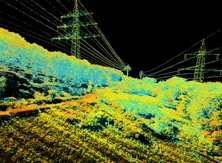
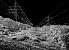
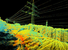
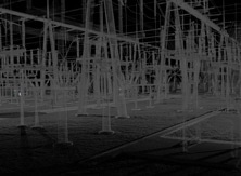
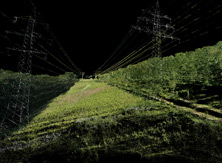
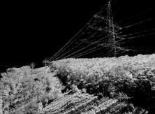
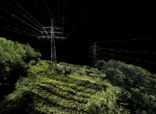
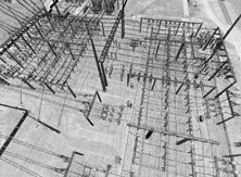
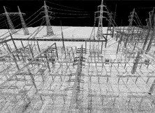
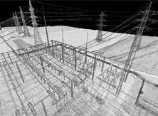
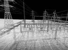
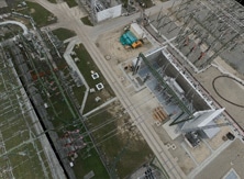
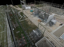
Utilities are an integral part of any nation’s infrastructure. As such, great care needs to be taken to be sure that they are well-maintained. Unfortunately, however, utilities can often be found in difficult-to-reach locations. Traditional airborne acquisition excels at looking at broad swaths of such information. Unmanned and terrestrial systems come in when there are specific areas that are in question and deliver the precision and accuracy needed to correctly assess their condition.
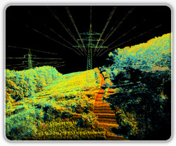
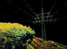
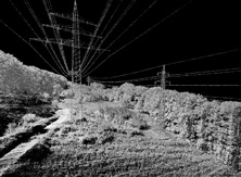
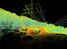
The RIEGL RiCOPTER with VUX-SYS allows for the acquisition of high-accuracy, high-resolution laser scan and image data. The RiCOPTER is the first unmanned aircraft system developed and manufactured by a leading provider of laser scanners and scanning systems and offers the first-class technique and system efficiency that RIEGL is well known for. The VUX-SYS is a complete miniaturized airborne laser scanning solution of low weight and compact size for use in UAS/UAV/RPAS.
The excellent measurement performance of the VUX-1UAV laser scanner, combined into the VUX-SYS with an IMU/GNSS unit, antenna, control unit, and optional digital cameras, and mounted onto the RiCOPTER results in survey grade measurement data accuracy.
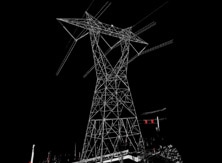
The VZ-400i is a cutting-edge 3D laser scanning system, which combines a future-oriented, innovative new processing architecture and cloud connectivity via WiFi and 3G/4G LTE with RIEGL’s latest laser scanning engine technology. It is the latest advancement in 3D laser scanning technology; an extremely fast field-to-office terrestrial laser scanning solution, which sets the benchmark in 3D laser scanning.
Ultra-high laser pulse repetition rates, long measurement ranges, survey-grade accuracy, and a user-friendly workflow allows extremely fast acquisition of highly informative measurement data in the field. With its advanced processing technology, data acquisition, ease of use, and simultaneous geo-referencing, filtering and analysis become real-time.
![]() RiCOPTER with VUX-SYS Power Line Project (PDF – 693KB)
RiCOPTER with VUX-SYS Power Line Project (PDF – 693KB)


