RIEGL ANNOUNCES NEW PRODUCTS IN THE ALS AND MLS SECTOR!
Posted by RIEGL on March 18, 2021
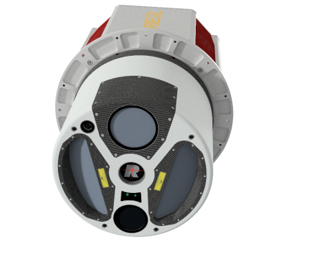
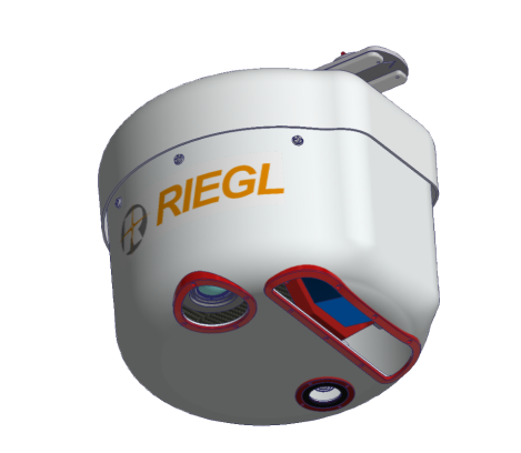
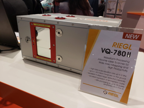
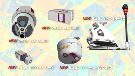
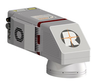
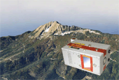
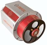
The NEW RIEGL VQ-780 II-S is a high performance, rugged, lightweight, and compact airborne laser scanner with increased laser power. This versatile system is designed for high efficient data acquisition at low, mid, and high altitudes, covering a variety of different airborne laser scanning applications from high density to wide area mapping. The sensor provides up to 1.33 million measurements/sec on the ground, up to 2 MHz PRR, an extremely dense scan pattern, and a wide effective swath width. The VQ-780II-S is designed to work with the latest high-performance INS/GNSS systems, flight management systems, and camera options.
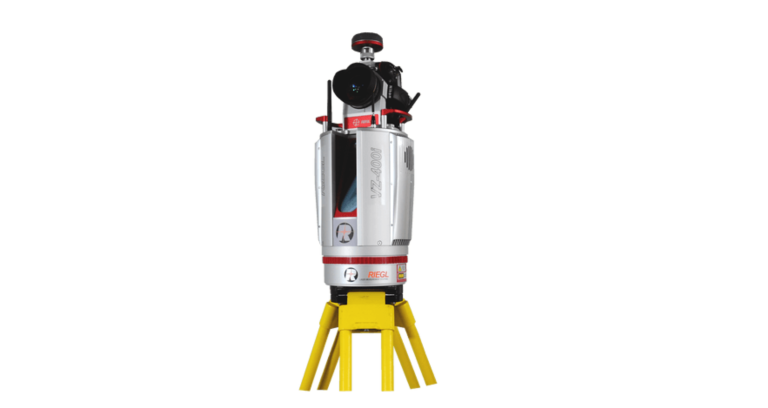
» Read MoreRIEGL RICAST: INCREASING PRODUCTIVITY WITH RIEGL’S VZ-400I ULTIMATE LIDAR SCANNER
Posted by RIEGL on March 11, 2021
Join Claudio Avello, Regional Sales Manager of South America for RIEGL USA, and Ramiro Juan Manuel Cura, Director of Cura & Jordan Engineering in Argentina during this week’s RiCAST. Learn more about Cura & Jordan and how their purchase of the RIEGL VZ-400i modified and improved the survey services and projects they offer to their customers. The two also chat about Cura & Jordan’s approach when offering a LiDAR unit to a customer who is unfamiliar with the technology, along with how they are able compare traditional topography with the RIEGL unit.
» Read MoreSENSING COLLABORATION
Posted by RIEGL on March 10, 2021
When speaking about using RIEGL technology throughout the project, Stuart Drahota of DPR Construction stated, “It’s like they built it future-proof. Just working with them was eye-opening from a technology perspective. We came up with five or six new workflows to utilize the data and do different analysis. They’re really focused on lasers, and they’ve really perfected their craft.”
» Read MoreAS TECHNOLOGY INCREASES, THE NEED FOR SPECIALIZED AIRCRAFT SOLUTIONS FOLLOWS
Posted by RIEGL on March 9, 2021
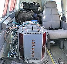
Textron Aviation featured an article on RIEGL’s decision to invest in a CESSNA Turbo STATIONAIR piston (t206H) in order to assist in increasing testing and calibration capabilities of RIEGL’s airborne laser scanning systems.
» Read MoreCOMPREHENSIVE, SCIENTIFIC WORK BY MUNICH UNIVERSITY OF APPLIED SCIENCES BASED ON RIEGL LASER DATA RECORDINGS IN STYRIA
Posted by RIEGL on March 4, 2021
RIEGL made a significant contribution to this work as the high-resolution laser scan data was provided by flying with our DA42 MPP and the VQ-1560i, thanks to the existing RIEGL test site in Styria.
» Read MoreRECORDINGS ARE NOW AVAILABLE FOR THE RIEGL ULTIMATE LIDAR FEBRUARY WEBINAR SERIES!
Posted by RIEGL on March 3, 2021
RIEGL made a significant contribution to this work as the high-resolution laser scan data was provided by flying with our DA42 MPP and the VQ-1560i, thanks to the existing RIEGL test site in Styria.
» Read MoreRIEGL’S ULTIMATE LIDAR WEBINAR SERIES: MARCH 2021
Posted by RIEGL on March 2, 2021
RIEGL will be hosting FREE webinars in the month of March and we have fantastic content lined up for you.
» Read MoreRIEGL RICAST: LIDAR BATHYMETRY – DIVING DEEPER
Posted by RIEGL on Feb 25, 2021
In this week’s RIEGL RiCAST, Michael Sitar, RIEGL USA’s Division Manager of Airborne Laser Scanning is joined by Dr. Martin Pfennigbauer, Director of Research and Intellectual Property at RIEGL Laser Measurement Systems.
» Read MoreRIEGL FEATURED WITH DIAMOND AIRCRAFT IN THE NEWS
Posted by RIEGL on Feb 25, 2021
For nearly 15 years, RIEGL and Diamond Aircraft have established a fruitful relationship, ensuring success for both companies and their esteemed customers by providing a high-performance turnkey airborne mapping system.
» Read MoreFINNISH GEOSPATIAL RESEARCH INSTITUTE ADDS RIEGL VQ-840-G TO THEIR AIRBORNE TOOLBOX
Posted by RIEGL on Feb 23, 2021
Plans to Pair it With Other Sensors to Conduct Research Using Three Wavelengths, and Also Perform Shallow Water Bathymetric Analysis
» Read MoreRIEGL RICAST: DIVING DEEP INTO LIDAR BATHYMETRY
Posted by RIEGL on Feb 18, 2021
RIEGL USA’s Division Manager of Airborne Laser Scanning, Michael Sitar, provides an overview on what bathymetry is and why it is important. Tune in as he discusses the core enabling technologies as well as some advantages and limitations with collecting LiDAR data, along with what government programs within the United States actively use or fund bathymetric data collection.
» Read MoreINTRODUCING ALL-NEW RIEGL RIINFO VIDEOS
Posted by RIEGL on Feb 17, 2021
Next week RIEGL will formally launch an all-new video series, RiINFO, with the release of our first video.
» Read MoreCHARACTERIZING TERMITE MOUNDS IN A TROPICAL SAVANNA WITH UAV LASER SCANNING
Posted by RIEGL on Feb 16, 2021
In 2018, a team of researchers from Ghent University, Wageningen University, the Commonwealth Scientific and Industrial Research Organisation (CSIRO), and the Australian government collected UAS LiDAR data at Litchfield National Park using a RIEGL RiCOPTER, equipped with a RIEGL VUX-1UAV scanner.
» Read MoreRIEGL RICAST: BY LAND AND BY SEA
Posted by RIEGL on Feb 11, 2021
Mr. France has been with RIEGL USA for ten years working in sales and support, and continuously providing solutions to geospatial acquisition challenges. He holds a BS in Aerospace Engineering, specializing in control & dynamics from the University of Cincinnati.
» Read MoreALTO DRONES DELIVERS EXACT MEASUREMENT DATA OF THE WORLD CHAMPION SKI SLOPES WITH THE RIEGL MINIVUX-SYS
Posted by RIEGL on Feb 11, 2021
A long period of preparation is required to stage an alpine event like the FIS Alpine World Ski Championships. With a single goal, the ski slopes will be available to the athletes on day X in the most ideal condition possible for their hunt for medals. In order for this to happen, many highly diverse points have to work together perfectly.
» Read MoreCARTOMORPHOSIS – A FOUR GENERATION SURVEYING EVOLUTION
Posted by RIEGL on Feb 09, 2021
Mr. Audirac shares how his experiences surrounding his family’s business from a young age sparked his passion for mapping. After following his father’s footsteps in studying Computing Systems Engineering, obtaining a master’s degree, and taking a seven-year sabbatical in the telecom industry; Mr. Audirac rejoined the family business, CartoData, under his father’s leadership. CartoData then went on to invest in their first airborne LiDAR system, A RIEGL VQ-480.
» Read MoreRIEGL’S ULTIMATE LIDAR WEBINAR SERIES: FEBRUARY 2021
Posted by RIEGL on Feb 09, 2021
RIEGL will be hosting a FREE webinar in the month of February and we have fantastic content lined up for you.
» Read MoreACCURACIES AMAZE THE EXPERTS TOUGH TEST OF LIDAR SENSORS AND AERIAL PLATFORMS
Posted by RIEGL on Feb 03, 2021
In 2019, NV5 Geospatial professionals, NV5 transportation and unmanned teams, and the Oklahoma Department of Transportation (ODOT), began discussions that led to groundbreaking research into LiDAR performance and accuracy over a two-mile stretch of rural roadway in Oklahoma.
» Read MoreRECORDINGS ARE NOW AVAILABLE FOR THE RIEGL ULTIMATE LIDAR JANUARY WEBINAR SERIES!
Posted by RIEGL on Feb 03, 2021
These recordings will be accessible for you to enjoy for the next month. To access the recordings, please click the image below for the entire January 2021 playlist!
» Read MoreUSING REMOTE SENSING TO PROTECT HISTORIC BUILDINGS IN URBAN CONSTRUCTION ZONES PART II – MAXIMIZING THE VALUE OF THE DATA
Posted by RIEGL on Jan 28, 2021
In addition to the use of hyper-spectral information for historic building preservation during construction, these types of base maps can be used for many other purposes during construction or for further research such as modeling sun/shadows, urban wind patterns, and disaster response planning. The data is a useful tool for public meetings and project websites, helping the community understand the projects being planned.
» Read MoreESTONIAN LAND BOARD USES RIEGL VQ-1560I AIRBORNE LIDAR MAPPING SYSTEM FOR NATIONWIDE COVERAGE
Posted by RIEGL on Jan 25, 2021
The VQ-1560i scanner was acquired because of its high data acquisition capabilities and good scan pattern. This system has enabled to cover the whole country with 2.1 p/m2 elevation data. In urban areas the point density is even higher being at 18 p/m2.
» Read MoreRIEGL RICAST: THE VMX-2HA MOBILE MAPPING SYSTEM
Posted by RIEGL on Jan 21, 2021
Mr. France has been with RIEGL USA for ten years working in sales and support, and continuously providing solutions to geospatial acquisition challenges. He holds a BS in Aerospace Engineering, specializing in control & dynamics from the University of Cincinnati.
» Read MoreRIEGL VZ-I LASER SCANNERS SUPPORT THE STEP TOWARDS THE “REMOTE OPERATED DIGITAL MINE”: EASY-TO-USE, INTUITIVE MINING APPS FOR AUTONOMOUS DATA ACQUISITION AND PROCESSING
Posted by RIEGL on Jan 21, 2021
RIEGL presents three new easy-to-use and intuitive mining apps that will support users in their daily work, especially in critical situations. Based on reliable real-time data, necessary decisions can be made promptly on a sound basis.
» Read MoreBEACONS OF THE PAST
Posted by RIEGL on Jan 20, 2021
GeoConnexion featured an article on the Beacons of the Past (BotP) project. To shed light on the hidden landscapes of the Chiltern Hills in Southern Britain, BotP was initiated by the Chilterns Conservation Board (CCB) and has been investigating the archeology of the Chiltern Hills to unveil the history of this landscape.
» Read MoreUSING REMOTE SENSING TO PROTECT HISTORIC BUILDING IN URBAN CONSTRUCTION ZONES
Posted by RIEGL on Jan 13, 2021
With every new underground urban rail or roadway tunnel, deep foundation shaft for a new building, or even simple streetscape upgrade, historically significant architecture in older city centers can become vulnerable. Earth displacement from settlement and the vibration from heavy equipment can cause costly and sometimes irreparable damage to structures and their aesthetic treatments.
» Read MoreRIEGL’S ULTIMATE LIDAR WEBINAR SERIES AND MORE: JANUARY 2021
Posted by RIEGL on Jan 7, 2021
RIEGL will be hosting a series of FREE webinars into the month of January and we have some fantastic content lined up for you.
» Read MoreA CLASS ACT – CORRIDOR MAPPING WITH NV5 GEOSPATIAL POWERED BY QUANTUM SPATIAL
Posted by RIEGL on Jan 7, 2021
In the first RIEGL RiCAST of the new year, Ryan Lynch of NV5 Geospatial powered by Quantum Spatial, joins Michael Sitar, RIEGL USA’s Airborne Division Manager, to explore corridor surveying and NV5 Geospatial’s latest class act.
» Read MoreAYRES ACQUIRES TRUE VIEW 620 3D IMAGING SYSTEM
Posted by RIEGL on Jan 7, 2021
LiDAR News and Geospatial World released an article that features GeoCue Group and their partnership with the Geospatial Division of consulting firm, Ayres, in their acquisition of a GeoCue True View 620 3D Imaging System (3DIS®).
» Read MoreMANAGING TROPICAL STORM RISK IN FLORIDA
Posted by RIEGL on Jan 5, 2021
xyHt Magazine featured an article by Al Karlin, Keith Patterson and Amar Nayegandhi. The increasing frequency and magnitude of storm events in Florida have had a devastating impact to local communities in recent years.
» Read MoreRIEGL WISHES YOU A MERRY CHRISTMAS AND A HAPPY NEW YEAR!
Posted by RIEGL on Dec 21, 2020
RIEGL’s core Smart-Waveform technologies provide pure digital LiDAR signal processing, unique methodologies for resolving range ambiguities, multiple targets per laser shots, optimum distribution of measurements, calibrated amplitudes and reflectance estimates, as well as the seamless integration and calibration of systems.
» Read More10 YEARS OF MOBILE LASER SCANNING (MLS) AT MCMULLEN NOLAN (MNG) AUSTRALIA
Posted by RIEGL on Dec 18, 2020
The remarkable and innovative, MNG, recently celebrated 10 years of MLS in Australia with a special party for MNG staff and their MLS customers in Perth, Western Australia.
» Read MoreRIEGL RICAST: RIEGL TERRESTRIAL LIDAR IN AN HYDROELECTRICAL POWER PLANT IN BRAZIL
Posted by RIEGL on Dec 17, 2020
Claudio Avello, South America Partner Development Manager for RIEGL’s USA, talks with Rogerio Neves, CEO at CPE Technologia. Rogerio has been working at CPE for over 24 years and is a graduate from the Universidad Federal de Mato Gross in Brazil, where he obtained his degree in Business. He also has a postgraduate degree in International Business from Miami University.
» Read MoreCOMPARING LIDAR SENSOR AND PLATFORM PERFORMANCE FOR TRANSPORTATION
Posted by RIEGL on Dec 16, 2020
Roads & Bridges released an article that features NV5 Geospatial (formerly Quantum Spatial) and their work with the Oklahoma DOT (ODOT), uncovering the unknowns about sensor performance and accuracy in real-world projects for transportation uses.
» Read MoreRIEGL USA HAS RELOCATED
Posted by RIEGL on Dec 15, 2020
RIEGL USA’s new 18,500 square foot facility is located on its own ground of approx. 19 acres at 14707 West Colonial Drive, Winter Garden, a charming city just west of Orlando, Florida.
» Read MoreGEOMETRY BY DESIGN: CONTRIBUTION OF LIDAR TO THE UNDERSTANDING OF SETTLEMENT PATTERNS OF THE MOUND VILLAGES IN SW AMAZONIA
Posted by RIEGL on Dec 14, 2020
The Journal of Computer Applications I Archaeology (JCAA) published a case study authored by Jose Iriarte, Mark Robinson, Jonas de Souza, Antonia Damasceno, Franciele da Silva, Francisco Nakahara, Alceu Ranzi and Luiz Arageo. Research shows that the southern rim of Amazonia was inhabited by societies during the Late Holocene.
» Read MoreRIEGL RICAST: ROAD TRIPS WITH JOSH AND THE VMX, CROSSING INTO TOMORROW
Posted by RIEGL on Dec 14, 2020
Welcome to our first international edition of the popular series “Road Trips with Josh and the VMX”. Today’s journey is off the interstate maps as we travel to the southernmost Polynesian island: New Zealand!
» Read MoreRIEGL ANNOUNCES EXPANSION OF THEIR NETWORK OF DEDICATED RIEGL OFFICES: NEW RIEGL OFFICE IN UK OPENED!
Posted by RIEGL on Dec 10, 2020
RIEGL UK Ltd will have a primary focus on the Terrestrial and UAV sectors, whilst providing initial point of contact for airborne and mobile products into various industries in the market. Working together with the headquarters in Austria, RIEGL UK will ensure all customers have the level of support to match the quality of technology that RIEGL offers.
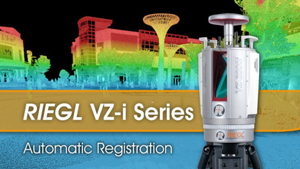
» Read More3D LASER SCAN OF SUPERTREE GROVE AT GARDENS BY THE BAY, SINGAPORE
Posted by RIEGL on Dec 9, 2020
3D Laser Scan of Supertree Grove at Gardens by the Bay, Singapore
» Read MoreSURFACE EXTRACTION AND ANALYSIS FROM RIEGL LASER SCAN DATA
Posted by RIEGL on Dec 8, 2020
With the LIS GeoTec software tool, RIEGL provides a RiSCAN PRO Plugin for geotechnical analysis of scanned rockfaces.
» Read MoreBRET BIENKOWSKI OF TETRA TECH PROVIDES VALUABLE INSIGHTS
Posted by RIEGL on Dec 7, 2020
Lidar News recently published an interview with Mobile Mapping Surveying Manager in LSIT at Tetra Tech, Bret Bienkowski.
» Read MoreTWO COMPANIES, ONE VISION – LIDAR TECH
Posted by RIEGL on Dec 3, 2020
LiDAR News recently published an article that highlights the partnership that has developed over the years between RIEGL and Quantum Spatial (QSI). The team over at QSI, were early adapters of 3D laser scanning/LiDAR technology. They completed their first LiDAR project back in 1995 with an airborne system.
» Read MoreRIEGL RICAST- THE NEW RIEGL VUX-120: YOUR ULTIMATE LIDAR SYSTEM FOR CORRIDOR MAPPING AND UTILITIES
Posted by RIEGL on Dec 3, 2020
In today’s episode of the RIEGL RiCAST, we are excited to share the remarkable features on one of our new products, the RIEGL VUX-120.
» Read MoreRECORDINGS ARE NOW AVAILABLE FOR THE RIEGL ULTIMATE LIDAR NOVEMBER WEBINAR SERIES!
Posted by RIEGL on Dec 2, 2020
Recordings of the RIEGL Ultimate LiDARTM Webinar Series for the month of November are now available!
REMOTE SENSING: ASSESSING REEF ISLAND SENSITIVITY BASED ON LIDAR-DERIVED MORPHOMETRIC INDICATORS
Posted by RIEGL on Dec 1, 2020
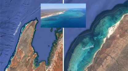
Using both the RIEGL LMS-Q680i-S as well as the RIEGL VQ-820-G; 22 islands along the northwest Western Australia were analyzed to gauge the contemporary geomorphic state, and the potential vulnerability to future erosion.
» Read MoreNEW RIEGL VUX-120 VIDEOS (IN SPANISH AND PORTUGUESE)
Posted by RIEGL on Nov 24, 2020
To better serve our Spanish and Portuguese speaking customers who use LiDAR for unmanned purposes, RIEGL released 2-minute videos featuring the NEW VUX-120. This instrument is small in size, extraordinarily light, suitable for integration into fixed-wing unmanned aerial vehicles and serves as the ultimate solution for low-altitude corridor mapping and complex object modeling.
» Read MoreMANFRED F. BUCHROITHNER, THOMAS GAISECKER: ICE SURFACE CHANGES IN EISRIESENWELT (SALZBURG, AUSTRIA) BASED ON LIDAR MEASUREMENTS BETWEEN 2017 AND 2020
Posted by RIEGL on Nov 23, 2020
Die Höhle, the official publication of the Austrian Speleological Association, published the scientific paper authored by Professor Manfred F. Buchroithner, Institute of Cartography, Technical University Dresden, Germany and Thomas Gaiseck, RIEGL Laser Measurement Systems GmBH. The scientific paper examines ice surface changes using LiDAR in the show cave part of Eisriesenwelt, one of the largest ice caves on Earth. Areal and mass-related comparisons of the ice cover were carried out over a three-year period in 2017, 2019 and 2020 using a RIEGL VZ-400i. The article gives insight on the results and shows detailed three-dimensional visualizations concerning the dynamics of the ice surface within the study period.
Die Höhle, the official publication of the Austrian Speleological Association, published the scientific paper authored by Professor Manfred F. Buchroithner, Institute of Cartography, Technical University Dresden, Germany and Thomas Gaiseck, RIEGL Laser Measurement Systems GmBH. The scientific paper examines ice surface changes using LiDAR in the show cave part of Eisriesenwelt, one of the largest ice caves on Earth. Areal and mass-related comparisons of the ice cover were carried out over a three-year period in 2017, 2019 and 2020 using a RIEGL VZ-400i. The article gives insight on the results and shows detailed three-dimensional visualizations concerning the dynamics of the ice surface within the study period.
RIEGL RICAST: RIEGL’S LATEST UAV LIDAR
Posted by RIEGL on Nov 19, 2020
Today, we are joined with My-Linh Truong, RIEGL USA’s ULS & UAS Business Segment Manager, as she provides insight on the RIEGL VUX-120 and miniVUX-3UAV; our new LiDAR sensors that were recently introduced at INTERGEO Digital 2020! These new sensors are the latest additions to our innovative VUX and miniVUX-series.
» Read MoreCASE STUDIES IN THE LAND DOWN UNDER – PART 2 OF 2
Posted by RIEGL on Nov 18, 2020
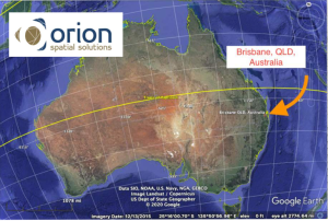
How an Innovative Australian Survey Firm, Orion Spatial Solutions, Used Euclideon’s “udStream” to Store, Share and Work With Big 3D Data on an Urban Transportation System Continuing Contract and Historical Rail Digital-Twin October 2020.
» Read MoreTECHNOTES: CASE STUDY- GEOMONITORING WITH RIEGL VZ-2000I
Posted by RIEGL on Nov 17, 2020
Austria is a small country with a rather high proportion of densely populated space in the alpine terrain. Even within the smallest valleys and at the steepest slopes; settlements and infrastructure, such as roads and railways are present. These settlements have existed for centuries and have been laid out in accordance with the experiences of their inhabitants at the safest possible points. Today, they are protected by structural measures from corresponding dangers, such as rockfall, mudflows and avalanches. In the case of linear infrastructure, not every detail part can be fully protected. Fig. 1 shows a typical mountain landslide as it often occurs after winter.
» Read MoreTECHNOTES: INFLUENCE OF ULS ACQUISITION CHARACTERISTICS ON TREE STEM PARAMETER ESTIMATION
Posted by RIEGL on Nov 16, 2020
Science Direct recently published a scientific journal authored by Moritz Bruggisser, Markus Hollaus, Johannes Otepka and Norbert Pfeifer. The journal goes into technical detail about how LiDAR can automatically detect the positions of tree trunks.
» Read MoreTALKS WITH JAMES: GEOSPATIAL LIDAR 2020
Posted by RIEGL on Nov 12, 2020
TMr. Van Rens is a recognized industry leader in 3D mapping techniques and their applications and lectures extensively to professional and lay audiences alike.
» Read MoreQUANTUM SPATIAL CANADA SUPPORTS DISASTER PREPAREDNESS ON VANCOUVER ISLAND THROUGH LIDAR SURVEY COVERING 9000 SQUARE KILOMETERS
Posted by RIEGL on Nov 11, 2020
GoGeomatics Canada released an article that features Quantum Spatial, an NV5 Geospatial company, announcing their new project to conduct a comprehensive LiDAR and imagery survey of Vancouver Island using a RIEGL VQ-1560i sensor. The goal is to understand coastline changes through creating topographical LiDAR resources in order to inform the region’s development and maintenance work. This project was also supported by Emergency Management BC (EMBC) and the federal government through the National Disaster Mitigation Program (NDMP).
» Read MoreRIEGL 3D VOXEL ANALYSIS MODULE ENABLES SURFACE COMPARISONS IN UNDERGROUND, CAVE, OR TUNNEL ENVIRONMENTS
Posted by RIEGL on Nov 11, 2020
GEOWEEK released an article that discusses the RIEGL “3D Voxel Analysis” software module, available with RIEGL’s RiSCAN PRO. The article goes over RIEGL‘s software for 3D scan data acquisition, registration and post-processing to output deliverables for many different LiDAR applications. This software enables the comparison of a reference data set and allows you to compare the data set while storing the result in a new point attribute. In various applications, the comparison of scan data provides a meaningful representation of the change in values.
» Read MoreCOMMERCIAL DRONE APPLICATIONS ACROSS EUROPE: SURVEYING AND MAPPING INNOVATIONS
Posted by RIEGL on Nov 10, 2020
Establishing and maintaining operations in the midst of COVID-19 has required a new way of thinking about drone technology for many organizations across Europe. This “new normal” when it comes to how drone technology can be adopted is redefining surveying and mapping and positively shaping the future of surveying applications in unexpected ways.
» Read MoreRECORDINGS ARE NOW AVAILABLE FOR THE RIEGL ULTIMATE LIDAR OCTOBER WEBINAR SERIES!
Posted by RIEGL on Nov 10, 2020
RIEGL’s core technology, the digitization of LiDAR signals (“Waveform LiDAR”), provides unique methodologies for resolving range ambiguities, multiple targets per laser shots, optimum distribution of measurements, calibrated amplitudes and reflectance estimates, as well as the seamless integration and calibration of systems.
» Read MoreRIEGL’S ULTIMATE LIDAR WEBINAR SERIES: NOVEMBER 2020
Posted by RIEGL on Nov 5, 2020
We are continuing with our series of FREE Ultimate LiDAR webinars during the month of November 2020 and we have some fantastic content lined up for you this month.
» Read MoreBLAZE NEW TRAILS OF PERFORMANCE; RIEGL’S LATEST AIRBORNE LIDAR SOLUTIONS
Posted by RIEGL on Nov 5, 2020
Our LiDAR expert, Michael, dives into detail on the new products that RIEGL has been manufacturing and innovating over the last 12 months! We are excited to showcase our product announcements, new features, capabilities and in the future, see our customers’ work lives become easier and more productive with their new systems.
» Read MoreGOING TO THE FINNISH LINE
Posted by RIEGL on Nov 4, 2020
In a project of the Finnish RIEGL distribution partner, Nordic Geo Center Oy ( www.geocenter.fi/ ), the RIEGL VMX-2HA mobile mapping system proved that the generated point clouds not only provide very precise measurement results for road pavement analysis but also allow efficient data acquisition and processing.
» Read MoreGPI AND RIEGL: FROM THE GROUND TO THE SKIES
Posted by RIEGL on Nov 3, 2020
GPI Geospatial owns and operates multiple RIEGL LiDAR sensors and systems including multiple VQ-1560 series (VQ-1560i and VQ-1560 II) airborne LiDAR sensors, as well as RIEGL VMX-450 mobile and VZ-400 and VZ-400i terrestrial units.
» Read MoreRIEGL RICAST- “VMX: 10 YEARS OF SUCCESS: EXPANDING THE CAPABILITIES”
Posted by RIEGL on Oct 29, 2020
Mr. Bienkowski is the Mobile Mapping Survey Manager for the Geomatics group with Tetra Tech. He obtained his B.S. degree in Geomatics from the University of Florida. Bret is experienced with surveying involving Light Detection and Ranging (LiDAR), specifically for mobile mapping and Unmanned Aerial Systems (UAS) collection and processing. As a Land-Surveyor-in-Training, he is currently pursuing his Professional Surveying and Mapping License in Florida. He holds his Part 107 Remote Pilot Certificate for UAS systems.
» Read MoreTHE FUTURE OF LIDAR IS CRITICAL TO THE FUTURE OF OUR WORLD
Posted by RIEGL on Oct 28, 2020
GIM International recently released an article written by James Van Rens, Senior Vice President of RIEGL USA. This article discusses how LiDAR technology has evolved over the last few decades, the major growth and development within photonics and the LiDAR industry, introducing A.I in order to increase productivity, and how we are able to use LiDAR technology to save lives!
» Read MoreNEW RIEGL VUX-120 VIDEO AVAILABLE ON YOUTUBE!
Posted by RIEGL on Oct 28, 2020
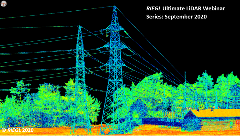
The small-sized and extremely lightweight RIEGL VUX-120 is especially suited for integration to fixed-wing UAVs and the ultimate solution for low-altitude corridor mapping and complex target modeling.
The innovative NFB (Nadir/Forward/Backward) scanning enables reliable data collection also on vertical structures and assets, such as high-voltage transmission towers, building facades or forestry applications.
» Read MoreCASE STUDIES IN THE LAND DOWN UNDER- PART 1 OF 2
Posted by RIEGL on Oct 27, 2020
Part 1 of the article describes Orion’s creation of a base map for a major mining operation. Part 2 will describe continuing services for a major roadway system, and a digital twin of an historical railway workshop. These are all applications where precision LiDAR was collected with RIEGL terrestrial, mobile and/or airborne laser scanners, that was uploaded into udStream by Orion. October 2020
» Read MoreRIEGL LIDAR IN AIRPORT APPLICATIONS: LIDAR DE RIEGL EN APLICACIONES AEROPORTUARIAS
Posted by RIEGL on Oct 22, 2020
GTBi is dedicated to pre-sale, sale, installation, training and maintenance of large format photogrammetry systems and RIEGL’s LiDAR equipment. GTBi additionally serves as our distributor for Colombia. Last year, GTBi joined RIEGL’s distinguished group of worldwide partners in order to further the reach and influence of the RIEGL brand in the Latin American markets. Our distinguished guest today; Salvador is a Geodesta Engineer and Cartographer and he obtained his degree from Polytechnic University of Valencia. He has nearly 25 years of professional experience in the field of geomatics.
» Read MoreCOMPARISON OF 3 LIDAR CAPTURES (ROADWAY) FROM DRONE & ROTARY PLATFORMS, AND AT VARYING ALTITUDES
Posted by RIEGL on Oct 22, 2020
We would like to highlight one of the presentations that was given at INTERGEO Digital 2020 last week by one of RIEGL USA’s long term customers, Quantum Spatial. Please read below to learn more information on their project with the Oklahoma Department of Transportation regarding their accuracy with LiDAR technology in the transportation industry.
» Read MoreRIEGL’S MARKET PRESENCE EXPANDS THROUGH DISTRIBUTION PARTNERSHIP IN MEXICO WITH TTQ DE MONTERREY!
Posted by RIEGL on Oct 21, 2020
Expanding our presence throughout Latin America, RIEGL is excited to welcome TTQ de Monterrey, based out of Mexico, to the growing base of renowned RIEGL distribution partners!
» Read MoreINTERGEO 2020 DIGITAL, OCTOBER 13-15, 2020: RIEGL PRESENTS THEIR NEW PRODUCTS 2020
Posted by RIEGL on Oct 9, 2020
The globally active Austrian laser scanner manufacturer will therefore show at the virtual RIEGL booth and in the online forums of INTERGEO 2020 DIGITAL which new developments in the field of LiDAR surveying technology can be used to further advance the digitization of the world
» Read MoreRIEGL RICAST: RIEGL IS HERE! INTERGEO DIGITAL 2020
Posted by RIEGL on Oct 8, 2020
This episode of RIEGL’s RiCAST “RIEGL is Here! INTERGEO Digital 2020” features for the first time RIEGL USA’s Susan Licari, Sales and Marketing Director and Miranda Welky, Marketing Events Coordinator as they discuss how to access our virtual booth, where to go if you want to have a private chat with our Ultimate LiDAR experts, and our informative presentations!
» Read MoreRECORDINGS ARE NOW AVAILABLE FOR THE RIEGL ULTIMATE LIDAR SEPTEMBER WEBINAR SERIES!
Posted by RIEGL on Oct 6, 2020
Recordings of the RIEGL Ultimate LiDARTM Webinar Series for the month of September are now available!
» Read MoreRIEGL RICAST- “VMX: 10 YEARS OF SUCCESS”: A CLOSER LOOK AT GETTING THE WORK DONE WITH THE VMQ-1HA
Posted by RIEGL on Oct 1, 2020
Welcome to the latest episode of the RIEGL RiCAST, which is the next installation of Joshua France’s “VMX: 10 Years of Success” series with Tim Platz, Vice President and Survey Department Director at Fishbeck.
» Read MoreRIEGL’S ULTIMATE LIDAR WEBINAR SERIES AND MORE: OCTOBER 2020
Posted by RIEGL on Oct 1, 2020
RIEGL will be hosting a series of FREE webinars in October, to reveal our new releases during the week of INTERGEO Digital 2020. Please join us and find out what RIEGL has “Behind the Curtain” with the new developments in the field of LiDAR surveying technology.
» Read MoreRIEGL TO VIRTUALLY ATTEND AND PRESENT AT AUVSI XPONENTIAL 2020!
Posted by RIEGL on Oct 1, 2020
AUVSI XPONENTIAL 2020 is the global stage for everything unmanned — from state-of-the-art propulsion technology, sensors, energy storage and UAS mitigation solutions to what’s coming over the horizon in AI, 5G, edge computing and more.
» Read MoreMOBILE LIDAR SYSTEMS IN COMPARISON
Posted by RIEGL on Sep 30, 2020
LiDAR technology is known for surveying systems and is characterized by specific technological advantages, including speed of data acquisition, independence from ambient light conditions and the ability to detect multiple targets in one direction. This helps to show why it’s the first choice and is the favored surveying technology in the railway sector – not only by means of systems installed on a train but also through mobile laser scanning.
» Read MoreNTERGEO 2020: WE ARE HERE! WIR SIND DABEI!
Posted by RIEGL on Sep 29, 2020
As per tradition, RIEGL will be presenting the latest news and updates concerning Ultimate LiDAR Technology during INTERGEO – make sure to join us at the RIEGL virtual exhibition booth!
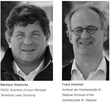
» Read MoreRIEGL RICAST: DIE 3D-VERMESSUNG DES WIENER STEPHANSDOMS (GERMAN) 3D SURVEYING OF THE ST. STEPHEN’S CATHEDRAL VIENNA
Posted by RIEGL on Sep 24, 2020
Learn more about the everyday life of a cathedral construction archivist, the very special tasks, that may occur in the field of preservation and revitalization of such an important cultural jewel, and how laser scanning can support this work.
» Read MoreDIAMOND AIRCRAFT SUCCESSFULLY DELIVERS DA42 MPP GEOSTAR AIRCRAFT TO FLYCOM, CONFIGURED TO HOLD RIEGL LIDAR SENSORS
Posted by RIEGL on Sep 23, 2020
TFlycom Technologies took delivery of a Diamond Aircraft 42 MPP GeoStar Special Mission Aircraft! Diamond ‘s Special Mission Division handed over the aircraft to Flycom and successfully completed the FAT (Factory Acceptance Test) at Diamond’s HQ in Wiener Neustadt, located south of Vienna, Austria. The plane was configured in order to carry various RIEGL LiDAR sensors as well as medium format camera payloads, all installed in the nose pod using the German IGI Flight Management System.
» Read MoreRESEARCHERS IN THE SOUTHERN HEMISPHERE INNOVATE USING LIDAR AND HYPER-SPECTRAL SCANNERS TO DOCUMENT AND HELP RESTORE BURN AREAS
Posted by RIEGL on Sep 22, 2020
Airborne Research Australia (ARA), under the scientific leadership of Dr. Jorg Hacker, is committed to providing the Australian government – as well as affected farmers and firefighters – with a publicly available collection of data from the areas around Adelaide and on Kangaroo Island destroyed by the forest fires of December 2019 and January 2020. The well-founded scientific data, which are recorded with a RIEGL LMS-Q680i-S Airborne Laser Scanner and continuously updated by repeated flights, provide information about the extent of the destruction. But they also show where and how nature is recovering from the catastrophe. This enables those responsible for restoring habitats and economic zones to make their decisions more easily and on a scientific basis.
» Read MoreEVOLUTION OF THE REVOLUTION: INDUSTRY LEADER CONTINUES TO PUSH THE 3D ENVELOPE
Posted by RIEGL on Sep 17, 2020
David Headrick (KCI Technologies, Inc.) certainly has a unique perspective on advanced surveying technologies. David started his career in traditional surveying, but after the Internet Bubble collapsed, he went to law school and practiced construction law for several years. In 2012, Tate Jones, owner of LandAir Surveying (since acquired by KCI) lured him back into the business. Now, David serves in a unique role as business developer, project manager, and general counsel.
» Read MoreRICAST: ARTIFICIAL INTELLIGENCE: A GEOSPATIAL REVOLUTION!
Posted by RIEGL on Sep 17, 2020
Nick Ferguson has led sales, marketing and product teams consulting with geospatial, energy and government organizations throughout the world. Nick holds a BS and MBA from Durham University (UK) and is a Chartered Geographer and Fellow of the Royal Geographical Society.
» Read MoreRIEGL RICAST: SAO PAULO FORESTRY RESTORATION PROJECT
Posted by RIEGL on Sep 10, 2020
Claudio Avello, South America Partner Development Manager for RIEGL USA, talks with Miguel Gerardo Vazquez, the Director of the Brazilian offices for Metro Cubico Engenharia. Miguel has more than 12 years of experience in the LiDAR industry and is a graduate from Universidade de Santiago de Compostela, where he obtained his Cartographic Engineering degree.
» Read MoreRIEGL TO VIRTUALLY EXHIBIT AND PRESENT AT COMMERCIAL UAV EXPO AMERICAS 2020!
Posted by RIEGL on Sep 8, 2020
RIEGL will be participating in the Virtual Exhibit Hall on Wednesday, September 16 and Thursday, September 17 from 9:00 AM-5:00 PDT. During this timeframe, you can visit our virtual booth to learn more about RIEGL and our unmanned offerings, view and download PDF’s and videos, and reach out to our team of experts to schedule a one-on-one meeting.
» Read MoreINTERGEO 2020 DIGITAL – WE ARE HERE
Posted by RIEGL on Sep 7, 2020
This year, INTERGEO will take place from October 13 – 15 in purely digital form with over 200 exhibitors and approximately 150 lectures and keynotes. For the first time, the international Geo-IT community will meet in virtual space. Visit the theme platforms Smart City Solutions and Interaerial Solutions digital from the comfort of your own home at INTERGEO Digital!
» Read More“VMX: 10 YEARS OF SUCCESS”: HOW THE WEST WAS SURVEYED, AN INTERVIEW WITH EARLY ADOPTER AND SURVEYOR, CLAY WYGANT
Posted by RIEGL on Sep 3, 2020
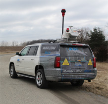
Clay has led the mobile division at Maser Consulting since 2013 and has grown their mobile mapping team to include two RIEGL systems and has many experienced and well-trained personnel on his team. He provides a very measured and detail-oriented approach to laser scanning. The results of this approach are visible every day with his excellent and exciting projects he and his team have already completed.
» Read MoreRAIL STRAIGHTNESS INSPECTION AFTER 3D SCAN DEMONSTRATION
Posted by RIEGL on Sep 2, 2020
The RIEGL VZ-400i was used for 3D scanning & post-processing for this test project. The rail measured is 25m long, clearly bent and the 3D data had to be acquired within 5 minutes. The team scanned some sample rails directly after production. The PointShape Inspector software was able to check bending inspection with the Straightness GD&T feature.
» Read MoreRECORDINGS ARE NOW AVAILABLE FOR THE RIEGL ULTIMATE LIDAR AUGUST WEBINAR SERIES!
Posted by RIEGL on Sep 1, 2020
Recordings of the RIEGL Ultimate LiDARTM Webinar Series for the month of August are now available!
These recordings will be accessible for you to enjoy for the next month. To access the recordings, please click the image below for the entire August 2020 playlist!
» Read MoreRIEGL’S ULTIMATE LIDAR WEBINAR SERIES AND MORE: SEPTEMBER 2020
Posted by RIEGL on Aug 31, 2020
We are continuing with our series of FREE Ultimate LiDAR webinars during the month of September 2020 and we have some fantastic content lined up for you this month. In addition, some of our RIEGL LiDAR experts will be presenting at other exciting industry related events you don’t want to miss out on!
» Read MoreUAV PARTNER SPOTLIGHT: SHINING THE LIGHT INTO THE OEM PARTNERSHIP WITH LIDARUSA
Posted by RIEGL on Aug 27, 2020
For today’s RiCAST, we are joined by RIEGL USA’s My-Linh Truong, ULS / UAS Business Segment Manager, as she leads a discussion with one of our OEM Partners, Jeff Fagerman from LiDARUSA. Jeff is a graduate of Ferris State University’s survey program with a BS in Survey Engineering and later from Purdue University with a MS in Photogrammetry. After 14 years as a lead photogrammetry software developer, he started LiDARUSA in 1999, providing conventional photogrammetry AT service.
» Read MoreARS ELECTRONICA FESTIVAL 2020, SEPTEMBER 9-13: TAKE A VIRTUAL INTERACTIVE TOUR OF VIENNA’S ST. STEPHEN’S CATHEDRAL WITH RIEGL 3D DATA!
Posted by RIEGL on Aug 26, 2020
Our latest press release, featuring the use of the RIEGL VZ-400i in the St. Stephen’s Cathedral and the data usage at the ARS Electronica conference, now features an English version followed by a German translated version. We hope you enjoy this fantastic press release!
» Read MoreFEATURES AND BENEFITS OF RIEGL’S VQ-1560 II WIDE AREA MAPPING SENSOR
Posted by RIEGL on Aug 20, 2020
RIEGL’s Michael Sitar, Executive Management Consultant, does an overview of one of our newest and innovative airborne scanning systems; the VQ-1560 II.
Michael goes into detail on this state-of-the-art instrument and highlights the benefits and its best practices in the LiDAR industry. The configuration of the VQ-1560 II is that of a full system design consisting of two laser systems, a dual laser sensor configuration that fires through a single common scanning mechanism. The dual LiDAR waveform processing airborne scanning system provides further increased performance and highest productivity based on a laser pulse repetition rate.
» Read MoreA DAY OF UAV LIDAR SURVEY
Posted by RIEGL on Aug 19, 2020
If you work in the geospatial industry, whether it’s as a field engineer, LiDAR technician, flying the skies as a pilot, or you are a novice LiDAR user, everyone enjoys obtaining the beautiful point clouds and datasets from the scanners. If you work in this industry, you are familiar with the results and the valuable information collected from LiDAR laser scanners. But not everyone gets to witness the full process that is involved with capturing the data.
» Read MoreRIEGL’S MARKET PRESENCE GROWS IN LATIN AMERICA THROUGH CONTINEX DISTRIBUTION PARTNERSHIP IN PANAMA
Posted by RIEGL on Aug 18, 2020
IExpanding our presence in Latin America through this strategic distribution partnership, RIEGL is excited to welcome Continex to the growing base of renowned RIEGL partners!
» Read MoreUSING LIDAR FROM A DRONE FOR DETAILED MAPPING OF HARD-TO-REACH LOCATIONS
Posted by RIEGL on Aug 17, 2020
We at RIEGL would like to thank the orginal author Jakub Karas for his well written words about his experience with RIEGL ULS LiDAR and how it has benefitted him and his team in the Czech Republic. Please enjoy the article below or click the link below to access the article at GeoConnexion!
» Read More¿ QUE ES LIDAR (WHAT IS LIDAR)?
Posted by RIEGL on Aug 13, 2020
In today’s RiCAST, for our Spanish speakers, we will be going back to the basics! Our RIEGL LiDAR expert, Claudio Avello, South America Partner Development Manager, will be discussing all things LiDAR! He will start from the basic foundation to the more complex expert level in this episode. Everyone who listens can fully grasp why this technology is extraordinarily important in the engineering and survey industry.
» Read MoreICELAND SPACE AGENCY: MIRRORING THE ENVIRONMENT ON THE MOON AND MARS!
Posted by RIEGL on Aug 12, 2020
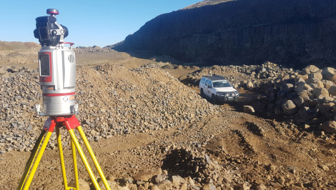
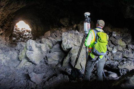
Iceland Space Agency (ISA) team members field testing the MS1: Can the scanner be carried and set up easily? Can future astronauts operate the touchpad and controls? Field tests on Earth pave the way for using a variety of equipment in space.
» Read MoreLOW AND SLOW: HELICOPTER-BASED LIDAR FOR SNOW & ICE OBSERVATIONS
Posted by RIEGL on Aug 11, 2020
The original article is posted in LiDAR News, we hope you enjoy this fascinating story below involving USACE CRREL and NCALM as they work together to develop a small footprint helicopter-based LiDAR pod system utilizing RIEGL airborne instrumentation.
» Read MoreTAN TALK: RIEGL’S LONG LASTING LINE OF TERRESTRIAL LASER SCANNERS
Posted by RIEGL on Aug 06, 2020
For today’s RiCAST, we have RIEGL USA’s Terrestrial Business Development Manager, Tan Nguyen, joining us with his latest episode of “Tan Talk”. Tan will be introducing and discussing in detail the state-of-the-art RIEGL VZ series. The VZ series is comprised of RIEGL’s innovative terrestrial laser scanning instruments. Terrestrial laser scanners are contact-free measuring devices which can collect dense point. A point cloud may be converted into a grid DEM to facilitate topographic mapping and spatial analyses. This TLS-focused RiCAST will recap the highlights and benefits of each instrument and how they each impact the LiDAR industry.
» Read MoreRECORDINGS ARE NOW AVAILABLE FOR RIEGL ULTIMATE LIDAR JULY WEBINAR SERIES
Posted by RIEGL on Aug 05, 2020
Recordings of the RIEGL Ultimate LiDAR Webinar Series for the month of July are now available!
These recordings will be accessible for you to enjoy for the next month! To access the recordings, please click the image below for the entire July 2020 playlist!
» Read MoreGEOCUE ADDS RIEGL SOLUTIONS TO THE TRUE VIEW PRODUCT LINE
Posted by RIEGL on July 31, 2020
The exciting news on the True View front is the addition of the new RIEGL miniVUX2 laser scanner to the product lineup. This new system falls into the domain of what are typically called “survey-grade” drone LIDAR scanning systems. Of course, being a True View 3D Imaging Sensor, it offers much more than just a point cloud generating engine.
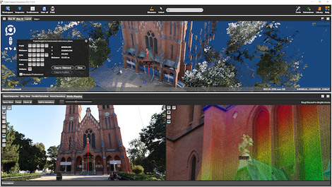
» Read MoreA SPECTACULAR LIDAR LOOK AT THE 600 YEAR OLD DUOMO DI MILANO
Posted by RIEGL on July 30, 2020
The demonstration of the RIEGL VZ-400i at the Duomo di Milano was conducted by technicians from RIEGL distribution partner, Microgeo srl in Florence, Italy. The subsequent video created from the point clouds was produced under Microgeo’s direction by NUBIGON, an international software company that allows users to make the most of LiDAR data to create animations, videos and computer models.
» Read MoreRIEGL’S ULTIMATE LIDAR WEBINAR SERIES AND MORE: AUGUST 2020
Posted by RIEGL on July 29, 2020
We are continuing with our series of FREE Ultimate LiDAR webinars during the month of August 2020 and we have some fantastic content lined up for you this month. In addition, some of our RIEGL LiDAR experts will be presenting at other exciting industry related events you don’t want to miss out on!
» Read MoreRIEGL PROVIDES HIGH PERFORMANCE WITH 3D LASER SCANNING TECHNOLOGY FOR HLR
Posted by RIEGL on July 24, 2020
Hampton, Lenzini and Renwick, Inc. (HLR) is a new RIEGL customer who have acquired a VZ-400i terrestrial laser scanner to add to their surveying and mapping capabilities. HLR is an employee-owned corporation and a leading provider of professional consulting engineering, environmental, and surveying services for public agencies and private-sector clients in Illinois.
» Read MoreGPI GEOSPATIAL EXPANDS AIRBORNE LIDAR ACQUISITION SERVICES THROUGH ADDITION OF RIEGL VQ-1560 II ULTRA HIGH-PERFORMANCE SYSTEM!
Posted by RIEGL on July 23, 2020
GPI, an established airborne, mobile, and terrestrial LiDAR services provider, has added the RIEGL VQ-1560 II to their toolbox of advanced digital sensors to further expand their capabilities. As a highly progressive company that uses proven technologies to satisfy their client’s needs, this cutting-edge airborne sensor will further allow GPI to provide advanced mapping solutions to meet and exceed their client’s expectations.
» Read More10 YEARS OF SUCCESS WITH THE VMX: THE PAST MEETS THE FUTURE- AN INTERVIEW WITH AN EARLY MOBILE SCANNER, CRAIG SHERIFF
Posted by RIEGL on July 23, 2020
Welcome to the next episode of the series “Celebrating the Success of the VMX”! This week we have Joshua France, RIEGL Mobile Segment Manager, hosting our first mobile user in Canada and mobile scanner pioneer, Craig Sheriff.
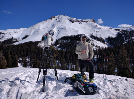
» Read MoreTERRESTRIAL LASER SCANNING WITH REAL-TIME DATA ANALYTICS FOR AVALANCHE FORECASTING
Posted by RIEGL on July 22, 2020
Depending on the type of climate you live in, the type of emergency disaster that can happen will vary. Examples of this include living by coastlines and face potential seasonal hurricanes or typhoons, living in an area with a volcano close by or in this stories’ case, living in the colder region of Montana in the United State, where avalanches are known to have disastrous aftermaths when they occur.
» Read MoreNEW: RIEGL VUX-240 VERSATILE AIRBORNE LASER SCANNER VIDEO IS NOW LIVE!
Posted by RIEGL on July 20, 2020
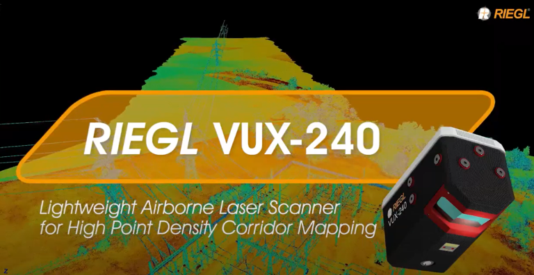
The RIEGL VUX-240 is a lightweight airborne laser scanner, especially designed for use on UAS/UAV/RPAS and small manned airplanes or helicopters. The high measurement rate of 1,500,000 meas./sec and a high scan speed of up to 400 lines/sec. are the basis for efficiently covering large areas when operated from fast UAVs or aircrafts especially in applications like power line, railway track, or pipeline inspection or topography in open-cast mining.
» Read MoreLAND SURVEYS (AUSTRALIA) AND MULTI-SENSOR DATA FUSION
Posted by RIEGL on July 17, 2020
Land Surveys, a RIEGL user, was recently featured in an article released by Spatial Source where their company and the team at C.R. Kennedy, a RIEGL distributor in Australia, highlight how the RIEGL VMQ-1HA mobile laser scanning system and RIEGL UAV LiDAR miniVUX-1UAV unmanned laser scanner collaborated together for a customer’s project and do most of the hard work for the survey team.
» Read MoreLIDAR IN THE BRAZILIAN MARKET: INTERVIEW WITH BOAZ TEIXEIRA FROM CPE TECHNOLOGIA
Posted by RIEGL on July 16, 2020
CPE Technologia is RIEGL’s distributor for Brazil and our RIEGL LiDAR expert Claudio Avello starts off the conversation with Boaz’s extensive 18-year experience in LiDAR. They discuss the Brazilian market and how LiDAR was first introduced and adapted by several companies and markets in the country.
» Read MoreGEOCUE ADDS RIEGL SOLUTIONS TO THE TRUE VIEW PRODUCT LINE
Posted by RIEGL on July 13, 2020
The True View 615 can be upgraded to the True View 620 configuration via the addition of the external IMU and an internal interface board. Thus, if you are not entirely sure that you need the enhanced accuracy of the 620, start with a 615 and upgrade should you need.
» Read MoreNEW RIEGL BATHYMETRY SCANNER VIDEOS! (IN SPANISH AND PORTUGUESE)
Posted by RIEGL on June 22, 2020
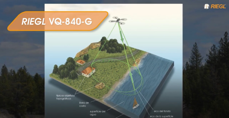
To better serve our Spanish and Portuguese speaking customers who use LiDAR for bathymetric purposes, RIEGL has just released these 3-minute videos featuring the VQ-840-G, a compact topo-bathymetric airborne laser scanner. These newly released videos highlight features and benefits of this scanner, presented in Portuguese and Spanish!
» Read MoreGEOCUE GROUP RELEASES TRUE VIEW 615/620, RIEGL/APPLANIX UAS
Posted by RIEGL on June 22, 2020
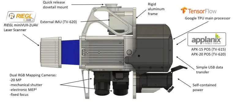
GeoCue’s True View product line gives surveyors the ability to produce high quality analytic data with precise accuracies. These systems come equipped with RIEGL’s miniVUX-2UAV laser scanner, integrated with dual photogrammetric cameras.
» Read MoreRIEGL TO VIRTUALLY ATTEND AND EXHIBIT AT AGIT 2020
Posted by RIEGL on June 22, 2020
Due to COVID-19, AGIT 2020 and the GI_Forum will now take place as a virtual conference from July 6 – 10, 2020. This virtual event is being hosted by Z_GIS, University of Salzburg, Austria.
We would like to invite you to visit us at the virtual RIEGL booth and to inform yourself about our latest products and developments in the RIEGL presentations of the conference and forum.
» Read MoreNEW RIEGL VQ-840-G VIDEO ON YOUTUBE!
Posted by RIEGL on June 18, 2020
The Accident Engineering Service of the Zurich City Police has, among other technologies, been using RIEGL 3D terrestrial laser scanners for accident scene investigation.
We release this video in German with English subtitles with kind permission by Zurich City Police, and we appreciate everyone at the Zurich City Police.
» Read MoreRIEGL’S ULTIMATE LIDAR WEBINAR SERIES: JUNE/JULY 2020
Posted by RIEGL on June 18, 2020
We are continuing our series of FREE Ultimate LiDAR webinars into the months of June and July 2020.
Register below for our future webinars and learn more from the RIEGL LiDAR experts from the comfort of your office.
» Read MoreRIEGL RICAST: JOSH FRANCE HAS A CONVERSATION WITH CALGARY’S DR. ROB RADOVANOVIC ABOUT MOBILE LIDAR
Posted by RIEGL on June 18, 2020
Their discussion features Dr. Radovanic’s experiences scanning hundreds of miles of roadway with the VMX-450, a predecessor to the current model, the VMX-2HA. He will talk about what they have learned over the past nine years of scanning with the VMX, and discuss industry demands in certain mobile surveying and environmental markets.
» Read MoreLIDAR’S IMPACT ON THE CHILEAN MINING INDUSTRY, INTERVIEW WITH DAVID SANTOS, MANAGER OF LIDAR TECHNOLOGY AT GEOCOM (SPANISH)
Posted by RIEGL on June 17, 2020
Today’s Interviewee is Mr. David Santos Carvallo, Geomensor Engineer of the University of Santiago de Chile. With more than 15 years of experience with laser scanner technologies, he has participated in various projects of integration and commissioning of LiDAR in many areas of the industry and has eight years working with RIEGL Instruments. He currently serves as Development Manager; he oversees the laser scanner area at GEOCOM S.A. in Santiago de Chile.
» Read MoreMEET BERNHARD THE RIEGL BEAR!
Posted by RIEGL on June 12, 2020
The Get Kids Into Survey (GKIS) program was designed as a fun way to introduce middle-school aged kids to this exciting career choice. Through fun posters and interesting activities, the hope is that youngsters start thinking about survey as a possible career. RIEGL is one of the early sponsors, and is very proud to be part of this great initiative. We even have our own cartoon character!
» Read MoreRIEGL RICAST: LIDAR FOR FORENSICS
Posted by RIEGL on June 11, 2020
Jill explains how RIEGL’s terrestrial scanners are being used to create court admissible, 3D records of crime and crash scenes by emergency responders around the world
» Read MoreLIDAR AND GIS GROW CLOSER TOGETHER
Posted by RIEGL on June 8, 2020
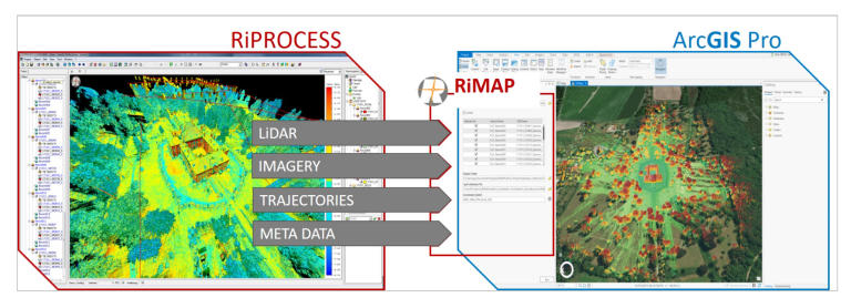
LiDAR Magazine recently published an interview with Ron Behrendt, Managing Director of Behron LLC, a geospatial consultancy. In this interview he discusses the RIEGL RiMAP software that is currently under development that will smooth the data flow and improve the efficiency of transferring LiDAR point clouds and associated imagery from RIEGL’s systems into Esri’s ArcGIS Platform.
» Read MoreJOSH’S TRIP TO MICHIGAN WITH DR. HARALD TEUFELSBAUER
Posted by RIEGL on June 8, 2020
Their one week-long road trip took them across the state to see first-hand the demand for mobile mapping systems, visit customers and create new professional relationships along the way. So fuel up your ride, grab a snack, and rev your engines for today’s road trip adventure with Josh and the VMX.
» Read MoreRECORDINGS ARE NOW AVAILABLE FOR RIEGL ULTIMATE LIDAR MAY WEBINAR SERIES
Posted by RIEGL on June 5, 2020
Recordings of the RIEGL Ultimate LiDAR Webinar Series for the month of May are now available. These recordings will be accessible for you to enjoy for the next month!
» Read MoreRIEGL RICAST: JOSH FRANCE INTERVIEWS LONGTIME VMX USER, JOE FEYDER OF REY ENGINEERS
Posted by RIEGL on June 8, 2020
Today we introduce a new RiCAST Podcast series: “Celebrating the 10 Years of Success with the VMX”, featuring conversations with RIEGL mobile scanning customers.
At REY, Joe oversees the mobilization, application and delivery of the firm’s mobile and terrestrial LiDAR technology. Joe has 40+ years of comprehensive experience in all aspects of professional land surveying and is an expert at providing pragmatic and resourceful survey approaches to complex projects.
» Read MoreRIEGL RICAST PODCAST GOES GLOBAL: NOW AVAILABLE FROM YOUR FAVORITE APP STORES
Posted by RIEGL on May 28, 2020
We are excited to announce that our RIEGL RiCAST podcast channel is now accessible from the Apple iTunes Store, and the Google Play Store!
Download your favorite podcast app on your mobile device, tablet or computer and you will be able to listen to our LiDAR-focused podcast that is now available for Apple and Android users.
» Read MoreINTRO TO ROAD TRIPS WITH JOSH AND THE VMX
Posted by RIEGL on May 28, 2020
We introduce Josh France, Mobile Segment Business Development Manager at RIEGL USA as he begins this series called “Road Trips with Josh and the VMX”. Josh has visited some amazing places around the globe as he meets with clients for demos, trainings and just to touch base. Now you are able to join him on his journey along the way.
» Read MoreSPIE DEFENSE + COMMERCIAL SENSING DIGITAL FORUM 2020: RIEGL’S SCIENTIFIC PRESENTATIONS NOW ONLINE
Posted by RIEGL on May 27, 2020
This year’s SPIE Defense + Commercial Sensing Conference scheduled for April 27 – May 8, 2020 had to be held as Digital Forum due to the COVID-19.
More than 3,600 people signed up for the opportunity to participate in the free event. Authors shared emerging research and technology advances in sensors, infrared technology, laser systems, spectral imaging, radar, LiDAR, AI/machine learning, and more. The community heard from experts working on materials, components, systems, and analytics for defense, security, and commercial applications.
» Read MoreEXTERNAL GNSS INTEGRATIONS FOR TERRESTRIAL SCANNER
Posted by RIEGL on May 20, 2020
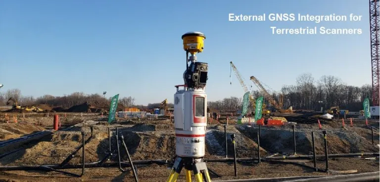
This RiCAST podcast will highlight:
- Intro to VZ-i series internal GPS
- How to configure external GNSS
- How to configure GNSS file for scanner
- Benefits of using GPS with terrestrial laser scanner
- Applications for GPS RTK + TLS
MODERN LIDAR TECHNIQUES EMPLOYED IN AREA NEARLY UNTOUCHED FOR 100 YEARS
Posted by RIEGL on May 19, 2020
Read the article linked below about two men, their crews, and a week-long project in one of the most remote and beautiful parts of Africa. The project involved the fusion of LiDAR from three different types of collection, and their observations about the experience.
Click here to DOWNLOAD the full story, with images, in PDF forma
» Read MoreRIEGL TO PRESENT INTRODUCTION TO LIDAR TECHNOLOGY IN COLLABORATION WITH UNIVERSITY OF GUADALAJARA, MEXICO (IN SPANISH)
Posted by RIEGL on May 18, 2020
RIEGL will be presenting a virtual Introduction to LiDAR Technology seminar to students at the University of Guadalajara on Thursday, May 21 at 11 AM EDT.
This all-day seminar will be presented in Spanish, and will cover how LiDAR can be used by surveyors to provide digital twin data of infrastructure, topography, etc. in 3D to engineers, scientists and academics.
» Read MoreLEVERAGING SENSOR TECHNOLOGY FOR MODERN DESIGN PROJECTS
A long-term and highly esteemed RIEGL client, GPI Geospatial Inc. (GPI), has been using LiDAR technology for many years and was an early-adopter of the technology. Matthew LaLuzerne, Vice President of GPI, wrote the attached article and we wanted to share it with our Newsroom subscribers and those following RIEGL on social media.
» Read MoreTHE RIEGL VMX-RAIL TRIPLE SCANNER MOBILE MAPPING SYSTEM!
To better serve our Spanish and Portuguese speaking customers who use LiDAR for rail applications, RIEGL has just released this tailored 3-minute video featuring the VMX-Rail Triple LiDAR Scanner.
» Read MoreRIEGL RICAST PODCAST – PREVIEW!
As a sneak peak, we want to start off strong with two of what we think are very interesting RiCAST recordings. These recordings are audio only and can be listened to on any smart device or your computer.
» Read MoreRIEGL ULTIMATE LIDAR WEBINAR SERIES – MAY 2020
RIEGL is continuing our series of FREE webinars in the month of May.Our users asked for more RIEGL content, and we are delivering it!
» Read MoreRIEGL’S NEW 3D VOXEL ANALYSIS TOOL WITHIN RISCAN PRO
RIEGL is proud to announce the “3D Voxel Analysis” software module that is the latest enhancement to RiSCAN PRO. The “3D Voxel Analysis” software module, available with RIEGL’s proprietary software package for 3D scan data acquisition and registration RiSCAN PRO, enables the comparison of a reference data set with a comparison data set and stores the result in a new point attribute. In various applications, the comparison of scan data provides a meaningful representation of the change in values.
» Read MoreJOINT SCIENTIFIC ARTICLE ON LIDAR FOR BATHYMETRY OF VERY SHALLOW WATERS, UNDER THE LEADERSHIP OF RIEGL, WINS ISPRS BEST PAPER OF 2019!
In cooperation with the Vienna University of Technology and the University of Stuttgart, Roland Schwarz and Martin Pfennigbauer from RIEGL Research succeeded in issuing a new and innovative contribution to topographic underwater mapping with the SVB algorithm (surface, volume and bottom) presented in their article. A considerable advantage of their method is that it relies only on a single laser wavelength. The jurors were impressed with the detailed modeling of the return waveform, the clarity of the explanation, the convincing experimental results, and the potential for broader applicability of the method.
» Read MoreRIEGL TO VIRTUALLY PRESENT AND ATTEND AT SPIE 2020!
Due to COVID-19, SPIE Defense + Commercial Sensing has been transformed from an in-person conference to a digital forum and will be held from April 27 – May 1, 2020.Registration for the Defense + Commercial Sensing Digital Forum and the engaging presentations is FREE.We invite you to join us for the following RIEGL presentations:• Comparison of Different Methods to Compute Total Propagation Uncertainty for Airborne Bathymetric LiDAR• Waveform-Averaging Airborne Laser Bathymetry Scanner
» Read MoreRIEGL VMQ-1HA HELPS CREATE A 3D CITY MAP FOR AN INNOVATIVE, SUSTAINABLE AND “SMART” HONG KONG
News.gov.hk shared an article in their Infrastructure & Logistics section recently that highlights a comprehensive mapping project underway in Hong Kong. The RIEGL VMQ-1HA is one of the key tools being used on this next generation of Hong Kong city mapping.
» Read MoreRIEGL ULTIMATE LIDAR WEBINAR SERIES
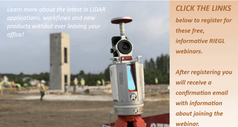
RIEGL will be hosting a series of FREE webinars in the month of April.Learn more about the latest in LiDAR applications, workflows and new products without ever leaving your office! Click the images below to register for FREE these informative RIEGL webinars. After registering, you will receive a confirmation email containing information about joining the webinar.
» Read MoreREADY WILLING ABLE: THE SWAT TEAM OF LIDAR
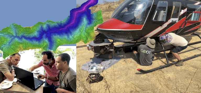
Years ago, Chapple’s Southern California-based firm received a client request for a high-resolution video of an electrical transmission circuit. When planning the shoot, his team made the decision to add aerial LiDAR scans collected with RIEGL equipment to their traditional video tools, giving them a product that included the element of 3D. The team and the client were both impressed with the quality of the LiDAR data and images, and this new way of viewing the world. They knew they were on to something special with LiDAR. Since then GEO1 has never looked back and is using LiDAR on project after project around the globe!
» Read MoreRIEGL USA’S VIRTUAL LIDAR CONFERENCE AGENDA IS LIVE!
We are just days away from RIEGL USA’s Virtual LiDAR Conference!Learn about RIEGL’s Ultimate LiDAR™ solutions from our leading experts on Tuesday, March 24, 2020 from 9AM – 5PM EST for a FREE, one-of-a-kind Virtual LiDAR Conference!
» Read MoreSAVE THE DATE FOR RIEGL USA’S VIRTUAL LIDAR CONFERENCE!
In response to the unfortunate postponement of GEO WEEK and due to the growing concerns of COVID-19, we have found a creative alternative way to meet with you.Learn more about the latest in RIEGL‘s LiDAR solutions without ever leaving your office at RIEGL USA’s Virtual LiDAR Conference.
» Read MoreCOMBINING TERRESTRIAL AND UAV-BORNE SCAN DATA IN AN ARCHAEOLOGY APPLICATION
Posted by RIEGL on March 5, 2020
RIEGL, along with the scientific support from the Ludwig-Boltzmann Institute in Vienna, conducted an extensive surveying campaign at the ruins of the medieval castle Gars in Lower Austria.
» Read MoreRIEGL TO PRESENT AND EXHIBIT AT CHC 2020!
Posted by RIEGL on February 20, 2020
RIEGL’s subject matter expert, Joshua France, will be presenting on airborne LiDAR bathymetry on February 27, 2020; and he along with fellow RIEGL team members will be exhibiting the technology at the CHC 2020!
» Read MoreRIEGL TO ATTEND AND EXHIBIT AT IAFSM 2020!
Posted by RIEGL on February 19, 2020
RIEGL will be exhibiting in the McGavock AB section during the conference. Meet with our team of RIEGL experts during this conference to learn about the latest LiDAR sensor technology, and discover how they can help you with your forensic needs!
IAFSM (International Association of Forensic & Security Metrology) 2020 will take place from February 23-27, 2020, at the Inn at Opryland in Nashville, Tennessee.
» Read MoreQUANTUM SPATIAL DEBUTS ALL-IN-ONE SENSOR
Posted by RIEGL on February 14, 2020
RIEGL’s core Smart-Waveform technologies provide pure digital LiDAR signal processing, unique methodologies for resolving range ambiguities, multiple targets per laser shots, optimum distribution of measurements, calibrated amplitudes and reflectance estimates, as well as the seamless integration and calibration of systems.
» Read MoreUAV LIDAR FAST-TRACK’S LEVEE DAMAGE ASSESSMENT AFTER HURRICANE HARVEY
Posted by RIEGL on February 7, 2020
Precision Aerial used RIEGL’s VUX-1 LiDAR sensor to get data in a fraction of the time necessary with previous methods.
In 2019, Precision Aerial performed three levee surveys utilizing their UAV LiDAR system. Using LiDAR, they were able to gather all the necessary data in just over one week. Traditional techniques would have required months of work and a survey crew. This updated process provided a viable means of delivering critical, accurate data from difficult-to-reach areas in a cost effective manner and in short period of time.
» Read MoreRIEGL WINS THE MEMBER CHOICE AWARD FOR THE VUX-240 AT THE 2020 MAPPS WINTER CONFERENCE!
Posted by RIEGL on January 24, 2020
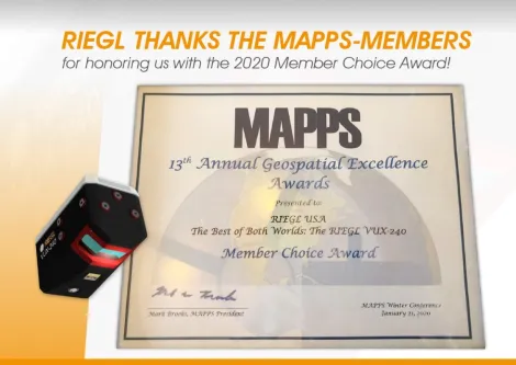
On January 21, 2020, it was announced that RIEGL won the Member Choice Award for the RIEGL VUX-240 lightweight UAV laser scanner in the Technology Innovation category at the 2020 MAPPS Winter Conference.
» Read MoreRIEGL’S UAS / ULS MARKET PRESENCE GROWS IN NORTH AMERICA THROUGH GEOCUE GROUP OEM PARTNERSHIP
Posted by RIEGL on January 17, 2020
Expanding their UAS / ULS presence in North America through this strategic OEM partnership, RIEGL is excited to welcome GeoCue Group to the growing base of renowned RIEGL integrators.
» Read MoreQUANTUM SPATIAL PURCHASES TWO NEW RIEGL VQ-1560 II AIRBORNE LIDAR SYSTEMS TO ADD TO THEIR FLEET!
Posted by RIEGL on January 15, 2020
RIEGL is incredibly excited to announce that Quantum Spatial, the United States’ largest independent geospatial data firm, has recently purchased two of RIEGL’s newest airborne LiDAR systems, the VQ-1560 II!
» Read MoreFOLLOW US ON OUR RIEGL SOCIAL MEDIA CHANNELS!
Posted by RIEGL on January 13, 2020
We here at RIEGL want you to be in the know on all of the newest products and developments, projects and upcoming events.
» Read MoreRIEGL WILL BE ATTENDING AND EXHIBITING AT TRB 2020!
Posted by RIEGL on January 7, 2020
We here at RIEGL want you to be in the know on all of the newest products and developments, projects and upcoming events.
» Read MoreRIEGL WISHES YOU A MERRY CHRISTMAS AND HAPPY NEW YEAR!
Posted by RIEGL on December 23, 2019
As another year has come and gone, we here at RIEGL reflect on the great year that we have had as a company and all the memories and experiences that we have gotten to share with you.
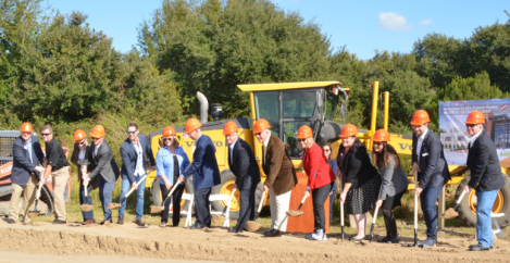
» Read MoreINTERNATIONAL TECH FIRM, RIEGL, BREAKS GROUND IN WEST ORANGE
Posted by RIEGL on December 20, 2019
Johannes Riegl Jr, president of the Austrian company, said the decision to build in Winter Garden was made so employees could live in an affordable but high-quality area.
» Read MoreVOTE FOR THE VUX-240 NOW FOR MAPPS EXCELLENCE AWARDS!
Posted by RIEGL on December 19, 2019
The RIEGL VUX-240 is a lightweight airborne laser scanner, especially designed for use on UAS/UAV/RPAS and small manned airplanes or helicopters.
» Read MoreGEOPOINT SURVEYING PRODUCES WHEN CALLED UPON
Posted by RIEGL on December 18, 2019
When asked about their decision to invest in RIEGL products, Jack explained, “We were attracted to RIEGL’s superior quality in sensor design and workflow administration.
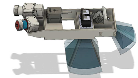
» Read MoreRIEGL INTRODUCES NEW INTEGRATED VP-1 HELICOPTER POD WITH VUX-240 AIRBORNE SCANNER!
Posted by RIEGL on December 10, 2019
The VUX-240 LiDAR sensor provides up to 1.5 million measurements per second and is ideally suited for applications like corridor mapping. It is also suited for installation on a larger UAS/UAV/RPAS or smaller manned aircraft.
» Read MoreMONITORING ROCK GLACIER DYNAMICS WITH IMPROVED MEASUREMENT FREQUENCY
Posted by RIEGL on December 5, 2019
While conventionally monitored at annual timescales, recent fortnightly monitoring of the rock glacier is being undertaken to quantify the contribution of individual processes to the annual surface change budget. This enables to constrain the various mechanisms of sediment production, transport, and removal from the system
» Read MoreRIEGL WILL BE ATTENDING AND EXHIBITING AT AGU 2019!
Posted by RIEGL on December 3, 2019
The American Geophysical Union 2019 (AGU 2019) conference will be taking place from December 9-13, 2019, at the Moscone Center in San Francisco, California.
RIEGL will be exhibiting at Booth 1514 during AGU 2019. Be sure to stop by our booth to learn about the latest developments in RIEGL Waveform-LiDAR technology including our fast-TLS solutions and how we can help you and your business needs!
» Read MoreDIAMOND AIRCRAFT DA62 MPP SURVEY CONCEPT
Posted by RIEGL November 27, 2019
“We ourselves have been using a Diamond DA42 MPP, equipped with its nosepod, for more than 10 years for test and calibration flights of our ALS laser scanners and systems and can only report the best about this aircraft”, says Dr. Johannes Riegl, CEO of RIEGL Laser Measurement Systems GmbH.
» Read MoreADVANTAGES AND CHALLENGES OF MULTI-SENSOR DATA FUSION
Posted by RIEGL November 22, 2019
This webinar, hosted by RIEGL USA, included:
- a brief look at the early days of 3D LiDAR data fusion
- important references and resources for mobile mapping systems and UAS
- real world challenges of using multiple LIDAR sensors on projects
- best practices and lessons learned in the field and office
- expert processing of mobile mapping trajectories
RIEGL INTRODUCES NEW LIDAR INSTRUMENT: THE VQ-1560 II!
Posted by RIEGL November 22, 2019
The NEW RIEGL VQ-1560 II dual channel waveform processing airborne LiDAR scanning system provides further increased performance, based on a laser pulse repetition rate of up to 4MHZ, resulting in more than 2.66 million measurements per second on the ground.
Offering highly efficient data acquisition at a wide range of point densities, the VQ-1560 II provides mission results with further increased productivity for both high point density mapping and ultra wide area mapping.
» Read MoreRIEGL USA ANNOUNCES GROUNDBREAKING CEREMONY FOR ITS NORTH AMERICAN HEADQUARTERS
Posted by RIEGL November 20, 2019
Internationally recognized for their Ultimate High-Performance LiDAR 3D scanning equipment and data processing software, RIEGL USA will break ground on a new North American headquarters and training facility in Winter Garden, west of Orlando, Florida.
The ceremony is scheduled for Friday, December 6, 2019 at 1:00 p.m. at 14707 West Colonial Drive, Winter Garden, FL 34847.
» Read MoreRIEGL USA TO ATTEND AND EXHIBIT AT AUTODESK UNIVERSITY 2019!
Posted by RIEGL November 12, 2019
RIEGL will be exhibiting at Booth INF202 during Autodesk University 2019. Be sure to stop by our booth to learn about the latest developments in RIEGL Waveform-LiDAR technology, such as our fast-TLS solutions and how they can help you and your business needs!
The VZ-400i is a 3D laser scanning system which combines an innovative new processing architecture, internet connectivity, and a suite of MEMS sensors with RIEGL’s latest waveform processing LiDAR technology.
» Read MoreRIEGL FURTHER STRENGTHENS MARKET PRESENCE IN SOUTH AMERICA BY ANNOUNCING NEW DISTRIBUTOR FOR COLOMBIA: GEOTOOLBOX IBÉRICA S.L.
Posted by RIEGL October 28, 2019
RIEGL USA proudly announces their newest distributor in Colombia, GeoToolBox Ibérica S.L., who are joining a highly distinguished group of worldwide partners to further the reach and influence of the RIEGL brand in the Latin American markets.
Specializing in the area of large format cameras and airborne LiDAR sensors with capabilities in sales, maintenance, support and training, GeoToolBox Ibérica S.L., has positioned themselves both in the Iberian market and in the international market, with a special presence in Latin America by building and establishing trusted relationships between themselves and their clientele.
» Read MoreREUNION RESORT 3D SCANNED IN 8 HOURS
Posted by RIEGL October 24, 2019
RIEGL was featured in LiDAR News after a highly successful terrestrial laser scanning project that was carried out during RIEGL’s North America Training Symposium 2019. The entire project consisted of scanning the full Reunion Resort grounds (400 scan positions) where the Training Symposium was held and registering the scans while out in the field. This process took just eight hours in total to complete!
» Read MoreRIEGL FURTHER STRENGTHENS TERRESTRIAL MARKET PRESENCE IN NORTH AMERICA WITH NEW DISTRIBUTOR SITECH SOUTH
Posted by RIEGL October 23, 2019
RIEGL is proud to announce the expansion of their terrestrial LiDAR presence in North America with the introduction of their new distribution partner, SITECH South. Operating out of their office in Smyrna, Georgia, SITECH South joins a distinguished group of RIEGL partners helping to promote the RIEGL brand.
» Read MoreRIEGL WELCOMES THE MINIVUX-2UAV TO THE UNMANNED FAMILY!
Posted by RIEGL October 11, 2019
The RIEGL miniVUX-2UAV makes use of RIEGL’s unique Waveform-LiDAR technology, allowing echo digitization and online waveform processing. Multi-target resolution is the basis for penetrating even dense foliage. As a further special feature, the wavelength is optimized for the measurement of snowy and icy terrain.
» Read MoreNEW VMX-RAIL MOBILE SCANNING SYSTEM VIDEO ON YOUTUBE!
Posted by RIEGL October 07, 2019
The RIEGL VMX-RAIL is a fully integrated mobile laser scanning system especially designed for rail application. The triple scanner system design allows for the utmost efficient capturing of dense, accurate, and feature-rich data, which is used for rail infrastructure asset management, as-built surveying, track and infrastructure monitoring, clash detection simulation, as well as clearance analysis, railway planning and engineering.
RIEGL VMX-RAIL Triple Scanner System YouTube Video
» Read MoreRIEGL TO ATTEND AND EXHIBIT AT AMERICAS GEOSPATIAL FORUM 2019!
Posted by RIEGL October 07, 2019
The Americas Geospatial Forums 2019 exhibition will be taking place on October 9-10, 2019 at the Hotel Sheraton Maria Isabel in Mexico City, Mexico.
RIEGL will be exhibiting at Table #15 during the conference.
» Read MoreFIRST NORTH AMERICAN CUSTOMER FOR THE NEW RIEGL VQ-1560II DUAL LIDAR AIRBORNE SYSTEM: SAM, LLC DECIDES TO UPGRADE FLEET OF SENSORS!
Posted by RIEGL October 04, 2019
RIEGL is proud to announce that SAM, LLC, a leader in providing geospatial data solutions, will be the first company in North America to acquire and deploy the most recent major advance in aerial scanning technology, the RIEGL VQ-1560 II dual channel waveform processing airborne LiDAR scanning system for high point density mapping and ultra-wide area mapping.
» Read MoreRIEGL AT INTERGEO 2019 FEATURED ON INTERGEO TV!
Posted by RIEGL October 04, 2019
INTERGEO 2019 happened a few short weeks ago in Stuttgart, Germany and everyone at RIEGL was proud to attend and to showcase all of our amazing new innovations. We have been creating and working on brand new sensors and systems to benefit the LiDAR industry!
If you were unable to attend the conference or want to see it again, we have a overview video for you from INTERGEO TV to be able to experience RIEGL at INTERGEO 2019 all over again!
Please click the link below and watch the RIEGL Recap video from INTERGEO this year in its entirety!
RIEGL Recap Video at INTERGEO 2019
» Read MoreRIEGL IS PROUD TO ANNOUNCE THE NEW VQ-780 II!
Posted by RIEGL October 02, 2019
We are proud to announce the introduction of the RIEGL VQ-780 II waveform processing airborne laser scanner for wide area mapping and high productivity!
With a pulse repetition rate of 2 MHz and more than 1.33 million measurements per second, this system provides mission results with further increased productivity for both high-point-density mapping and ultra-wide-area mapping.
» Read MoreNEW RIEGL INSTRUMENTS AT INTERGEO FEATURED BY SPAR 3D
Posted by RIEGL September 25, 2019
“RIEGL’s presence at INTERGEO is always substantial, but the story for the company at INTERGEO 2019 wasn’t just about the updates that were specifically showcased at the event. How RIEGL has been able to double the scanning capacity of a variety of their existing products was a theme that was highlighted at the event but will continue to be a focus throughout the rest of the year.”
» Read MoreNEW RIEGL VQ-840-G VIDEO ON YOUTUBE!
Posted by RIEGL September 23, 2019
The RIEGL VQ-840-G is a compact topo-bathymetric airborne laser scanner especially suited for coastline and shallow water mapping providing more than 2 Secchi depths water penetration. Optionally complemented by an integrated IMU/GNSS system and a camera or an IR rangefinder, the system is ready for integration in various aircraft platforms including UAVs.
» Read MoreRIEGL VUX-240 WINS THE WICHMANN INTERGEO INNOVATION AWARD 2019!
Posted by RIEGL September 20, 2019
During the closing event of INTERGEO 2019 on Thursday, September 19, the RIEGL VUX-240 Airborne Laser Scanner was awarded with the coveted glass trophy in the hardware category.
The scanner can be easily mounted to unmanned platforms (UAVs), as well as to helicopters, gyrocopters, and other small manned aircrafts.
» Read MoreRIEGL TO ATTEND AND EXHIBIT AT RAILWAY INTERCHANGE 2019!
Posted by RIEGL September 18, 2019
The Railway Interchange 2019 exhibition will be taking place September 22-25, 2019 at the Minneapolis Convention Center in Minneapolis, Minnesota.
Be sure to stop by the booth to meet with our team of RIEGL experts and learn about how our rail LiDAR solutions can best work for you and your business needs.
» Read MoreRIEGL AT INTERGEO 2019: COME SEE THE LATEST WAVEFORM LIDAR NEWS AT BOOTH I1.024!
Posted by RIEGL September 17, 2019
According to our slogan “Innovation in 3D”, we are delighted to present to you our latest developments and the highlights presented for ALS, TLS, ULS, BLS and MLS.
If you are at INTERGEO 2019, stop by our booth, I1.024 in Hall 1, to see our latest developments in person and to meet with our team of RIEGL experts.
» Read MoreRIEGL VZ-400I USED TO DETECT DEFORESTATION IN THE AMAZON RAINFOREST
Posted by RIEGL September 12, 2019
The Amazon rainforest is the world’s richest and most-varied biological ecosystem, containing several million species of insects, plants, birds, and other forms of life, many still not yet discovered by science. The Amazon covers an area of 2,300,000 square miles, this makes up about 40 percent of Brazil’s total surface area.
» Read MoreRIEGL TO ATTEND, EXHIBIT, AND PRESENT AT INTERGEO 2019!
Posted by RIEGL September 10, 2019
RIEGL will be exhibiting at Booth I1.024 in Hall 1 during the conference. Be sure to stop by the booth to meet with our team of RIEGL experts, see our latest technological contributions for the LiDAR industry, and to take advantage of this opportunity to learn more about what RIEGL has been up to!
Join us and take advantage of this opportunity to learn more about our state-of-the-art instruments!
- the VZ-i Line Laser Scanners with new features and new accessories
- the proven VMX-2HA Mobile Mapping System
- the broad portfolio on sensors and systems for airborne and UAV-based laser scanning including the latest developments for even higher productivity and even increased performance
INTERGEO INNOVATIONS AWARD 2019: VOTE FOR THE RIEGL VUX-240!
Posted by RIEGL September 3, 2019
Everyone is invited to vote and has the chance to win one of the very attractive prizes in the Wichmann Award raffle. More information is available at gispoint.de/wiaVoting is open until September 18th, 5:00 P.M so vote today for the VUX-240!
» Read MoreDEWBERRY COLLECTING LIDAR DATA OF WESTERN EVERGLADES NATIONAL PARK USING RIEGL VQ-880-G!
Posted by RIEGL August 29, 2019
LiDAR Magazine recently featured a story on an environmental project to assist and benefit the Florida Everglades, which is being conducted by Dewberry with the RIEGL VQ-880-G. The U.S. Geological Survey (USGS) hand selected Dewberry, a privately held professional services firm, to plan, acquire, and process topobathymetric LiDAR for up to 788 square miles of surface area in the western part of the Everglades National Park in Florida.
Dewberry is using a developed LiDAR system, utilizing the RIEGL VQ-880-G topo-bathymetric LiDAR sensor for data collection of the National Park. The VQ-880-G carries out laser range measurements for high resolution surveying.
» Read MoreRIEGL MINIVUX-1UAV USED TO SCAN ESTADIO NACIONAL STADIUM
Posted by RIEGL August 20, 2019
The joint effort between companies was done while using the RIEGL miniVUX-1UAV to scan and collect data of the Estadio Nacional Stadium in Santiago, Chile!
The 360° data capture field of view of the miniVUX-1UAV allows complete acquisition of the environment.
» Read MoreLIDAR AND BVLOS UAVS: ENABLING THE ULTIMATE SOLUTION FOR HIGHLY EFFICIENT MAPPING
Posted by RIEGL August 16, 2019
LiDAR technology continues its emergence as an important tool for increased surveying and mapping accuracy and efficiency—even as providers await regulatory relief to allow them to fly beyond visual line of sight.
» Read MoreRIEGL’S JAMES VAN RENS ATTENDS MEETING OF THE UNITED NATIONS GLOBAL GEOGRAPHIC INFORMATION MANAGEMENT
Posted by RIEGL August 16, 2019
James Van Rens, Senior Vice President with RIEGL USA and Strategic Advisor for Government and Industry Relations for the RIEGL International Group, recently participated in the 9th meeting of the United Nations Global Geographic Information Management.
» Read MoreJAMES VAN RENS WINS PRESIDENTIAL AWARD AT MAPPS SUMMER CONFERENCE 2019!
Posted by RIEGL August 5, 2019
James Van Rens has served on the MAPPS Board of Directors as the Associate Member Liaison since Summer of 2017 and has been a dedicated member of RIEGL management for the last twenty-two years. He is a well-known leader in 3D mapping techniques and their applications with numerous contributions made to the geospatial industry.
» Read MoreFIELD SURVEY OF THE ROUTE OF THE LIFT UP TO LANGKOFELSCHARTE
Posted by RIEGL July 29, 2019
Without this scanner, it would not be possible to work so fast, efficiently, precisely and cost-effectively,” he exclaimed about his miniVUX-1UAV.
The following project at the Sella Pass in Val Gardena, South Tyrol, was to be implemented for a customer as quickly as possible. The lift route on the Langkofelscharte (2,685m) is approximately 1.4 km and a height difference of 500m. The terrain survey covers about a width of 80m.
» Read MoreNV5 PROVIDES INTEGRATED UAV LIDAR MAPPING SERVICES
Posted by RIEGL July 22, 2019
One of our well established customers NV5, was featured in an interview with LiDAR News. The article “NV5 Provides Integrated UAV Lidar Mapping Services” was conducted with Lukas Fraser, LiDAR Specialist and Matt O’Brien, UAV Director, at the NV5 office in San Diego, CA.
» Read MoreRIEGL: MOBILE LASER SCANNING THROUGH THE BLUE MOUNTAINS RAIL CORRIDOR
Posted by RIEGL July 16, 2019
One of our valued RIEGL mobile customers, Michael Finlay who is a Geospatial Engineer with Jacobs, recently shared an amazing railroad video that he worked on with his team.
This project took the RIEGL VMX-450 mobile system scanning through the Blue Mountains rail corridor. The length of the project extended from Springwood to Lithgow to scan some of the most challenging conditions for an MLS system, happening even between the regular train services!
» Read MoreRIEGL CONTINUES ON COURSE FOR SUCCESS: RIEGL INVESTS IN NEW OFFICE AND PRODUCTION FACILITIES!
Posted by RIEGL July 15, 2019
New, additional facility expansions at the headquarters in Austria as well as a new facility in the United States.
RIEGL, an internationally successful manufacturer of LiDAR scanners for surveying applications headquartered in Horn, Austria, is investing heavily in the expansion of production and office space. The continued, worldwide demand for the high-performance sensors allows the company to grow and expand further.
» Read MoreMANY SENSORS FOR A TULIP TREE MAP
Posted by RIEGL July 11, 2019
After hurricane deforestation in Puerto Rico, NASA scientists study forest regrowth using high-resolution, multi-sensor image data.
» Read MoreRIEGL TO ATTEND AND EXHIBIT AT ESRI UC 2019 !
Posted by RIEGL July 2, 2019
RIEGL will be attending and exhibiting at Esri UC 2019!
Esri UC 2019 will be taking place from July 8th-12th, 2019, at the San Diego Convention Center, San Diego California.
» Read MoreRIEGL AT AGIT 2019: DON’T MISS TO MEET WITH OUR EXPERTS IN SALZBURG JULY 3-5!
Posted by RIEGL July 1, 2019
AGIT Symposium and EXPO will take place in Salzburg, Austria, from 3 to 5 July 2019.
For one week, representatives from R&D and industry will discuss the latest scientific developments and their implementation as best practice solutions with users
» Read MoreRADAR SURVEY TEAM USES NEW INNOVATION FOR FASTER SURVEYS
Posted by RIEGL June 14, 2019
Hill Air Force Based in Utah recently obtained the RIEGL VZ-2000i long range laser scanning system to help revolutionize how they survey terrain and man-made features.
» Read MoreAXIS GEOSPATIAL LEANS ON LIDAR TO SHARPEN COMPETITIVE EDGE
Posted by RIEGL June 13, 2019
AXIS GeoSpatial, was recently featured in LiDAR Magazine. Discussing in this article how they utilize LiDAR sensors and services, their combined years of experience, and dedication to their customers, AXIS GeoSpatial is showcasing how they’ve given themselves an edge in the industry and how they are establishing themselves as market leaders
» Read MoreREGISTRATION NOW OPEN FOR RIEGL’S NORTH AMERICA TRAINING SYMPOSIUM!
Posted by RIEGL June 11, 2019
Registration is now open for the 2020 Riegl North America Training Symposium!
The Training Symposium will be held October 14-17, 2019 at the Reunion Resort in Orlando, Florida for North American RIEGL users.
» Read MoreANCIENT LANDFORMS OF THE AUSTRALIAN RAINFOREST REVEALED BY AIRBORNE LIDAR
Posted by RIEGL May 28, 2019
LiDAR remote sensing technology has been used in many archaeological applications around the world, such as finding Mayan pyramids in Central America and trenches dug during an historic siege of Vienna in Austria.
Australia has no pyramids to be discovered, but there are places left where the landforms are all but unknown. LiDAR is ideal to shed light on these areas – literally.
» Read MoreRIEGL TO ATTEND AND EXHIBIT AT SPAR 2019 !
Posted by RIEGL May 14, 2019
SPAR 2019 will be taking place from May 21-23, 2019, at the Anaheim Convention Center in Anaheim, California.
RIEGL will be exhibiting at Booth 319 during SPAR 2019. Be sure to stop by our booth to learn about the latest developments in RIEGL Waveform-LiDAR technology and how we can help you and your business!
» Read MoreRIEGL to Attend and Exhibit at TUC 2019!
Posted by RIEGL May 1, 2019
The VZ-400i ultra high-performance 3D terrestrial laser scanner! The VZ-400i is a 3D laser scanning system which combines an innovative new processing architecture, internet connectivity, and a suite of MEMS sensors with RIEGL’s latest waveform processing LiDAR technology.
» Read MoreRIEGL to Exhibit and Present at AUVSI XPONENTIAL 2019!
Posted by RIEGL April 24, 2019
AUVSI XPONENTIAL 2019 will take place from April 29th-May 2nd, 2019 at McCormick Place in Chicago, Illinois.
» Read MoreRIEGL to Attend and Exhibit at AEC BuildTech 2019!
Posted by RIEGL April 23, 2019
RIEGL will also be exhibiting at Booth 717 during AEC BuildTech 2019. Come meet with our team of RIEGL experts to discuss your business needs and how our LiDAR solutions can help you with design & building processes.
» Read MoreLeading Edge Geomatics Leverages Lidar Technology
Posted by RIEGL April 16, 2019
Leading Edge Geomatics (LEG) was founded in 2008 in Lincoln, New Brunswick, Canada and has quickly grown to be one of the leading 3D mapping firms in North America.
» Read MoreRIEGL Featured on Inside Unmanned Systems Webinars!
Posted by RIEGL April 9, 2019
My-Linh Truong, ULS / UAS Segment Manager with RIEGL USA, was featured during this webinar, along with two of our valued RIEGL customers: Russ Faux, Senior Vice President for Strategic Initiatives with Quantum Spatial, Inc., and Rob Dannenberg, Discipline Leader, Principal Associate, Unmanned Aviation with Maser Consulting.
» Read MoreAutomate 2019
Posted by RIEGL April 2, 2019
RIEGL will be exhibiting at Booth 9353 during Automate 2019. Be sure to come by and meet our team of RIEGL experts to learn about our latest innovative instruments that we use worldwide.
» Read MoreRIEGL Announced as Finalist for AUVSI XCELLENCE Awards
Posted by RIEGL April 1, 2019
RIEGL was nominated for their NEW RIEGL VUX- 240, a compact airborne laser scanner especially designed for use on UAS/UAV/RPAS, as well as small manned airplanes or helicopters. With its wide field of view of 75° and an extremely fast data acquisition rate of up to 1.8 MHz (1.5 MHz effective), this sensor is perfectly suited for high point density corridor mapping applications. The VUX- 240 is extremely well suited for BVLOS operation, due to features like 1 terabyte of internal storage and its lightweight design.
» Read MoreWebinar: Scanning Ahead with Unmanned RIEGL Waveform LiDAR
Posted by RIEGL March 13, 2019
With a significant increase in demand for high performance sensors and systems as the Unmanned Aerial Systems (UAS) marketplace expands exponentially, it can be difficult to stay on top of every cutting edge technology in airborne, mobile, terrestrial, industrial and unmanned laser scanning solutions.
» Read MoreDennis Hirota is Titans of Technology Hall of Fame Recipient!
Posted by RIEGL March 5, 2019
Dr. Hirota was chosen for this prestigious award for his advocacy in technology, not only advancing his career and business through technology but also for working consistently to lift the state of Hawaii to new technological heights.
» Read MoreLidar Data Collection for Southwest Floriada Water Management District
Posted by RIEGL February 19, 2019
The Southwest Florida Water Management District has released an fascinating video showing how they collect and use LiDAR data to form their watershed plans. Al Karlin with the Southwest Florida Water Management District explains in this video what LIDAR is and why they choose to use it. Dowe Gallagher Aerospace’s VQ-1560i is featured in this video for data capture.
» Read MoreComplete Mobile Surveying of Amtrak's New York PENN Station
Posted by RIEGL February 18, 2019
This article was originally posted on LiDAR News and features a mobile surveying project done by HNTB and SSI on Amtrak’s New York Penn Station. This project is one of the first extended mobile LiDAR projects completed underground.
» Read MoreLooking at it Another Way
Posted by RIEGL January 31, 2019
RIEGL was featured in the January/February issue of Mining Magazine in an article called “Looking at it Another Way”. This article discusses how changing geophysics technology such as RIEGL LiDAR technology is helping to create successful, efficient exploration projects, such as drill optimization technology, for new and growing mines.
» Read MoreRIEGL Wins the Prestigious Mapps Geespatial Technology Excellence Award for the VMX-2HA at the 2019 Mapps Winter Conference in Denver!
Posted by RIEGL January 29, 2019
On January 27, 2019, it was announced that RIEGL won the Geospatial Excellence Award for the RIEGL VMX-2HA mobile LiDAR mapping and imaging platform in the Technology Innovation category at the 2019 MAPPS Winter Conference. The MAPPS awards competition recognizes the professionalism, value, integrity and achievement that member firms have demonstrated in their projects and technology developments over the previous year.
» Read MoreNew RIEGL Office in Australia Opened!
Posted by RIEGL January 24, 2019
The new office will provide direct RIEGL representation throughout Australia and New Zealand, offering full support to its existing RIEGL distributors in Australia C.R. Kennedy, and in New Zealand, Geospace. RIEGL Australia will have a primary focus on the airborne/UAV sectors, whilst our partners will continue to drive terrestrial and mobile products into various industries in the market. Working together, RIEGL Australia will ensure all customers, at all times, have the level of support to match the quality of technology that RIEGL offers.
» Read More2019 ESRI Federal GIS Conference
Posted by RIEGL January 23, 2019
RIEGL will be attending and exhibiting at the 2019 Esri Federal GIS Conference! The 2019 Esri Federal GIS Conference will take place from January 29th-30th, 2019 at the Walter E. Washington Convention Center. RIEGL will also be exhibiting at Booth 401 during the 2019 Esri Federal GIS Conference. Take this opportunity to come by to meet with our team of RIEGL experts and to get in-booth demonstrations of the RIEGL VZ-400i.
» Read MoreRIEGL to Attend, Exhibit and Present at Geo Week 2019!
Posted by RIEGL January 22, 2019
RIEGL will be attending, exhibiting and presenting at GEO WEEK 2019! GEO WEEK 2019 will take place from January 25th-31st, 2019, at the Hyatt Regency Denver at Colorado Convention Center. This event is an opportunity for attendees of MAPPS, ASPRS and ILMF to come together for an outstanding conference experience! The combined event will feature a single exhibit hall and all-encompassing social activities, giving attendees access to more geospatial solutions and networking than would have been possible had the events continued separately.
» Read MoreRIEGL to Attend and Exhibit at FTBA 2019!
Posted by RIEGL January 16, 2019
RIEGL will be attending and exhibiting at FTBA 2019! FTBA 2019 will take place from January 17th-18th, 2019 at the Hyatt Regency Orlando in Orlando, Florida. RIEGL will be exhibiting at Booth 207 during the conference. Be sure to stop by the booth to meet with our team of RIEGL experts, see our latest technological contributions for the transportation industry, and to take advantage of this opportunity to learn more about our VZ-400i terrestrial laser scanner.
» Read MoreHappy New Year From RIEGL
Posted by RIEGL January 11, 2019
Happy New Year from all of us here at RIEGL! To kick 2019 off right, we would like to invite you to not only follow us here on our blog but also on all of our social media. Become a RIEGL superfan and keep up-to-date with all of our latest information, featured projects, and instrument spotlights!
» Read MoreRIEGL to Attend and Exhibit at TRB!
Posted by RIEGL January 8, 2019
TRB 2019 will take place from January 13-17, 2019 at the Walter E. Washington Convention Center in Washington, DC, USA. RIEGL will be exhibiting at Booth 326 during the conference. Be sure to stop by our booth to meet with our team of RIEGL experts. Learn about our offerings for the transportation industry and see in-booth demonstrations of our VZ-400i terrestrial laser scanner.
» Read MoreRIEGL to Exhibit and Attend AGU 2018!
Posted by RIEGL December 5, 2018
AGU 2018 will take place from December 10-14, 2018 at the Walter E. Washington Convention Center in Washington, D.C. RIEGL will be exhibiting at Booth #1738 during the conference. Meet with our team of RIEGL experts during this conference to learn about the RIEGL LiDAR sensors and solutions that we offer to the geospatial industries!
» Read MoreRIEGL to Exhibit and Present at IAFSM 2018!
Posted by RIEGL December 4, 2018
IAFSM (International Association of Forensic & Security Metrology) 2018 will take place from December 10-14, 2018 at the Hilton Hotel Downtown Fort Worth in Fort Worth, Texas. RIEGL will be exhibiting at Table 8 during the conference. Meet with our team of RIEGL experts during this conference to learn about the latest developments with RIEGL’s sensors and systems and how they can help you and your forensic needs!
» Read MoreIntergeo 2018: RIEGL is Expanding thier Airbone and UAV Sensor Product Range!
Posted by RIEGL November 7, 2018
With these latest developments and updates, RIEGL now offers sensors and systems to be used at low flight altitudes (generally met with UAV) starting with the miniVUX-1 – to new uses for medium flight altitudes used in large UAS/UAV/RPAS with higher payload capacity or in manned helicopters – to scanners and systems for data acquisition at high flight altitudes using manned fixed wing aircraft such as the well-proven VQ-780i Airborne Laser Scanner and the proven VQ-1560i Dual Wavelength Airborne Mapping System.
» Read MoreRIEGL to Attend and Exhibit at Autodesk University 2018!
Posted by RIEGL November 6, 2018
Autodesk University 2018 will take place from November 13-15, 2018 at the Venetian in Las Vegas, Nevada. RIEGL will be exhibiting at Booth #B823 during the conference. Meet with our team of RIEGL experts during this conference to learn about the latest developments in RIEGL Waveform-LiDAR technology, how they work with Autodesk products, and how they can help you and your business!
» Read MoreRIEGL to Exhibit and Present at Latin America Geospatial Forum 2018!
Posted by RIEGL October 30, 2018
RIEGL will be exhibiting and presenting at Latin America Geospatial Forum 2018! Latin America Geospatial Forum 2018 will take place from November 6-8, 2018 at the Sheraton Maria Isabel Hotel in Mexico City, Mexico. RIEGL will be exhibiting at Booth 12 during the conference. Meet with our team of RIEGL experts during this conference to learn about the RIEGL LiDAR sensors and solutions that we offer to the geospatial industries!
» Read MoreRIEGL to Exhibit and Present at Future of Mining Americas 2018!
Posted by RIEGL October 23, 2018
RIEGL will be exhibiting and presenting at Future of Mining Americas 2018! Future of Mining Americas 2018 will take place from October 29-30, 2018 at the Embassy Suites by Hilton Denver Downtown Convention Center in Denver, Colorado. RIEGL will be exhibiting at Booth 2 during the conference. Meet with our team of RIEGL experts to learn about the RIEGL LiDAR solutions that we offer to the mining industries.
» Read MoreNovel LIDAR Data Improves Our Understanding of Tropical Forests
Posted by RIEGL October 11, 2018
Dr. Kim Calders and his team have just completed 2 months of field work in Australian tropical forests collecting both terrestrial and UAS lidar data to support a novel LiDAR data fusion methodology. Forest ecosystems contain more biomass than any other ecosystem. However, estimating biomass without cutting down trees is difficult. Traditional methods of estimating aboveground biomass (ABG) are based on correlations between destructive estimates of volume and diameter and/or height, which can be measured more easily in the field.
» Read MoreVote for the MINIVUX-1UAV!
Posted by RIEGL October 10, 2018
We have been nominated for this year’s Wichmann Innovation Award (which will be awarded at INTERGEO) and we are counting on your votes to win the best hardware product of 2018!
» Read MoreRIEGL to Attend and Exhibit at IACP 2018!
Posted by RIEGL October 2, 2018
IEGL will be exhibiting and presenting at IACP (International Association of Chiefs of Police) 2018! IACP 2018 will take place from October 6-9, 2018 at the Orange County Convention Center in Orlando, Florida. RIEGL will be exhibiting at Booth 368 during the conference. Meet with our team of RIEGL experts to learn about RIEGL’s scanners and systems for law enforcement.
» Read MoreSAM, LLC: Using Technology to Enhance Solutions
Posted by RIEGL September 26, 2018
Surveying and Mapping, LLC (SAM) was founded in 1994 with a core guiding principle of leveraging the latest technologies to maximize value for clients. Today, SAM is the largest geospatial service company in the U.S. and has a reputation for being a technology leader in the AEC industry.
» Read MoreRIEGL to Exhibit and Present at Commercial UAV Expo 2018!
Posted by RIEGL September 25, 2018
RIEGL will be exhibiting and presenting at Commercial UAV Expo 2018!
Commercial UAV Expo will take place from October 1-3, 2018 at the Westgate in Las Vegas, Nevada.
» Read MoreDowe Gallagher Adds Textron Cessna Caravan Ex To Lidar Offerings
Posted by RIEGL September 24, 2018
Dowe Gallagher Airborne Data Group (DGADG) recently added a new Textron Cessna Caravan EX to its expanding LiDAR (Topographic and Bathymetric) aerial survey offerings. The Caravan EX platform, equipped with the G1000 avionics package, brings added safety, dispatch reliability and fuel efficiency and is powered by the newest generation Pratt & Whitney PT-6A-140 867HP turboprop engine.
» Read MoreRIEGL to Attend and Exhibit at InnoTrans!
Posted by RIEGL September 18, 2018
RIEGL will be attending and exhibiting at InnoTrans 2018!
The 12th InnoTrans will take place from September 18-21, 2018 at ExpoCenter City in Berlin, Germany.
RIEGL will be exhibiting at Booth 233 in Hall 5.2 during the conference. Meet with our team of RIEGL experts to learn about the latest developments for rail technology and see the world introduction of the VMX-RAIL: Mobile mapping system for track mapping and clearance surveying!
» Read MoreRIEGL to Attend and Exhibit at AREMA 2018!
Posted by RIEGL September 13, 2018
RIEGL will be attending and exhibiting at AREMA 2018!
The AREMA Annual Conference & Exposition will take place from September 16-19, 2018 at the Hilton Chicago in Chicago, Illinois.
RIEGL will be exhibiting at Booth 802 during the conference. Meet us to learn about RIEGL’s rail offerings and to see the RIEGL VMX-2HA high performance dual scanner mobile mapping system on site!
» Read MoreLiDAR Helps Reveal Lost Roman Road
Posted by RIEGL August 28, 2018
Analysis of LiDAR and aerial photography, conducted by Historic England for the Secrets of the High Woods Project and commissioned from Fugro BV, has led to the rediscovery of a long-speculated route from Roman times between Chichester and Arundel in England.
» Read MoreRIEGL Is Proud to Be a Founding Member of the World Geospatial Industry Council!
Posted by RIEGL August 8, 2018
In a historic development, worldwide geospatial industry leaders have come together to announce the formation of the World Geospatial Industry Council (WGIC).
» Read MoreRIEGL Wins 2018 Esri 3D Impact Award!
Posted by RIEGL July 19, 2018
RIEGL is pleased to be the recipient of the 2018 Esri 3D Impact Award last week during the annual Esri User Conference!
The award was presented to the company during the Esri Imagery Summit in San Diego, California on Sunday, July 8, 2018 in recognition of a joint initiative that RIEGL and Esri have been working on: the LMAP initiative.
“RIEGL understands what’s required to make 3D GIS come alive. Their sensors are revolutionizing the notion of a 3D image, and as a trusted Esri Partner, we are working together to ensure our common customers are able to create the map of the future.” stated Lawrie Jordan, Director of Imagery with Esri.
» Read MoreRIEGL to Attend and Exhibit at the Esri User Conference!
Posted by RIEGL July 3, 2018
RIEGL USA will be attending and exhibiting at the 2018 Esri User Conference!
The 2018 Esri User Conference will be held at the San Diego Convention Center in San Diego, California from July 9-13, 2018.
RIEGL will be exhibiting at Booth 830 during the conference. Be sure to stop by our booth to learn about the latest developments in RIEGL Waveform-LiDAR technology and how we can help you and your business with your GIS needs!
» Read MoreWebinar: Meeting the Needs of the Airborne LiDAR Market
Posted by RIEGL June 27, 2018
RIEGL USA is hosting a free webinar on Wednesday, July 18, 2018! Join us from 2:00-3:00 PM EST for Meeting the Needs of the Airborne LiDAR Market with RIEGL‘s Industry Leading ALS Sensor Portfolio and Latest Technological Developments!
If you would like to join this informative and fascinating webinar, click the following link: WEBINAR REGISTRATION
» Read MoreSeminar: Launch of the RIEGL VZ-2000i in Brazil!
Posted by RIEGL June 26, 2018
RIEGL’s distribution partner for Brazil, CPE Tecnologia, is hosting an official RIEGL seminar and the launch of the VZ-2000i terrestrial laser scanner in Brazil on July 5 and 6, 2018!
Thomas Gaisecker, Senior Manager of International Sales for RIEGL, will be the special guest speaker at this event. Join this event to learn how to improve your profits and the quality of your job with this long range, very high speed 3D laser scanner.
Join Thomas and CPE Tecnologia on July 5, 2018 at 8:30 AM at the University Newton Paiva- Buritis Unity in Belo Horizonte, Brazil or on July 6, 2018 at 8:30 AM at the Auditorium of Fundação Institute de Terras do Estado de São Paulo “José Gomes da Silva” in São Paulo, Brazil for this can’t miss seminar!
See the brochures below for more information and how to contact CPE to sign up! We look forward to welcoming you to these seminars!
» Read MoreFree Webinar Tomorrow! Introducing the Delair DT26X LiDAR with RIEGL miniVUX-1DL
Posted by RIEGL June 25, 2018
Delair is hosting a FREE webinar tomorrow at 5:00 PM CET on their new DT26X LiDAR UAV with the RIEGL miniVUX-1DL LiDAR sensor!
Join Chase Fly, Geospatial Expert with Delair, and Philipp Amon, Business Division Manager ULS with RIEGL, to learn about how this dual-sensor payload mounted on a professional fixed-wing UAV that can fly for nearly two hours and up to 30 km away really opens the door to tackling large-scale mapping projects in a way that can be both safer and more economical than using conventional manned aircraft.
» Read MoreThe RIEGL miniVUX-1UAV: Charting the Evolution of RIEGL Sensors and Systems
Posted by RIEGL June 20, 2018
Jamie Young, Director- Data/LiDAR Services with PrecisionHawk, wrote an article for LiDAR Magazine on the evolution of RIEGL sensors and systems and how PrecisionHawk is utilizing the RIEGL miniVUX-1UAV miniaturized UAV LiDAR sensor to not only meet but exceed their expectations. Read more below or at the LiDAR Magazine website!
Over the last five decades, few can claim to have devoted more to the development of lidar technology than Dr. Johannes Riegl, founder and CEO of the RIEGL group. The miniVUX-1UAV is a recent example of his team’s unique insight and ability. Prior to founding his namesake firm, Dr. Riegl focused on research and development work at the Vienna University of Technology from 1968-78. He started by developing high performance Avalanche Pulse Generators that are in principle still used in thousands of RIEGL instruments today for driving the semiconductor laser transmitter. In this article, I’ve opted to highlight some of RIEGL’s key milestones and innovations that led to the development of the miniVUX-1UAV:
» Read MoreRIEGL to Attend and Present at the 19th Annual JALBTCX Airborne Coastal Mapping and Charting Workshop!
Posted by RIEGL June 19, 2018
RIEGL USA will be attending and presenting at the 19th Annual JALBTCX Airborne Coastal Mapping and Charting Workshop!
The 19th Annual JALBTCX Annual Airborne Coastal Mapping and Charting Workshop will be held at the Rhode Island Convention Center in Providence, Rhode Island from June 26-28, 2018.
Kohei Wakamatsu from Nakanihon Air Service Co., Ltd., a Japanese RIEGL customer, and Dr. Martin Pfennigbauer, Director of Research & Intellectual Property of RIEGL Austria, will be presenting “Helicopter Integration of Topo-Hydrographic Airborne Laser-Scanning System SAKURA-GH” on Tuesday, June 26, 2018 from 10:00-11:30 AM.
» Read MoreSCANX3D – THE NAME SAYS IT ALL
Posted by RIEGL June 14, 2018
Editor Note: The original article appears on the LiDAR News website. It is a feature on one of our customers, ScanX3D, who utilize a RIEGL VZ-400i terrestrial laser scanner for a multitude of surveying and building documentation jobs. Read more about the company and the projects they are working on below or at the LiDAR News website!
To many people, selecting a name for their new business can be one of the most important decisions they can make. Company names are a key part of branding, which makes you wonder about some of the big names like Uber, Airbnb and Google; versus Autodesk, Intel and Facebook, for instance. The latter, by the way, was the nickname for the “Photo Address Book” which all students at Phillips Exeter, a prep school in Exeter, NH received when they arrived at school, as did Mark Zuckerberg who spent two years there before moving onto Harvard and well, I think you know the rest of the story.
It certainly seems that ScanX3D also chose an appropriate company name as they are quickly becoming a highly respected player in the 3D laser scanning marketplace. Based in Cromwell, Connecticut, the company has 18 employees who are focused on solving a wide range of customer problems that all have one thing in common: applying LiDAR technology to provide an efficient solution.
» Read MoreDewberry Selected to Update High-Resolution LiDAR for Puerto Rico and U.S. Virgin Islands
Posted by RIEGL June 12, 2018
Dewberry, a privately held professional services firm, has been selected by the U.S. Geological Survey (USGS) to collect and process Quality level 1 topographic LiDAR data of Puerto Rico and the U.S. Virgin Islands to identify the impact of Category 5 Hurricane Maria, which struck the territories in September 2017.
The firm’s subconsultant, Leading Edge Geomatics, will be performing the LiDAR data acquisition using two RIEGL VQ-1560i dual channel waveform processing airborne LiDAR mapping systems. Dewberry will perform all ground surveys and its geospatial team will complete the processing and creation of digital elevation models and other ancillary products.
» Read MoreNAKANIHON and RIEGL to Give Joint Presentation on Helicopter-based Airborne Bathymetric LiDAR Systems
Posted by RIEGL June 11, 2018
Nakanihon is a Japanese general aviation company and a long-time valued RIEGL customer with over 40 years of experience in the airborne research and survey field. In 2017, the 5th generation of the helicopter-based airborne LiDAR system, which is referred to as SAKURA (stands for “Cherry Blossom”), was launched.
The 5th SAKURA iteration (called “SAKURA-GH”) utilizes the Airborne Laser Scanning System, the VQ-880-GH, which was developed by RIEGL in the same year, to address the industry’s need for helicopter operations. Find more detailed information on this Waveform-LiDAR system especially designed for helicopter integration and its special features for combined hydrographic and topographic surveying at: www.riegl.com/vq-880-gh
In the presentation, Mr. Wakamatsu will highlight the benefits of helicopter-based airborne bathymetric LiDAR systems in terms of the topographic characteristics of Japan. Additionally, the installation carried out by Nakanihon and the technical realizations of a helicopter integration will be covered. Preliminary data examples and results will also be discussed.
» Read MoreRIEGL to Exhibit and Present at SPAR 3D Expo & Conference 2018!
Posted by RIEGL May 29, 2018
RIEGL will be exhibiting and presenting at SPAR 3D Expo & Conference 2018!
SPAR 3D 2018 will be held at the Anaheim Convention Center in Anaheim, California from June 5-7, 2018.
RIEGL will be exhibiting at Booth 501 during the conference. Be sure to stop by our booth to learn about the latest developments in RIEGL Waveform-LiDAR technology and how we can help you and your business!
Meet with our team of RIEGL experts at our booth throughout the week and see our RIEGL instruments in person: the RIEGL VZ-400i, the RIEGL VZ-2000i, the RIEGL VMX-2HA, the RIEGL miniVUX-1DL, and the RIEGL miniVUX-1UAV, integrated on a DJI-M600 with the RIEGL Integration Kit 600.
The VZ-400i is a cutting-edge, ultra high performance 3D terrestrial laser scanning system that is redefining productivity through the combination of future-oriented, innovative processing architecture and internet connectivity with RIEGL’s latest waveform processing LiDAR technology.
» Read MoreThe RIEGL miniVUX-1UAV LiDAR sensor integrated with the DJI M600!
Posted by RIEGL May 29, 2018
We have a new video up on the RIEGL YouTube channel featuring the miniVUX-1UAV LiDAR sensor integrated with the DJI M600 UAV. Check out this video to see how we can explore its outstanding qualities of capturing airborne laser scan data!
To showcase the outstanding qualities of the RIEGL miniVUX-1UAV LiDAR Sensor, we did this great video in cooperation with our partner for Australia, C.R. Kennedy, www.crkennedy.com
The RIEGL miniVUX-SYS – comprising a RIEGL miniVUX-1UAV LiDAR engine, an appropriate IMU/GNSS system and an optional camera system – provides a typical operating flight altitude (AGL) of 260 ft, a maximum measurement range of 250m and survey-grade measurements with an accuracy of 15 mm.
For quick and straight forward integration into several types of multi-rotor UAVs – e.g. the DJI Matrice M600 shown in the video – RIEGL offers the Integration Kit 600 coming with an appropriate, shock absorbing mounting-kit, power supply module, and the necessary cabling.
» Read MoreExtremely Fast Data Registration with the RIEGL VZ-i Terrestrial Laser Scanner Series!
Posted by RIEGL May 15, 2018
We’ve posted a new video up to our YouTube channel on the use of Automatic Registration with the RIEGL VZ-i series and the dramatic time savings it has.
With the Automatic Onboard Registration with the VZ-i scanners, fast and highly accurate merging of point clouds with leveling and geo-referencing can be achieved from different scan positions.
This real-time data flow is enabled through dual processing platforms: a dedicated processing system for data acquisition, waveform processing and system operations, and a second processing platform which enables automatic onboard registration, geo-referencing, and analysis to be executed simultaneously.
» Read MoreGPI Geospatial Purchases RIEGL VQ-1560i Ultra High Performance Airborne LiDAR System!
Posted by RIEGL May 7, 2018
RIEGL is pleased to announce that GPI Geospatial, Inc. has purchased the VQ-1560i ultra high performance airborne LiDAR system!
GPI, an established user of RIEGL airborne, mobile, and terrestrial sensors and systems, has chosen to add the VQ-1560i to their toolbox of advanced digital sensors to further expand their capabilities. As a highly progressive company that uses proven technologies to satisfy their client’s needs, this cutting edge RIEGL airborne sensor will further allow GPI to provide advanced mapping solutions to meet and exceed their client’s expectations.
» Read MoreRIEGL to Exhibit and Present at AUVSI XPONENTIAL 2018!
Posted by RIEGL April 24, 2018
RIEGL will be exhibiting and presenting at AUVSI XPONENTIAL 2018!
AUVSI XPONENTIAL 2018 will be held at the Colorado Convention Center in Denver, Colorado from April 30-May 3, 2018.
RIEGL will be exhibiting at Booth 811 during the conference. Be sure to stop by our booth to learn about the latest developments in RIEGL unmanned Waveform-LiDAR technology and how we can help you and your business!
» Read MoreRIEGL Announced as Finalist for AUVSI XCELLENCE Awards
Posted by RIEGL April 5, 2018
ARLINGTON, Va. – RIEGL has been named as a finalist in the Inspection/Mapping & Surveying category of the XCELLENCE Awards by the Association for Unmanned Vehicles Systems International (AUVSI). RIEGL was selected from a pool of accomplished applicants as one of several finalists.
Winners will be announced during the awards ceremony at AUVSI XPONENTIAL on Tuesday, May 1 at the Colorado Convention Center in Denver.
RIEGL is an international leading provider of cutting edge technology in unmanned, airborne, mobile, terrestrial, and industrial laser scanning solutions.
» Read MoreQuantum Spatial - Setting the Standard
Posted by RIEGL April 4, 2018
Russ Faux is currently Sr. Vice President for Growth Initiatives at Quantum Spatial, Inc. He has spent most of his 30-year career working with some form of airborne remote sensing and geospatial technologies. In 1998, he founded a small remote sensing company named Watershed Sciences, Inc. (WSI) that focused on water resource applications using thermal infrared imagery and newly emerging digital cameras.
Russ recalls, “WSI purchased its first airborne LiDAR sensor in 2003 after recognizing the tremendous potential the technology offered to the natural resource and engineering communities. WSI introduced 3D laser scanning to many clients that quickly included the Puget Sound and Oregon LiDAR Consortiums.”
» Read MoreGeodynamics Honored at Esri Federal GIS Conference for Excellence in Location Intelligence
Posted by RIEGL March 21, 2018
Geodynamics, a RIEGL customer, won the Collaboration Partner of the Year award for the Federal Small Business Specialty at the 2018 Esri Federal GIS conference last night!
This award recognizes companies that use Esri’s technology to help the U.S. government run more efficiently and transparently through innovation.
Geodynamics, utilizing a RIEGL VZ-400i laser scanner, is a woman-owned small business providing state-of-the-art coastal and ocean mapping and geospatial analysis to the private, governmental, and academic sectors for engineering and natural resource management.
» Read MoreProving the Rescue Potential of Multi-Sensor UAVs
Posted by RIEGL March 15, 2018
“Specially equipped unmanned aerial vehicles (UAVs or ‘drones’) have in the past been proposed for firefighting, for search missions, for delivery of rescue kits, and many other impressive tasks. There are high expectations of the use of drones for this type of work, and for obvious reasons: they can go where it would be too hazardous or even impossible for manned aircraft to go. This is one of the major arguments for UAV utilisation.”
GIM International is featuring an article on how multi-sensor UAVs are proving their potential for rescue missions and for venturing into disaster zones. The article discusses an experiment carried out with RIEGL LiDAR solutions and additional sensors to test how they can handle the complexity of emergency scenarios.
» Read MoreRIEGL TO EXHIBIT AT 2018 ESRI FEDERAL GIS CONFERENCE!
Posted by RIEGL March 14, 2018
RIEGL will be exhibiting at the 2018 Esri Federal GIS Conference!
The 2018 Esri Federal GIS Conference will be held at the Walter E. Washington Convention Center in Washington, D.C. from March 20-21, 2018.
RIEGL will be exhibiting at Booth 716 during the conference. Be sure to stop by our booth to learn about the latest developments in RIEGL Waveform-LiDAR technology and how they can help government professionals to achieve their missions!
Join us at the booth and at the conference to learn more about GIS, LiDAR, and the latest innovations and solutions.
RIEGL is looking forward to a successful conference and to welcoming you to the 2018 Esri Federal GIS Conference!
» Read MoreSSI: INVESTING IN 3D TECHNOLOGY
Posted by RIEGL March 12, 2018
Editor Note: One of our customers, Surveying Solutions, Inc., is currently being featured on LiDAR News. Check out the post below or at the LiDAR News website to learn more about SSI and the fantastic projects they’re doing with RIEGL LiDAR!
Andrew Semenchuk was an early adopter of laser scanning technology. As a professional surveyor, licensed in multiple states, he has over twenty years of experience in the transportation industry. Andy served for 15 years in state government and held the position of Automation Specialist where he was responsible for developing and successfully operating the first statewide CORS network and the purchase of the Michigan DOT’s first terrestrial LiDAR unit in 2000.
Andy served as the Supervising Surveyor for the Michigan DOT until he decided to further his career on the private sector side, later joining forces with Surveying Solutions, Inc (SSI). SSI was founded in 2001 and now has four offices in Michigan. SSI provides a variety of geospatial services and technology to solve their client’s problems nationwide.
» Read MoreESP ASSOCIATES, P.A. USING THEIR RIEGL VMX-1HA FOR ROAD SURVEYING IN LOUISIANA
Posted by RIEGL February 27, 2018
ESP Associates, P.A. took delivery of their RIEGL VMX-1HA high speed, high performance dual scanner mobile mapping system and immediately put it to work!
ESP took their scanner up to Baton Rouge, Louisiana to work on the LaDOTD 1-10 widening project with NTB Associates. Utilizing the VMX-1HA hardware and RIEGL software suite to scan and survey the roads allows the state of Louisiana to save money by reducing the number of crews needed, reduces the need for road closures as the crew can scan while driving at highway speeds, and increases safety for both the surveying crews, as well as the drivers on the road.
“The functionality and ability to see the data collected in RiACQUIRE makes managing the data capture of a large-scale project such as this one in Baton Rouge very easy. My team was able to assess the project’s needs, see our coverage and review the records to ensure the completeness of the collection mission. The new automated target detection functions in RiPROCESS ensures that tie objects are accurately placed, making point cloud registration much more streamlined.” said Ryan Swingley, P.S., Geospatial Manager with ESP Associates, P.A.
» Read MoreDELAIR INTRODUCES INDUSTRY'S MOST ADVANCED FIXED-WING UAV FOR LIDAR-BASED AERIAL SURVEYING AND 3D MAPPING
Posted by RIEGL February 5, 2018
New Delair DT26X LiDAR drone combines LiDAR sensing with RGB camera data to enable highly accurate and high-resolution 3D representation and measurement over large areas with minimal flights and in challenging environments
DENVER, Colo. – February 5, 2018 – Delair, a leading supplier of drone solutions for commercial industries, today introduced the next generation of its high-performance Delair DT26X LiDAR UAV, the industry’s first long-range fixed wing drone to combine highly accurate Light Distance and Ranging (LiDAR) sensing capabilities with an integrated high resolution RGB (red, green, blue) camera, dramatically increasing the precision, efficiency and cost effectiveness of surveying and 3D mapping. Details of the new model, which builds on Delair’s proven expertise in long distance, BVLOS UAV operations, were revealed at the International Lidar Mapping Forum, in Denver.
Aerial-based LiDAR allows for extremely detailed and accurate collection of elevation data of the ground, even in large and vegetated areas, but is typically performed with specialized, single function platforms or expensive manned aircraft surveys with long lead times. Camera-enabled drones offer a complementary solution for collecting imagery that can augment the LiDAR-based models. Most projects therefore require multiple mapping flights and separate UAVs, with initial missions using LiDAR sensors and subsequent flights equipped with RGB-cameras to enhance the digital rendering. The Delair DT26X LiDAR’s combined payload of a lightweight sensor and integrated camera allows the acquisition of LiDAR and photogrammetry data in a single flight, which drastically reduces cost and immediately provides an extremely detailed digital model of the inspected assets. The LiDAR sensor is specifically designed for UAV use, adding little weight or bulk to the Delair frame. The fully-integrated smart RGB camera enables real-time camera sensor control and in-flight photo review with automated quality checks.
» Read MoreRIEGL TO EXHIBIT AND PRESENT AT 2018 FTBA CONSTRUCTION CONFERENCE!
Posted by RIEGL February 2, 2018
RIEGL will be exhibiting and presenting at the 2018 FTBA Construction Conference!
The 2018 FTBA Construction Conference will be held at the Hyatt Regency Orlando in Orlando, Florida from February 8-9, 2018.
RIEGL will be exhibiting at Booth 313 during the conference. Be sure to stop by our booth to learn about the latest developments in RIEGL Waveform-LiDAR technology for the construction industry and how they can help you and your business!
Join our team of RIEGL experts at Booth 313 to see live demonstrations of our VZ-400i terrestrial laser scanner for yourself!
The RIEGL VZ-400i is a cutting-edge ultra high performance 3D laser scanning system which combines a future-oriented, innovative processing architecture and internet connectivity with RIEGL’s latest waveform processing LiDAR technology. Be sure to come by the booth to test the scanner for yourself!
» Read MoreRIEGL WINS A PRESTIGIOUS MAPPS GEOSPATIAL EXCELLENCE AWARD FOR TECHNOLOGY INNOVATION AT THE 2018 MAPPS WINTER CONFERENCE!
Posted by RIEGL February 1, 2018
On Wednesday, January 31, 2018, RIEGL became the proud recipient of the 2017 MAPPS Geospatial Products and Services Excellence Award. This prestigious award was bestowed upon the RIEGL miniVUX-1UAV miniaturized LiDAR sensor for unmanned laser scanning in the Technology Innovation category at the 2018 MAPPS Winter Conference!
The RIEGL miniVUX-1UAV is a user-friendly and cost-efficient device to acquire survey-grade measurement data by use of remotely piloted multi-rotor, rotary-wing, or fixed-wing UAVs for a variety of applications.
The RIEGL miniVUX-1UAV provides high speed data acquisition using echo signal digitization and online waveform processing, based on RIEGL’s sophisticated Waveform-LiDAR technology. Its excellent multiple target capability achieves superior measurement results, the 360° field of view allows complete acquisition of the environment, and its well-designed housing supports mounting, even with restricted weight and space requirements.
» Read MoreCAD PARTNER GMBH AND RIEGL TO EXHIBIT AT SOLIDWORKS WORLD 2018!
Posted by RIEGL January 31, 2018
CAD Partner GmbH and RIEGL will be exhibiting at SOLIDWORKS World 2018!
SOLIDWORKS World 2018 will be held at the Los Angeles Convention Center in Los Angeles, California from February 4-7, 2018.
RIEGL will be exhibiting at our partner, CAD Partner GmbH’s, booth, Booth 313 during the conference. Be sure to stop by our booth to learn about the latest developments in RIEGL Waveform-LiDAR technology, how it works with SOLIDWORKS, and how we can help you and your business!
Join the CAD Partner GmbH and RIEGL experts at Booth 313 to see live demonstrations of our RIEGL VZ-400i terrestrial laser scanner for yourself!
» Read MoreRIEGL TO EXHIBIT AND PRESENT AT ILMF 2018!
Posted by RIEGL January 30, 2018
RIEGL will be exhibiting and presenting at the International LiDAR Mapping Forum (ILMF) 2018!
ILMF 2018 will be held at the Hyatt Regency Denver in Denver, Colorado. from February 5-7, 2018.
RIEGL will be exhibiting at Booth 315 during the conference. Be sure to stop by our booth to learn about the latest developments in RIEGL Waveform-LiDAR technology and how they can help you and your business!
Stop by our booth to see some of our instruments on display: the NEW VQ-780i, the VQ-1560i, the VP-1, the NEW VMX-2HA, the miniVUX-1UAV, the NEW miniVUX-1DL, and the NEW Integration Kit 600 for the miniVUX.
» Read MoreUAS-BORNE LIDAR FOR MAPPING COMPLEX TERRAIN AND VEGETATION STRUCTURE
Posted by RIEGL January 11, 2018
GIM International has posted a new article featuring a project done using the RIEGL RiCOPTER remotely piloted aircraft system and RIEGL VUX-1UAV lightweight UAV laser scanner for mapping complex terrain and vegetation structure.
The article, written by Dr. Gottfried Mandelburger, Philipp Glira, and Norbert Pfeifer of TU Wien, conducted an experiment with the RIEGL RiCOPTER and RIEGL VUX-1UAV to test the potential of UAS-borne laser scanning for 3D mapping of complex natural landscapes in high resolution.
“The field experiment employing the RIEGL VUX sensor system mounted on the RiCOPTER UAS provided a homogeneous, ultra-high-resolution 3D point cloud of a complex alluvial area comprising both topography and vegetation. With a point density of more than 1,500 points/m2, a vertical strip-fitting precision of less than 2cm and a comprehensive 3D capturing of the terrain shape and vegetation structure, the experiment demonstrated the high potential of UAS-borne laser scanning for different environmental sciences and applications.”
» Read MoreRIEGL Partner Spotlight: Phoenix LiDAR
Posted by RIEGL January 8, 2018
This partner spotlight is on Phoenix LiDAR, one of our RIEGL partners who specialize in unique multi-vehicle LiDAR solutions for their clients. We here at RIEGL are proud and honored to work with such a fantastic company and people.
We hope that you enjoy this fascinating look into who Phoenix LiDAR is and the work they do!
Phoenix LiDAR are pioneers of the UAV LiDAR industry who continue to push research and development to bring customers surveying and mapping solutions that are lighter, more powerful, and easier to use. A RIEGL partner for many years, Phoenix consistently integrates RIEGL sensors into some of its most powerful LiDAR payloads to offer customers a balance of data accuracy, lower weight, and overall budget.
The company came to be in 2012 when CEO Grayson Omans foresaw the convergence of two industries: first, that LiDAR sensors would soon become light enough to fly on unmanned aerial vehicles, also known as UAVs or drones, and second, that UAV prices would soon drop enough that surveying organizations and the like would seek drone LiDAR solutions for their offerings. LiDAR, at that time, was widely used in surveying, but unmanned aerial LiDAR was an untapped opportunity.
» Read MoreRIEGL to Exhibit at TRB 97th Annual Meeting!
Posted by RIEGL January 2, 2018
RIEGL will be exhibiting at the Transportation Research Board (TRB) 97th Annual Meeting!
The TRB 97th Annual Meeting will be held at the Walter E. Washington Convention Center in Washington, D.C. from January 7-11, 2018.
RIEGL will be exhibiting at Booth 213 during the conference. Be sure to stop by our booth to learn about the latest developments in RIEGL Waveform-LiDAR technology for the transportation industry and how they can help you and your business!
Join our team of RIEGL experts at Booth 213 to see live demonstrations of our VZ-400i terrestrial laser scanner for yourself!
» Read MoreMerry Christmas and Happy Holidays!
Posted by RIEGL December 20, 2017
Happy Holidays and Best Wishes from all of here at RIEGL!
May your 2018 be peaceful and prosperous!
» Read MoreRIEGL’s “Smart Waveform” LiDAR: New Sensors and Systems Offering Unique User Benefits
Posted by RIEGL December 19, 2017
GIS Resources Magazinefeatured RIEGL in their December issue.
The article discusses our use of “Smart Waveform” LiDAR, as well as some of our newest sensors and systems that were unveiled at INTERGEO 2017: the VZ-2000i long range, very high speed 3D terrestrial laser scanner system, the VQ-880-GH topo-hydrographic airborne laser scanning system, the VQ-780i airborne scanner for wide area mapping, and the miniVUX-1DL “Downward-Looking” LiDAR sensor for unmanned laser scanning.
» Read MoreUnderground Cave Scanning Using the RIEGL VZ-400i Terrestrial Laser Scanner!
Posted by RIEGL December 6, 2017
We have a new video up on the RIEGL YouTube featuring the VZ-400i ultra high performance 3D laser scanner and its outstanding qualities of capturing underground data for large areas!
To showcase the outstanding qualities of the RIEGL VZ-400i for underground data acquisition of large areas, a special 3D laser scanning project was executed in the summer of 2017.
Data of the famous Eisriesenwelt, a cave labyrinth with a total length of more than 40 kilometers in Werfen, Austria, was captured in 370 scan positions within two days.
Only four hours were necessary for registration and post processing of the data. Based on RIEGL‘s Waveform-LiDAR technology, additional scan data attributes are provided with each measurement. Using the reflectance value -for example- allows surface material detection and e.g. visualization of all surfaces covered with ice.
» Read MoreRIEGL to Exhibit and Participate at the 2017 AGU Fall Meeting 2017!
Posted by RIEGL December 5, 2017
RIEGL will be exhibiting and participating at the 2017 AGU Fall Meeting!
The 2017 AGU Fall Meeting will be held at the New Orleans Morial Convention Center in New Orleans, Louisiana from December 11-15, 2017.
RIEGL will be exhibiting at Booth 1550 during the conference. Be sure to stop by our booth to learn about the latest developments in RIEGL Waveform-LiDAR technology and how they can help you and your business!
Join our team of RIEGL experts at Booth 1550 to see live demonstrations of our VZ-400i terrestrial laser scanner for yourself!
The RIEGL VZ-400i is a cutting-edge ultra high performance 3D laser scanning system which combines a future-oriented, innovative processing architecture and internet connectivity with RIEGL’s latest waveform processing LiDAR technology.
» Read MoreGEOLOGIST WILL UPGRADE MONITORING OF GREENLAND GLACIER CRITICAL TO SEA-LEVEL RISE
Posted by RIEGL October November 30, 2017
Leigh Stearns, a geologist with the University of Kansas, is working with a RIEGL VZ-6000 ultra long range terrestrial laser scanner, incorporated into an ATLAS (Autonomous Terrestrial Laser Scanning) system to monitor rates of ice loss on the Helheim Glacier, a tidewater glacier undergoing large-scale changes due to global climate change.
“LiDAR is an emerging technology for the earth sciences because it produces an incredibly detailed 3-D view of features,” said the KU researcher. “Repeat LiDAR scanning reveals small-scale changes with very high precision. These systems are now used to measure how bridges are sagging, how tectonic faults propagate and now how glaciers flow. The ATLAS systems are unique because they’re designed to scan the glacier terminus every six hours, year-round. That’s not a trivial task when there’s no sunlight in the winter, winds are high and it’s very cold.”
» Read MoreRIEGL HELPS SAM O. HIROTA DEVELOP COMPETITIVE ADVANTAGE
Posted by RIEGL October November 29, 2017
Gene Roe from LiDAR News has done a fantastic write-up on Sam O. Hirota, Inc., their use of RIEGL laser scanning equipment, and how their use of RIEGL Smart-Waveform technology gives them a competitive advantage in the field.
Dr. Hirota explained, “When you purchase highly technical equipment that is sometimes in the early development phases, you evaluate as many of the current products as possible. A small company like ours cannot afford to make purchase mistakes. You need to have confidence in the quality of design, manufacture, software and maintenance.
All RIEGL hardware is designed and assembled to the highest possible quality and reliability standards. The software is designed to be used specifically with the hardware.” Dr. Hirota recalls, “On a visit to the RIEGL factory, I saw printed circuit boards being assembled, systems integrated and tested. I knew that these were quality measurement products that would work in the field for a long time.”
» Read MoreRIEGL JAPAN CELEBRATING TWENTY YEARS!
Posted by RIEGL October November 28, 2017
RIEGL Japan, the Japanese office of RIEGL Laser Measurement Systems, is celebrating their twenty-year anniversary in 2017!
Initially started in 1993 when Mr. Teruo Sasaki, CEO of ZIMMER JAPAN at the time and current CEO of RIEGL Japan, began to sell and distribute RIEGL products throughout Japan, RIEGL Japan was officially founded in 1997.
Currently operating in Tokyo with a dedicated long term and experienced team of LiDAR enthusiasts, RIEGL Japan sells, distributes, and supports customers throughout the country.
The RIEGL technology is used widely in Japan and RIEGL Japan has a tremendous footprint in the industry with reference customers for survey or research applications such as Mitsubishi Heavy Industries, Nakanihon Air Service, Luce Search Co., Ltd., Misuzu CO., Ltd., numerous national research institutes, steel manufacturers, automobile manufacturers, universities, and surveying companies.
With the Japanese government, beginning to promote the effective use of 3D data acquired by Terrestrial or Unmanned based LiDAR systems this year; RIEGL Japan is making steady efforts to expand the market in Japan by brining latest technology to the market.
» Read MoreCUSTOMER SPOTLIGHT: AMERICAN ENGINEERS, INC.
Posted by RIEGL October November 15, 2017
This customer spotlight features American Engineers, Inc., headquartered in Glasgow, Kentucky, and their work with the RIEGL VZ-400 terrestrial laser scanner. We hope that you enjoy this fascinating look into their company and the work they do!
RIEGL VZ-400 Terrestrial Laser Scanner
American Engineers, Inc. (AEI) is a full-service, award-winning, surveying and mapping firm established more than thirty-five years ago headquartered in Glasgow, Kentucky with 2 additional locations in Kentucky (Louisville and Owensboro) and one in Georgia.
AEI is committed to staying ahead of the technology wave and has added RIEGL LiDAR to complement their traditional boundary, topographic, and land title survey capabilities. They are confident in the level of accuracy RIEGL LiDAR provides and that translates from their surveyors to their engineers and ultimately to the quality of the designs they deliver.
» Read MoreRIEGL TO EXHIBIT AND PRESENT AT THE COMMERCIAL UAV SHOW 2017!
Posted by RIEGL October November 13, 2017
The Commercial UAV Show 2017 will be held at ExCel London in London, England on November 15 and 16, 2017.
Join the RIEGL experts at Booth 37 to learn about the latest developments in unmanned laser scanning and how they can help you and your unmanned needs!
Be sure to come by the booth to see some of the fantastic RIEGL unmanned developments on display! We will have the NEW RIEGL miniVUX-1DL, the NEW RIEGL miniVUX-1UAV Integration Kit, and the RiCOPTER with the RIEGL VUX-SYS airborne laser scanning system on display at our booth.
The NEW RIEGL miniVUX-1DL is a sister device to the miniature UAV laser scanner, the RIEGL miniVUX-1UAV. The added indicator “DL” means “downward-looking” and refers to its special design tailored to meet the needs of corridor mapping tasks (downward-looking, optimized field of view, small size).
The NEW RIEGL miniVUX-1UAV Integration Kit is a new kit developed by RIEGL to assist in integrating a miniVUX LiDAR sensor easily with the DJI M600 Pro in under sixty minutes.
The RIEGL RiCOPTER is a high-performance unmanned multi-rotor aircraft equipped with RIEGL’s VUX-SYS sensor system to offer a fully integrated turnkey solutions for professional UAS surveying missions to acquire high-accuracy, high resolution laser scans and imagery.
» Read MoreRIEGL to Exhibit at Autodesk University 2017!
Posted by RIEGL October November 7, 2017
RIEGL will be exhibiting at Autodesk University 2017!
Autodesk University 2017 will be held at the Venetian in Las Vegas, Nevada from November 14-16, 2017.
RIEGL will be exhibiting at Booth C314 during the conference. Be sure to stop by our booth to learn about the latest developments in RIEGL Waveform-LiDAR technology, how they work with Autodesk products, and how they can help you and your business!
RIEGL’s innovative laser scanning technology captures 3D LiDAR data that can be exported into Autodesk’s software such as AutoCAD, AutoCAD Civil 3D, and Revit. This allows Autodesk software users to utilize the 3D data for CAD work, civil engineering design, construction documentation, BIM modeling, planning, design, analysis and many other applications.
Join our team of RIEGL experts at Booth C314 to see live demonstrations of our VZ-400i terrestrial laser scanner for yourself!
» Read MoreRIEGL USA to Host End of Year Terrestrial Promotional Webinar
Posted by RIEGL November 7, 2017
RIEGL USA will be hosting a North American End of Year Promotional Webinar on Tuesday, November 14 at 2:00 PM EST.
Please join RIEGL’s terrestrial expert, Shannon Trammell, for this special year end event!
We will be discussing the following topics:
-New Software: RiPANO Demonstration
-VZ-400i OnBoard Registration Demonstration
-Pricing Promotion on VZ-400i’s
-VZ-400 Trade-In Program
Please join us for this fantastic webinar on the November 14th
RIEGL to Attend and Present at IAFSM 2017!
Posted by RIEGL October 25, 2017
IAFSM 2017 will be held at the Hyatt Regency Downtown Atlanta in Atlanta, Georgia from October 30-November 3, 2017.
RIEGL will be exhibiting during the conference. Be sure to stop by our table to learn about the latest developments in RIEGL Waveform-LiDAR technology and how they can help you and your forensic needs!
Shannon Trammell, Forensics LiDAR Specialist of RIEGL USA, will be holding a workshop on Monday, October 30, 2017 from 8:00 AM-12:00 PM: “Up Your Game: How to Use LiDAR for Traffic Homicide Investigations Effectively from Collection to Court”. The workshop will cover topics such as equipment needs, operation, and what’s important when considering LiDAR, making an impact with criminal cases, data that stands up without question in court, improved delayed fatality investigations, overcoming the lack of documentation when a crash turns fatal, and a new tool for data viewing that is great for the courtroom!
Shannon Trammell and Ed Phillips, Accident Reconstruction Specialist with the County of San Diego Traffic Engineering section, will also be presenting “Make an Impact with Criminal Cases Using 3D LiDAR Data in Court.” on Wednesday, November 1 from 11:00 AM-11:30 AM at the conference. Be sure to stop by this presentation to learn about how data that stands up without questions is important when criminal cases go to trial and about how a new and powerful software tool will make viewing and explaining data in court a breeze!
» Read MoreTulloch Mapping Purchases the FIRST RIEGL VMX-2HA!
Posted by RIEGL October 24, 2017
RIEGL is pleased to announce that Tulloch Mapping, based in Canada, has become the first company in the world to purchase the RIEGL VMX-2HA high speed, high performance dual scanner mobile mapping system!
Tulloch Mapping was one of the early adopters of RIEGL’s VMX system and technology, purchasing a VMX-250 in 2011. Since that time, the company has deployed the unit on hundreds of projects throughout North America, with outstanding results across the board. It was natural then, for the firm to explore the option of purchasing a next generation VMX system when the time was right. After seeing the VMX-1HA system in action and evaluating results, Tulloch decided a VMX-HA series system would enhance their survey and mapping offering, and decided to proceed with the purchase of a new system in September 2017.
“We are excited to announce our first customer for the RIEGL VMX-2HA only weeks after introduction at INTERGEO. Tulloch has helped grow the mobile mapping market by providing excellent data to their clients. We are thrilled to continue working with such an innovative company like Tulloch.” said Joshua France, Mobile Systems Segment Manager of RIEGL USA.
The RIEGL VMX-2HA is a high speed, high performance dual scanner mobile mapping system which provides dense, accurate, and feature-rich data at highway speeds. With 2 million measurements and 500 scan lines per second, this turnkey solution is ideally suited for survey-grade mobile mapping applications.
» Read MoreThe NEW RIEGL VQ-780i Waveform Processing Airborne LiDAR System!
Posted by RIEGL October 18, 2017
We have a new video up on YouTube on our NEW RIEGL VQ-780i waveform processing airborne laser scanner for ultra wide area mapping and high productivity!
The new RIEGL VQ-780i is a high performance, rugged, lightweight, and compact airborne mapping sensor. This versatile system is designed for high efficient data acquisition at low, mid, and high altitudes, covering a variety of different airborne laser scanning applications from high density to ultra wide area mapping.
» Read MoreRIEGL to Exhibit and Present at Commercial UAV Expo Americas 2017!
Posted by RIEGL October 17, 2017
RIEGL will be exhibiting and presenting at Commercial UAV Expo Americas 2017!
Commercial UAV Expo Americas 2017 will be held at the Westgate Resort & Casino in Las Vegas, Nevada from October 24-26, 2017.
Join the RIEGL USA experts, along with RIEGL partners Aeroscout and Aethon Aerial Solutions, at Booth 309 to learn about the latest developments in unmanned laser scanning and how they can help you and your unmanned needs!
Be sure to come by the booth to see some of the fantastic RIEGL unmanned developments on display! We will have the NEW RIEGL miniVUX-1DL, the RIEGL BathyCopter, the RIEGL miniVUX-1UAV on the DJI M600, and the RIEGL VUX-1LR inside of the RIEGL VP-1 attached to the Aeroscout B-330 on display at the booth.
The NEW RIEGL miniVUX-1DL is a sister device to the miniature UAV laser scanner, the RIEGL miniVUX-1UAV. The added indicator “DL” means “downward-looking” and refers to its special design tailored to meet the needs of corridor mapping tasks (downward-looking, optimized field of view, small size).
The RIEGL BathyCopter is a small UAV-based surveying system for hydrographic applications ideally suited for generating profiles of inland water bodies.
» Read MoreRIEGL to Exhibit at ChinterGEO 2017!
Posted by RIEGL October 11, 2017
ChinterGEO 2017 will be held at the Xiamen International Expo Centre in Xiamen, China from October 20-22, 2017.
Over its 20-year history and as China’s largest and most famous exhibition for surveying and mapping technology, this annual event has witnessed many changes within the surveying and mapping industry.
One of the RIEGL partners in China, Red China, will be participating at this important event at Booth B3-07. Be sure to come by the booth to learn more about all of the latest RIEGL developments!
RIEGL is excited to see you all at ChinterGEO 2017!
» Read MoreRIEGL to Present at SilviLaser 2017!
Posted by RIEGL October 9, 2017
RIEGL will be presenting at SilviLaser 2017!
SilviLaser 2017 will be held at the Inn at Virginia Tech and Skelton Conference Center in Blacksburg, Virginia from October 10-12, 2017.
SilviLaser 2017!
Based on the innovative Waveform-LiDAR technology, RIEGL laser scanners provide an outstanding high-density point cloud ideally suited for applications in forestry and agriculture. Advanced processing algorithms account for a full exploitation of the information included in scan data. The high-performance multi-target capability enables an excellent vegetation penetration resulting in a high number of ground returns that can be used to generate very detailed terrain models. Point classification is the basis for growth monitoring, height modeling, or the detection of deadfall.
RIEGL – as the pioneer in providing such informative Waveform-LiDAR data for forestry applications – is strongly represented in various presentations during SilviLaser 2017.
» Read MoreThe new RIEGL miniVUX-1DL for UAV-Based Powerline Mapping!
Posted by RIEGL October 9, 2017
We have a new video up on YouTube on our NEW RIEGL miniVUX-1DL for UAV-based Powerline Mapping!
The new RIEGL miniVUX-1DL is a sister device to the miniature UAV laser scanner RIEGL miniVUX-1UAV. The added indicator “DL” means “downward-looking” and refers to its special design tailored to meet the needs of corridor mapping tasks (downward-looking, optimized field of view, small size). For more information, please visit www.riegl.com!
» Read MoreRIEGL's NEWEST Mobile Development!
Posted by RIEGL October 6, 2017
Released last week at INTERGEO 2017, RIEGL has launched their newest, innovative Waveform-LiDAR sensors in all of their segments!
VMX-2HA
This blogpost will focus on the newest development in our mobile segment, the NEW RIEGL VMX-2HA high speed, high performance dual scanner mobile mapping system.
The RIEGL VMX-2HA is a high speed, high performance dual scanner mobile mapping system which provides dense, accurate, and feature-rich data at highway spends. With 2 million measurements and 500 scan lines per second, this turnkey solution is ideally suited for survey-grade mobile mapping applications.
This powerful technology is comprised of two RIEGL VUX-1HA high accuracy LiDAR sensors and a high performance INS/GNSS unit, housed in an aerodynamically -shaped protective cover. A camera interface for up to 9 optional cameras enables complementation of the LiDAR data with precisely geo-referenced images.
» Read MoreRIEGL's NEWEST Unmanned Developments!
Posted by RIEGL October 5, 2017
Released last week at INTERGEO 2017, RIEGL has launched their newest, innovative Waveform-LiDAR sensors in all of their segments!
miniVUX-1DL
This blogpost will focus on all of the newest developments in our unmanned segment.
The first unmanned hardware development unveiled at INTERGEO 2017 is the NEW RIEGL miniVUX-1DL “Downward-Looking” LiDAR sensor for unmanned laser scanning.
The RIEGL miniVUX-1DL is a sister device to the miniature UAV laser scanner, the RIEGL miniVUX-1UAV. The added indicator “DL” means “downward looking” and refers to its special design tailored to meet the needs of corridor mapping tasks (downward looking, optimized field of view, small size).
» Read MoreRIEGL's NEWEST Terrestrial Developments!
Posted by RIEGL October 4, 2017
Released last week at INTERGEO 2017, RIEGL has launched their newest, innovative Waveform-LiDAR sensors in all of their segments!
VZ-2000i
This blogpost will focus on all of the new hardware and software developments in our terrestrial segment.
The newest hardware development for the RIEGL terrestrial segment announced at INTERGEO 2017 is the NEW RIEGL VZ-2000i long range, very high speed 3D terrestrial laser scanning system.
The RIEGL VZ-2000i combines proven user friendliness in the field with fast and accurate data acquisition. This is based on a future-oriented, innovative new processing architecture, internet connectivity, and RIEGL’s latest waveform processing LIDAR technology. This waveform processing technology enables such high speed, long range, high accuracy measurements even in poor visibility and demanding multi-target situations and delivers reliable data even in harsh environments like open-pit mining.
» Read MoreRIEGL's NEWEST Airborne Developments!
Posted by RIEGL October 3, 2017
Released last week at INTERGEO 2017, RIEGL has launched their newest, innovative Waveform-LiDAR sensors in all of their segments!
This blogpost will focus on all of the new developments in our airborne segment.
The first airborne development launched at INTERGEO 2017 is the NEW RIEGL VQ-780i waveform processing airborne laser scanner for ultra wide area mapping and high productivity!
The RIEGL VQ-780i is a high performance, rugged, lightweight, and compact airborne mapping sensor. This versatile system is designed for high efficient data acquisition at low, mid, and high altitudes, covering a variety of different airborne laser scanning applications from high density to ultra wide area mapping. The system provides clutter-free point clouds with high accuracy, excellent vertical target resolution, calibrated reflectance readings, and pulse shape deviation for unsurpassed information content on each single measurement.
» Read MoreChustz Surveying Drone + LiDAR
Posted by RIEGL October 2, 2017
One of our customers, Chustz Surveying, has posted a fantastic video on YouTube highlighting a corridor survey of a 3-mile US Army Corps of Engineers levee project.
This project was done with their RIEGL RiCOPTER with VUX-SYS (VUX-1UAV, 2x Sony A6000 cameras, Applanix AP20 IMU). The data was processed using RiPROCESS, Global Mapper, and ArcGIS.
With the data captured and processed in-house, this allows for a quick turn-around time and reduces the risk of data compromise.
Check out the video below and check out details on the project HERE
» Read MoreRIEGL Announces Significant Product News at Intergeo 2017
Posted by RIEGL September 27, 2017
RIEGL launches their newest, innovative Waveform-LiDAR sensors and systems at INTERGEO 2017 in Berlin.
For terrestrial laser scanning, RIEGL introduced the NEW RIEGL VZ-2000i 3D Laser Scanner. This long range, very high-speed 3D laser scanner captures up to 1.2 million measurements per second and covers ranges up to 2,500 m with 5 mm accuracy and 3 mm precision. RIEGL’s unique Waveform-LiDAR technology enables high speed, long range, high accuracy measurements even in poor visibility and demanding multi-target situations and delivers reliable data even in harsh environments.
In software related news, also for this addition to the VZ-i Series, RIEGL announced the new and Automatic On-Board Registration as a key feature. Two on-board processors enable the scanner to perform different processes in real-time enabling automatic registration of the scan data already during acquisition in the field. RIEGL also released an app to remotely control their VZ-i series scanners from anywhere in the world. RiPANO software allows for fast and easy visualization of terrestrial laser scan projects where the user can explore 360° panorama views in their browser.
In Airborne Scanning, major news is the NEW RIEGL VQ-780i Waveform Processing Airborne Laser Scanner for ultra-wide area mapping. This advancement of the well-proven RIEGL LMS-Q780 is a high performance, rugged, lightweight, and compact airborne sensor that provides up to 666,000 measurements per second at a 60° scan angle. This versatile system is designed for highly efficient data acquisition at low, mid, and high altitude, covering a variety of different airborne laser scanning applications from high density to ultra-wide area mapping and to provide crisp, clear point clouds by actively suppressing atmospheric clutter.
» Read MoreINTERGEO Day One!
Posted by RIEGL September 26, 2017
RIEGL has kicked off their first day at INTERGEO with a big start!
New product releases were displayed for the first time this morning in Berlin including the NEW RIEGL VQ-780i waveform processing airborne laser scanner for ultra wide area mapping and high productivity, the NEW RIEGL VMX-2HA high speed, high performance dual scanner mobile mapping system, the NEW RIEGL miniVUX-1DL “download-looking” LiDAR sensor for UAV-based laser scanning, the NEW RIEGL VQ-1560i-DW dual channel waveform processing airborne LiDAR system with simultaneous measurements from green and infrared laser wavelengths, the NEW RIEGL VZ-2000i long range, very high speed 3D terrestrial laser scanning system, the NEW RIEGL RiCOPTER-M remotely piloted aircraft system with exceptional payload capability, and the NEW RIEGL VQ-880-GH fully integrated topo-hydrographic airborne laser scanning system optimized for helicopter usage!
» Read MoreControl Your RIEGL Terrestrial Laser Scanner from Anywhere in the World!
Posted by RIEGL September 22, 2017
RIEGL has launched the VZ-i Series App, available on the Apple® App Store for iOS devices and for Windows and Android devices in the RIEGL Members Area.
This app allows you to control your RIEGL VZ-i series laser scanning system remotely. The graphical user interface (GUI) of the laser scanner is mirrored on the screen of your device.
RIEGL
You may especially benefit from using the app when operating the scanner from inside a vehicle while the scanner is mounted to the roof. Or in case the laser scanner is a part of a fixed remote installation, the app facilitates checking the scanner’s operation easily through remote access, to name just a few.
The app requires iOS 8.0 or later and runs on iPhone®, iPad® and iPod touch®.* For Android, the app requires version 4.1 (SDK 16) or later. There are no special requirements for Windows.
» Read MoreRIEGL Scanners Used for Collision Investigation in Australia
Posted by RIEGL September 14, 2017
After serious road traffic collisions, it is standard practice to accurately document forensic evidence in an objective and timely manner. This evidence recovery process can be stressful and time-consuming, especially in conditions where hundreds or thousands of vehicles are lined up and waiting.
The Victoria police force, Australia, are using two RIEGL VZ-400i terrestrial laser scanners with Nikon D810 cameras to measure and map fatal collision scenes throughout Victoria with millimeter accuracy in less than half the time. They have been using their new scanners since March 2017.
Victoria police benefitted from the extensive experience RIEGL has gathered with numerous police forces around the world, including the Met Police in the UK. These experiences have resulted in a tailored, extremely fast, and easy-to-use field to office workflow that is unmatched in the industry, making the RIEGL VZ-400i the premiere choice for investigators worldwide.
The New South Wales police force are also utilizing a RIEGL VZ-400i for collision investigation in their state.
» Read MoreRIEGL to Exhibit and Present at DroneTechX 2017!
Posted by RIEGL August 31, 2017
RIEGL, along with local distribution partner GPS-Lands, will be exhibiting and presenting at DroneTechX 2017!
DroneTechX 2017 will be held at the Suntec Singapore International Exhibition & Convention Center in Suntec City, Singapore on September 6 & 7, 2017.
Please join the RIEGL and GPS-Lands experts, bronze sponsors of this event, at Booth #E09 throughout the week to learn about industry leading RIEGL Smart-Waveform LiDAR. Come by to learn about how our hardware and software can help you and your unmanned needs!
We will be showcasing the RIEGL RiCOPTER remotely piloted aircraft system and the NEW RIEGL miniVUX-1UAV miniaturized LiDAR sensor for unmanned laser scanning.
» Read MoreRIEGL to Exhibit and Present at InterDrone 2017!
Posted by RIEGL August 30, 2017
RIEGL will be exhibiting and presenting at InterDrone 2017!
InterDrone 2017 will be held from September 5-8, 2017 at the Rio All Suite Hotel & Casino in Las Vegas, Nevada
Please join the RIEGL experts at Booth 113 at InterDrone 2017 throughout the week to learn about industry leading RIEGL Smart Waveform-LiDAR. Come by to learn about how our hardware and software can help you and your unmanned business!
We will be showcasing the RIEGL miniVUX-1UAV miniaturized LiDAR sensor for unmanned laser scanning.
The RIEGL miniVUX-1UAV is a user-friendly and cost-efficient device to acquire survey-grade measurement data by use of remotely piloted helicopters and unmanned aircrafts for a variety of applications. This sensor can be easily integrated onto other drones and unmanned vehicles, as well.
» Read MoreRIEGL IS MAKING THE DIFFERENCE – INTERVIEW WITH KIEWIT CORPORATION'S JONATHAN BEATY
Posted by RIEGL August 29, 2017
Gene Roe from LiDAR News interviewed Jonathan Beaty, Field Inspection Services Manager, from Kiewit Corporation
» Read MoreRIEGL to Exhibit at Mining Philippines 2017!
Posted by RIEGL August 29, 2017
RIEGL, along with local distribution partner GPS-Lands, will be exhibiting at Mining Philippines 2017!
Mining Philippines 2017 will be held at the Sofitel Philippine Plaza Manila in Manila, Philippines from September 5-7, 2017.
Please join the RIEGL and GPS-Lands experts at Booth #B11 throughout the week to learn about mining industry leading RIEGL Smart-Waveform LiDAR. Come by to learn about how our hardware and software can help you and your mining needs!
RIEGL and GPS-Lands are looking forward to welcoming you to Mining Philippines 2017!
» Read MoreCCLD Takes Delivery of the RIEGL VUX-SYS!
Posted by RIEGL August 22, 2017
CCLD Technologies Inc., headquartered just north of Atlanta, Georgia, has taken delivery of the RIEGL VUX-SYS for unmanned applications!
The RIEGL VUX-SYS is comprised of a VUX-1UAV with an Applanix AP20 integrated with CCLD’s DJI M600 Pro.
The VUX-SYS is a completely integrated laser scanning system of low weight and compact size to meet the challenges of emerging survey solutions by UAS/UAV/RPAS both in measurement performance as well as in system integration.
The excellent measurement performance of the VUX-1UAV, in combination with the precise inertial measurement unit and the associated GPS/GLONASS receiver results in survey-grade measurement accuracy.
“We’re excited to be collecting data using this advanced technology in a very unique way. With measurable deliverables at better than survey grade accuracy, we will offer this solution to targeted markets with great success!” – Cory O’Leary, Director of UAV Service, CCLD Technologies Inc
» Read MoreNSS and the RIEGL VZ-400i in Australia!
Posted by RIEGL August 17, 2017
National Survey Solutions (NSS), formerly known as Northern Surveying Services, have been in the surveying and construction industry for over 40 years.
Based in Tasmania, Australia, NSS has typically been involved in large civil construction projects across the state.
NSS has always invested in state of the art equipment and 3D laser scanners have been no exception.
When Rod Brumby, Registered Land Surveyor and 3D Scanning Specialist previously from Sinclair Knight Merz, joined NSS in early 2014, he had seen the benefits of 3D laser scanning and its deliverables for many years. Since then, NSS have been carrying out many 3D scanning projects across Tasmania and the East Coast of Australia.
When RIEGL announced their new ultra high performance VZ-400i 3D laser scanner, NSS was on the forefront to purchase the new system. The various options that the VZ-400i gives the user was definitely the selling point. With its speed, accuracy and range, the VZ-400i only increased NSS’ capabilities, particularly in its mining and civil construction applications. More often than not, NSS utilise the new scanner for large mining sites to capture the topography quickly and efficiently with a fast turnaround, particularly with RIEGL’s new firmware updates with the on-board registration capabilities.
» Read MoreRIEGL to Exhibit and Present at GeoSmart Asia 2017!
Posted by RIEGL August 16, 2017
RIEGL, along with local distribution partner GPS-Lands, will be exhibiting and presenting at GeoSmart Asia 2017!
GeoSmart Asia 2017 will be held at the Putrajaya International Convention Center in Putrajaya, Malaysia from August 22-24, 2017.
Please join the RIEGL and GPS-Lands experts at Booth #9 throughout the week to learn about industry leading RIEGL Smart-Waveform LiDAR. Come by to learn about how our hardware and software can help you and your business!
We will be showcasing the RIEGL RiCOPTER remotely piloted aircraft system, the RIEGL VZ-400i ultra high performance 3D laser scanner, and the RIEGL VMX-1HA dual scanner mobile mapping system.
The RIEGL RiCOPTER is a high-performance unmanned multi-rotor aircraft for professional UAS missions.
The RIEGL VZ-400i is a cutting-edge 3D terrestrial laser scanner which combines a future-oriented, innovative new processing architecture and internet connectivity with RIEGL’s latest Smart-Waveform LiDAR technology.
» Read MoreRIEGL to Exhibit at Geomatics Indaba 2017!
Posted by RIEGL August 15, 2017
RIEGL, along with one of our local partners in South Africa, Horts Geo-Solutions, will be exhibiting at Geomatics Indaba 2017!
Geomatics Indaba 2017 will be held at the Durban ICC in South Africa from August 21-23, 2017.
Geomatics Indaba 2017
Geomatics Indaba 2017 is billed as Africa’s largest geomatics conference, exhibition, and training event on surveying, geospatial information, GIS, mapping, remote sensing, and location-based business. This year’s theme is “Transforming Today for a Better Tomorrow.”
Please join the RIEGL and Horts Geo-Solutions experts at Booths #3 and #5 throughout the week to learn about industry leading RIEGL Smart-Waveform LiDAR. Come by to learn about how our hardware and software can help you and your business!
RIEGL and Horts Geo-Solutions are looking forward to welcoming you to Geomatics Indaba 2017!
» Read MoreOn a Straight Trajectory
Posted by RIEGL August 11, 2017
RIEGL was heavily featured in an article on Applanix, their developments, and our partnership in the June/July edition of Inside Unmanned Systems Magazine.
“Bottom line, with the Applanix partnership, we can focus on sensors and our customers can focus on data- not the specifics of an IMU or GPS.”
» Read MoreRIEGL USA Announces Exciting News from MAPPS Summer Conference 2017!
Posted by RIEGL August 10, 2017
RIEGL USA is proud to announce that during the MAPPS Summer Conference 2017, James Van Rens, CEO, was named to the Board of Directors for MAPPS 2017-2018 and was awarded a Presidential Award!
Mr. Van Rens was selected for the Board of Directors to represent MAPPS Associate Members on the board throughout the next 2 years.
The Presidential Awards were presented to geospatial professionals for the significant contributions to the MAPPS association and the geospatial profession for 2017. RIEGL USA’s significant effort with the National Map – 3D Elevation Program (3DEP), which included the publication of an e-book promoting the program, were the key factors for the bestowal of the Presidential Award.
All of us here at RIEGL are pleased and honored with the recognition granted by MAPPS.
» Read MoreInvesting in Airborne LiDAR
Posted by RIEGL August 10, 2017
Gene Roe from LiDAR News did a fantastic write-up on SurvTech Solutions and their use of the RIEGL LMS-Q1560 for airborne laser scanning!
Airborne LiDAR
“Since the RIEGL LMS-Q1560 has the capacity to collect full waveform data, we are investing in R&D efforts to take advantage of this capability in order to benefit our clients and provide a more complete three-dimensional description of the point cloud data, specifically within the vegetation canopy” said Carlos Prieto.
No Longer a Slippery Slope
Posted by RIEGL August 9, 2017
RIEGL was heavily featured in an slope monitoring article in the July/August edition of Mining Magazine.
“Slope monitoring forms an integral part of slope management in open-pit mines and is important for two key reasons: the most obvious is the cost and safety challenges imposed by pit wall instability should a failure of significant volume occur.”
» Read MoreDirect Georeferencing and LiDAR
Posted by RIEGL August 8, 2017
RIEGL was heavily featured in an article on a webinar we co-presented with Inside Unmanned Systems on direct georeferencing and LiDAR in the June/July edition of Inside Unmanned Systems Magazine.
“For today’s high-precision LiDAR to work effectively, from both data acquisition all the way to automated and semi-automated feature extraction, the integration between the GNSS and the LiDAR is critical to its success.”
» Read MoreDr. Johannes Riegl, Founder and CEO of RIEGL, Featured in Geospatial World!
Posted by RIEGL August 2, 2017
Dr. Johannes Riegl was recently featured in Geospatial World magazine!
This special feature on Dr. Riegl, “40 Years of Disruptive Innovation in 3D” focuses on the innovative, visionary work that Dr. Riegl has brought to the forefront of the industry and what sets RIEGL apart.
“The biggest achievement of RIEGL is the fact that we have been able, again and again, to prove ourselves to be a leading innovator in the field of LiDAR technology for nearly four decades now.”
» Read MoreCustomer Spotlight: Maser Consulting, P.A.
Posted by RIEGL August 1, 2017
This customer spotlight focuses on Maser Consulting, P.A. and their use of RIEGL mobile and unmanned LiDAR solutions. Enjoy this customer spotlight!
Maser Consulting P.A., an industry forerunner in LiDAR data acquisition, is a privately owned, multi-discipline, engineering firm with a unique balance of public and private sector experience. As trusted advisors to their clients, they offer comprehensive consulting services, cultivate opportunities for strategic and sustainable growth and embrace leading-edge technologies. Committed to providing professional services with superior value and responsiveness, their culture of excellence is promoted through advancing staff development, fostering a safe work environment, and creating a rewarding team atmosphere.
» Read MoreNO ORDINARY VIEW: MATHIAS DISNEY
Posted by RIEGL July 19, 2017
Dr. Mathias (Mat) Disney is a Reader in Remote Sensing in the UCL Department of Geography and member of the Environmental Monitoring and Modelling Group. Dr. Disney has been kind enough to allow us to guest post one of his blogs featuring RIEGL VZ terrestrial laser scan data. You can contact Dr. Disney at his webpage or his Twitter. Visit his blog at http://disneytls.blogspot.com/! Enjoy!
Phil and I (and my put-upon son, on his birthday no less) spent a day last week scanning part of the Queen Elizabeth Olympic Park, to characterise the 3D structure of the vegetation in the park. The park is a legacy of the 2012 Olympics, and provides the first new parkland in London in over a century. Extensive landscaping has resulted in “…. over 35km of pathways and cycleways, 6.5km of waterways, over 100 hectares (ha) of land capable of designation as Metropolitan Open Land, 45ha of Biodiversity Action Plan Habitat, 4000 trees, playgrounds and a Park suitable for year-round events and sporting activities.” (Legacy Communities SchemeBiodiversity Action Plan 2014-2019, LCS-GLB-S106-APP-BAP-001-V01, 2013). UCL has ambitious plans for expansion into UCL East. As part of this, our colleague Prof. Kate Jones and her team have been doing some amazing work using in situ sensors to map bat populations in the area, in real time. See more details of the project here.
By measuring the 3D structure of the park, we’re hoping to be able to provide Kate and her team with information they can use to help understand the paths and activities of the bats in the park. And while we’re at it we hope to be able to map and monitor changes in the trees and shrub cover of the park over time. Phil has produced some stunning fly-throughs of the data we collected.
» Read MoreCustomer Spotlight: SSI
Posted by RIEGL July 11, 2017
This customer spotlight features SSI and their use of RIEGL mobile LiDAR systems. Enjoy!
As an industry leader, SSI has remained committed to investing in both their people and their technology. Their talented staff understands that successful projects are a result of providing clients with the tools and innovative solutions to get projects done Better, Smarter, Faster, and Safer: That is the SSI Advantage.
SSI MoLi
For over fifteen years, that philosophy, combined with the very latest in geospatial technology, has allowed SSI to provide clients with a comprehensive range of services and solutions to help them make the most accurate and informed decisions.
Choosing to use RIEGL LIDAR was SSI simply responding to their clients’ needs. There was a demand for highly accurate datasets to be acquired and delivered faster and more efficiently. Mobile LiDAR accomplished that goal while also providing an array of additional benefits.
» Read MoreRIEGL to Exhibit at 62nd FSMS Annual Conference!
Posted by RIEGL July 11, 2017
RIEGL will be exhibiting at the 62nd FSMS Annual Conference and Trade Show!
The 62nd FSMS Annual Conference and Trade Show will be held from July 19-22, 2017 at the Naples Grande Beach Resort in Naples, Florida.
Please join the RIEGL experts at Booth 49 at the FSMS Annual Conference to learn about industry leading RIEGL Smart Waveform LiDAR. Come by to learn about how our hardware and software can help you and your surveying & mapping needs!
We will also have the RIEGL VMX-1HA mobile mapping system on site for live demonstrations!
The RIEGL VMX-1HA is a high speed, high performance dual scanner mobile mapping system, which provides dense, accurate and feature-rich data at highway speeds. With 2 million measurements and 500 scan lines per second, this turnkey solution is ideally suited for survey-grade mobile mapping applications.
» Read MoreCarbomap Ready to Map the World with Advanced LiDAR on Fixed-Wing UAV
Posted by RIEGL July 7, 2017
Carbomap, an environmental survey company, in collaboration with high performance LiDAR manufacturer RIEGL, UAVE and The University of Edinburgh, today announced the first successful demonstration flight of a RIEGL VUX-1LR survey-grade waveform laser scanner on a fixed wing, long range unmanned aerial vehicle (UAV). This is likely the first time that such a high-performance scanner has ever flown on a fixed wing UAV with such an advanced specification for long duration (8 hrs) and long range (1,000 km).
With centimetre-scale 3-dimensional accuracy, this breakthrough development will greatly increase the worldwide accessibility to high quality laser scanning (known as LiDAR). Throughout the world, LiDAR data is used for mapping infrastructure, conducting forest inventory, and determining flood risk in river basins, for example. However, obtaining such high quality 3D data can be very expensive to obtain using conventional airborne surveys. It is difficult to process without specialised software, and as a consequence, it is rarely available in most developing nations. By bringing such instruments together into a single UAV system (named Forest-Lux or F-Lux, for short), together with its own solution-focused software, it is now possible to get a system that can be a local asset, under local stakeholder control, and be operated at an affordable price in any country in the world.
» Read MoreCustomer Spotlight: Scripps Institution of Oceanography at University of California San Diego
Posted by RIEGL June 28, 2017
This customer features the Scripps Institution of Oceanography at University of California San Diego and their use of the RIEGL VMZ-2000 hybrid mobile laser mapping system to study coastal erosion. Enjoy!
Scripps Institution of Oceanography at University of California San Diego is one of the oldest, largest, and most important centers for ocean, earth, and atmospheric science research in the world.
The Scripps mission is to seek, teach, and communicate scientific understanding of the oceans, atmosphere, Earth, and other planets for the benefit of society and the environment.
Scripps scientists and engineers are using the RIEGL VMZ-2000 hybrid mobile laser mapping system to study coastal erosion. The VMZ-2000 was selected for high performance and good value, and is performing up to expectations.
» Read MoreRIEGL to Exhibit and Present at Esri IMF and Esri UC 2017!
Posted by RIEGL June 27, 2017
RIEGL will be exhibiting and presenting at the Esri Imaging and Mapping Forum and at the Esri User Conference 2017!
The Esri Imaging and Mapping Forum will be held from July 8-11, 2017 at the Manchester Grand Hyatt and the Esri User Conference will be held from July 10-14, 2017 at the San Diego Convention Center in San Diego, California.
Please join the RIEGL experts at Booth M204 at the Esri Imaging and Mapping Forum and at Booth 2030 during the Esri User Conference throughout the week to learn about industry leading RIEGL Waveform-LiDAR. Come by to learn about how our hardware and software can help you and your GIS needs!
» Read MoreRIEGL Mobile Waveform-LiDAR Solutions
Posted by RIEGL June 21, 2017
RIEGL 3D laser scanners are ideally suited for mobile mapping applications. In order to register scan data acquired from moving platforms, such as boats, trains, road and off-road vehicles, the laser scanner is supplemented by position and attitude sensors, for example GPS (Global Positioning System) and IMU (Inertial Measurement Unit).
RIEGL offers mobile scanners and solutions for various applications such as transportation infrastructure mapping, rail mapping, road surface measurements, city modeling, rapid capture of construction sites and bulk material, surveying in open-pit mining, GIS mapping and asset management, as-built surveying, efficient data and image acquisition, road surface scans, shore surveying and marine applications, civil engineering, topography, monitoring, façade modeling, architecture, archaeology, mapping of rail tracks and rail infrastructure, rapid safe data capture with minimal disruption to network schedules, clash detection, axis based measurements of rail infrastructure, clearance analysis, indoor and outdoor mobile mapping, and tunnel profile measurements, amongst others.
» Read MoreCPE Tecnologia Seminars in Brazil!
Posted by RIEGL June 20, 2017
RIEGL distribution partner for Brazil, CPE Tecnologia, has been and is hosting seminars in this summer!
The first seminar took place on June 8, 2017 in Belo Horizonte at Federal University of Minas Gerais (UFMG). Over sixty-five participants were in attendance to see the RIEGL VMQ-1HA high speed, single scanner mobile mapping system in action! The RIEGL VMQ-1HA is a compact, economically priced, high speed single scanner mobile mapping system, well suited for a variety of mobile mapping applications.
Belo Horizonte
During the seminar, the attendees were shown the functionality of the system, applications it can be used for, how the system is mounted and operated in the field, as well as case studies comparing the productivity and data quality between the VMQ-1HA and traditional methods used in Brazil.
MASER CONSULTING P.A. HIRES CHRISTOPHER M. SIEBERN AS SENIOR GEOSPATIAL SURVEY MANAGER
Posted by RIEGL June 13, 2017
Maser Consulting P.A., a national multidiscipline consulting and engineering design firm is pleased to announce Christopher M. Siebern has joined the team as a Senior Survey Manager with the Geospatial service division.
Christopher M. Siebern
Maser Consulting has been expanding its geospatial survey services, having added a new Unmanned Aerial System (UAS) service and most recently a second RIEGL mobile mapper which adds to the versatility and quantity of the department’s workload. These exciting new investments have enabled the firm to stay ahead of the industry curve and continue moving its services forward.
“The rapid pace of our firm’s growth in geospatial technology has resulted in an increase in LiDAR field teams”, explained Leonardo E. Ponzio, Executive Vice President and COO of Maser Consulting. “Chris was hired in a unique capacity to gain efficiencies in the workflow, moving raw field data through the process in the office, and performing analytics to ensure the highest level of accuracy is maintained.”
» Read MoreJALBTCX Technical Award for RIEGL
Posted by RIEGL June 9, 2017
RIEGL has received Sebastian Sizgoric Technical Achievement Award at this year’s JALBTCX conference in Savannah, Georgia!
The recipient of the Sebastian Sizgoric Technical Achievement Award will have made a major contribution in the field of LiDAR bathymetry and airborne coastal mapping and charting within the past two years. This year’s award has been given to RIEGL honoring their efforts and developments in this field.
Sebastian Sizgoric Technical Achievement Award
The trophy was presented to RIEGL during the 18th Annual JALBTCX Airborne Coastal Mapping and Charting Workshop taking place from June 6 through June 8, 2017 at Savannah International Trade and Convention Center, Georgia.
JALBTCX is the Joint Airborne Lidar Bathymetry Technical Center of Expertise whose mission is to perform operations, research, and development in airborne LiDAR bathymetry and complementary technologies to support the coastal mapping and charting requirements of the US Army Corps of Engineers (USACE), the US Naval Meteorology and Oceanography Command, and the National Oceanic and Atmospheric Administration (NOAA).
» Read MorePushing LiDAR to the Limits
Posted by RIEGL June 7, 2017
Ningaloo Reef and the Tantabiddy area. Inset: Aerial view of the Tantabiddy area during the flight.
High-resolution Bathymetric Lidar from Slow-flying Aircraft
Airborne bathymetric Lidar is an ideal tool to study underwater features in the usually rather clear waters along the coast of Australia. Due to the remoteness of many of the continent’s coastlines, this is often the only economically viable option for large-scale bathymetric mapping at high resolution. A new toolkit consisting of two airborne Lidar systems flown on a small and slow-flying research motorglider was trialled in NW Western Australia.
» Read MoreQuantum Spatial Continues to Explore Innovative Solutions for Riverine Mapping with RIEGL
Posted by RIEGL June 6, 2017
Teaming with experts from LiDAR manufacturer RIEGL, Quantum Spatial, Inc. was recently involved in an exciting new test of RIEGL’s newest sUAS technology innovation for hydrographic applications – the RIEGL BathyCopter – on three different stream restoration sites in Oregon.
The BathyCopter is a unique, small unmanned aerial system (sUAS) equipped with a green wavelength laser designed for generating depth profiles of inland rivers and lakes. Companion flights were conducted using the popular RIEGL VUX-1 survey grade sensor to collect highly detailed terrestrial data within the immediate riparian zone. This sensor combination allowed our team to create a seamless 3D topographic and bathymetric surface model for each site in amazingly high resolution.
» Read MoreSwiss-Based UAV Pioneer Aeroscout Introduced its New Scout B-330 UAV Helicopter at AUVSI XPONENTIAL
Posted by RIEGL May 24, 2017
The new Scout B-330 UAV in front of the Swiss Alps
Aeroscout, a long term partner of performance leading LiDAR manufacturer RIEGL, is excited to present the Scout B-330 UAV helicopter, which is built with a high payload capacity of up to 50 kg (110 lbs), a very long flight endurance (at least three hours) and the capability of flying at very high altitudes (up to 3,000m above sea level) in a typical mission scenario. This includes a full autonomous take-off sequence, a mission flight at variable speed, and a landing sequence.
The beautiful Scout B-330 is specifically designed for LiDAR-based powerline mapping missions. It sets a new benchmark in the long endurance UAV class with its combination of flexibility, world-renowned Swiss quality, and very competitive pricing.
» Read MoreAll In A Day's Work
Posted by RIEGL May 23, 2017
Can laser scanning from UAV and car replace total station and GPS surveys of roads? A project in Croatia tried to find out:
Developments in the field of laser scanners and laser scanning systems have increased in the past few years. Physical size has decreased while performance has increased. The number of laser pulses per second has reached a million and the measurement distance is in the hundreds of metres.
RIEGL has implemented these and other features in a variety of compact, powerful, and precise scanners. Attached IMU/GNSS units, governing control units and optional cameras collect/record a multitude of additional properties during each scan. Due to the straightforward attachment system, a quick and easy installation is possible onto helicopters, vehicles and even UAVs – the modern tools of choice to accurately surveying road infrastructure in the highest possible quality.
» Read MoreDEWBERRY TO COLLECT AND PROCESS LIDAR DATA FOR SOUTHWEST FLORIDA WATER MANAGEMENT DISTRICT
Posted by RIEGL May 17, 2017
Data will support district’s mission of preserving and protecting water resources for the community in Hillsborough County.
Dewberry has been selected to collect, process, and assess airborne topographic lidar data for Hillsborough County, Florida, covering approximately 1,200 square miles within the Southwest Florida Water Management District (SWFWMD).
Dewberry performed airborne topographic lidar mapping for this project in early 2017 using the new, fully integrated and calibrated Dual Channel Airborne Mapping System, the RIEGL VQ-1560i sensor. The VQ-1560i’s laser pulse repetition rate provides more than 1.3 million measurements per second on the ground and offers data acquisition at a wide range of point densities, making it ideal for aerial surveys of ultra-wide areas and complex urban environments.
» Read MoreRIEGL TO EXHIBIT AND PRESENT AT AUVSI XPONENTIAL 2017!
Posted by RIEGL May 02, 2017
RIEGLwill be exhibiting and presenting at AUVSI XPONENTIAL 2017!
AUVSI XPONENTIAL 2017 will be held from May 8-11, 2017 at the Kay Bailey Hutchison Convention Center in Dallas, Texas.
RIEGL will be exhibiting at Booth 2953 during the conference. Joining them at the booth will be RIEGL partner, Aeroscout
Please join the RIEGL and Aeroscout experts throughout the week at Booth 2953 to learn about industry leading RIEGL Waveform-LiDAR. Come by to learn about how our hardware and software can help you and your business!
» Read MoreRIEGL TO EXHIBIT AND PRESENT AT TUC 2017!
Posted by RIEGL May 02, 2017
RIEGL will be exhibiting and presenting at TUC 2017!
TUC 2017 will be held from May 8-12, 2017 at the UCF Rosen College in Orlando, Florida.
Please join the RIEGL experts throughout the week to learn about industry leading RIEGL Waveform-LiDAR. We will be exhibiting in the Atrium and holding mobile demonstrations in the parking lot. Come by to learn about how our hardware and software can help the transportation industry!
» Read MoreThe Diary of LiDAR
Posted by RIEGL April 12, 2017
Did you know that the RIEGL VZ has now been featured in a comic about LiDAR? Click the link here to check it out!
This amazing comic was done by ERCcOMICS, a creative and ambitious project that exploits the power of visual storytelling to innovate the way European science is communicated.
» Read MoreRIEGL Product Portfolio Overview on YouTube!
Posted by RIEGL April 11, 2017
We have posted a short overview of RIEGL‘s comprehensive, state-of-the-art LiDAR portfolio for airborne, terrestrial, unmanned, and mobile surveying projects on YouTube!
» Read MoreRIEGL to Exhibit and Present at SPAR 3D Expo & Conference!
Posted by RIEGL March 28, 2017
Please join the RIEGL experts at Booth 615 throughout the week to learn about industry leading RIEGL Waveform-LiDAR. Come by to learn about how our hardware and software can help you and your business!
We will be holding a RIEGL TLS Workshop on Monday, April 3 from 8:00 AM-12:00 PM. Our team of RIEGL experts will be discussing the RIEGL VZ-400i terrestrial laser scanner, the RISOLVE software, new tools in RiSCAN PRO, Registration Power Tool, GeoSys Manager, and RIEGL MLS applications.
» Read MoreTerra Drone Corporation Announces New Concept UAV, Terra Powerlifter Series
Posted by RIEGL March 16, 2017
Terra Drone Corporation has announced the launch of the new ‘Terra Powerlifter’ unmanned aerial vehicle (UAV) series, continuing its focus of bringing the best of Japanese innovation for the benefit of Australia’s agriculture, construction and resource sectors.
Offering up to two hours’ continuous flight time and capable of carrying a heavy payload of up to 10 kilograms (approx 22 pounds), the unique UAV is fully integrated with the world-leading RIEGL LiDAR (light detection and ranging) laser measurement systems for an unsurpassed standard in 3D mapping.
» Read MoreSurveying at the South Pole
Posted by RIEGL March 7, 2017
In January, Adam LeWinter and Dave Finnegan, U.S. Army Corps of Engineers of the Cold Regions Research and Engineering Laboratory (CRREL), traveled to the Amundsen-Scott South Pole Station to conduct a terrestrial lidar/thermal infrared survey of the elevated station as part of a National Science Foundation-funded project.
They used a Riegl VZ-1000 with integrated InfraTec VarioCAM high-definition thermal camera to capture a three-dimensional thermal map of the building, to assess the building envelope for thermal efficiency.
» Read MoreRIEGL Offers Lightweight LiDAR
Posted by RIEGL March 2, 2017
RIEGL exhibited its miniVUX-1UAV, first rolled out in October 2016 at the InterGEO conference in Germany, for remotely piloted helicopters and unmanned aircraft. The unit is based on the company’s waveform processing LiDAR technology, said My-Linh Truong, RIEGL USA’s manager of UAS customer experience.
“It includes a 360-degree field-of-view capability that allows unrestricted data acquisition. It’s also pretty light at 1.55 kilograms,” she said.
Other features include mechanical and electrical interface for IMU monitoring, multiple target capability, aluminum housing for fixed-wing and rotary UAVs, and is suited for snowy and icy conditions, the company said.
» Read MoreOrbit GT and RIEGL Strengthen Data Interoperability for Terrestrial Scanning
Posted by RIEGL March 2, 2017
Orbit GT and RIEGL are strengthening data interoperability for terrestrial scanning by making data exchange between software systems much easier than before!
“Orbit GT and RIEGL share a common view that data interoperability should be as easy as possible, also for quite complex and large datasets, as are abundant in the scanning business”, says Peter Bonne, CEO of Orbit GT. “We are very happy with the effort that the RIEGL team has done to bring this interoperability to the next level and make results from terrestrial scanning ready for our portfolio of LiDAR and Imagery data management, feature extraction and publishing software.”
“In our efforts to provide the best solutions for the client, we team up with software industry leaders like Orbit GT. Providing georeferenced panorama image exports with the latest release of RiSCAN PRO is another step towards our common goal of eroding the barrier between kinematic and static laser scanning and process the data in a shared environment such as Orbit’s MM Feature Extraction Bundle Software “, says Christian Sevcik, Manager Strategic Software Alliances. ” With this update, it has never been easier to combine LiDAR data and imagery collected with a static laser scanner like the RIEGL VZ-400i with mobile mapping data.”
» Read MoreCustomer Spotlight: US Army Corps of Engineers Cold Regions Research and Engineering Laboratory
Posted by RIEGL March 1, 2017
Editor’s Note: This customer spotlight features the US Army Corps of Engineers Cold Regions Research and Engineering Laboratory (CRREL) and their creation of a HeliPod system, which utilizes RIEGL airborne scanners to allow for terrain-following surveys in high-relief areas. Enjoy!
CRREL’s HeliPod system installed on an R44 helicopter for full coverage glacier mapping of the Wolverine Glacier, Alaska. Credit: Adam LeWinter – CRREL
The US Army Corps of Engineers Cold Regions Research and Engineering Laboratory (CRREL), in collaboration with the National Center for Airborne Laser Mapping (NCALM), has developed a helicopter pod-based airborne LiDAR system to allow for terrain-following surveys in high-relief areas. The HeliPod System accepts either a RIEGL VQ-480i or VQ-580 scanner, integrated with an iXBlue ATLANS-C IMU and a NexTrack 2 Flight Management System.
» Read MoreUsing RIEGL’s miniVUX-1UAV on a Drone for Power Line Inspections
Posted by RIEGL March 1, 2017
Original article written by Jeremiah Karpowicz at Commercial UAV News here
RIEGL announced the newest addition to their UAV-based LiDAR sensor family at the end of 2016, and that technology along with many of their other products were on display at the recently concluded International LiDAR Mapping Forum (ILMF), where they were especially well received. Aethon Technologies expressed an interest in the mini-VUX as soon as it debuted, which showcased just how enthusiastic one of the leaders in the surveying community was around being able to leverage the product’s new features. The miniVUX-1UAV will be utilized in Aethon’s creation, the Helios-1, which debuted at ILMF to a great reception.
» Read MoreNASA’s Successful Deployment of RIEGL Airborne Sensors- Award from Austrian Trade Chamber
Posted by RIEGL February 28, 2017
NASA Jet Propulsion Laboratory (JPL) and NASA Goddard Space Flight Center (GSFC) have been successfully deploying various RIEGL airborne laser scanners and systems for a variety of earth science applications.
NASA JPL utilizes a RIEGL LMS-Q1560 dual LiDAR channel airborne laser scanning system to measure snowpack depth of major mountain watersheds more completely and accurately. Their use of the system allows them to better gauge the volume of water that travels down rivers and streams as runoff from snowpack.
» Read MoreRIEGL to Exhibit and Present at CONEXPO-CON/AGG 2017!
Posted by RIEGL February 28, 2017
CONEXPO-CON/AGG 2017 will be held at the Las Vegas Convention Center in Las Vegas, Nevada from March 7-11, 2017.
Please join the RIEGL experts at Booth G70901 in the Gold Hall to learn about RIEGL Waveform-LiDAR for your construction needs. Come by to learn about how our hardware and software can help you and your business!
In addition to our exhibition, we will have our RiCOPTER unmanned aircraft system and our VZ-400i ultra high performance 3D terrestrial laser scanner on display!
The RiCOPTER is a high-performance unmanned multi-rotor aircraft for professional UAS missions for a variety of applications.
» Read MoreMaps Made With Light Show the Way
Posted by RIEGL February 21, 2017
The topic, officially, was water. But during a scientific conference in Butte, Montana, in 2013, earthquake expert Michael Stickney glimpsed something unexpected in a three-dimensional lidar image of the Bitterroot Valley in nearby Missoula.
The valley’s beauty makes it a magnet for newcomers, some of them Hollywood and Silicon Valley celebrities. In a bare-earth lidar image, with the land surface portrayed in detail, Stickney saw what no one knew existed: an active seismic fault with the potential to trigger a magnitude 6.5 to 7.5 earthquake.
» Read MoreThe Latest in LiDAR
Posted by RIEGL February 17, 2017
As with many geospatial data acquisition approaches, the technologies that make LiDAR possible have experienced numerous advancements over the years — from hardware to software to application relevance to integration aptitude — with the aim to increase usability and decrease cost. With nearly 70 percent of respondents to the latest POB Laser Scanning Surveying Trends study indicating growth in demand for LiDAR services, POB decided to revisit the topic of LiDAR in general and examine its place in the geospatial world today. In recent interviews with representatives from Quantum Spatial, RIEGL and Velodyne LiDAR, POB asked about the latest advancements in LiDAR, in addition to fundamental questions that newcomers to the remote sensing method may have.
» Read MoreRIEGL VZ-4000 Supporting the NASA Snowex Campaign
Posted by RIEGL February 16, 2017
Peter Gadomski, of the US Army Corps of Engineers Cold Regions Research and Engineering Laboratory, and Jeffery Deems, of the National Snow and Ice Data Center and the University of Colorado, Boulder, used a RIEGL VZ-4000 TLS in February 2017 to support the NASA SnowEx campaign.
The VZ-4000 was used to measure snow depths in the Senator Beck basin in southwestern Colorado, collecting data in areas that are unsafe to sample directly due to avalanche hazard. Two other teams collected TLS data at Grand Mesa, Colorado.
» Read MoreNew Mini-VUX1UAV Videos on YouTube
Posted by RIEGL February 16, 2017
The new RIEGL miniVUX-1UAV is a user-friendly and cost-efficient device to acquire survey-grade measurement data by use of remotely piloted helicopters and unmanned aircrafts for a variety of applications.
Based on RIEGL‘s sophisticated waveform processing LiDAR technology, the RIEGL miniVUX-1UAV provides high-speed data acquisition using echo signal digitization and online waveform processing. Its excellent multiple-target capability enables achieving superior measurement results even under adverse atmospheric conditions.
» Read MoreFly through a Huge Volcanic Cave with These Stunning 3-D Scans
Posted by RIEGL February 16, 2017
The detailed animations will help NASA scientists figure out how to use natural caves as shelter on future missions to the moon or Mars.
When humans at last reach the surface of Mars, one of the first things they may need to do is dive beneath it.
That’s why a team of NASA researchers gathered in August at Craters of the Moon National Monument in Idaho: The intrepid explorers created the first complete three-dimensional scan of Indian Tunnel, one of the largest and most accessible lava tubes at the monument.
» Read MoreThe VZ-1000 at the South Pole!
Posted by RIEGL February 9th, 2017
Adam LeWinter and Dave Finnegan (US Army Corps of Engineers Cold Regions Research and Engineering Laboratory) traveled to the Amundsen-Scott South Pole Station to conduct a terrestrial LiDAR/Thermal Infrared survey of the Elevated Station as part of a National Science Foundation funded project.
The system utilizes the Riegl VZ-1000 with integrated InfraTec VarioCAM HD thermal camera to capture a 3-dimensional thermal map of the building, used to assess the building envelope for thermal efficiency. Working in temperatures down to -30 degree C, CRREL designed a heated thermal jacket to keep both scanner and camera warm.
» Read MoreRIEGL to Exhibit and Present at Esri FedGIS 2017
Posted by RIEGL February 7, 2017
RIEGL will be attending the 2017 Esri FedGIS Conference!
The 2017 Esri FedGIS Conference will be held at the Walter E. Washington Convention Center in Washington, D.C. from February 13-14, 2017.
Please join the RIEGL experts at Booth D1 to learn about RIEGL Waveform-LiDAR for your geospatial needs. Come by to learn about how our hardware and software can help you and your business!
In addition to our exhibition, we will have our RiCOPTER unmanned aircraft system, our BDF-1 compact and lightweight bathymetric depth finder, and our miniVUX-1UAV miniaturized LiDAR sensor for unmanned laser scanning on display!
» Read MoreRIEGL to Exhibit and Present at ILMF!
Posted by RIEGL February 7, 2017
RIEGL will be exhibiting and presenting at ILMF (International LiDAR Mapping Forum) 2017!
ILMF 2017 will be held at the Hyatt Regency Denver in Denver, CO from February 13-15, 2017.
Please join the RIEGL experts at Booths 16 and 19 throughout the week to learn about industry leading RIEGL Waveform-LiDAR. Come by to learn about how our hardware and software can help you and your business!
» Read MoreRIEGL's Notable Week at Geospatial World Forum 2017!
Posted by RIEGL January 30, 2017
RIEGL’s survey-grade UAV LiDAR platform, the RiCOPTER, was one of the highlights at the show and attracted many visitors to the booth.
Several RIEGL presentations held during the conference discussed the industry-leading performance of RIEGL’s Waveform-LiDAR technology and how it is able to contribute to various surveying challenges in applications such as topographic mapping, hydrography, 3D city modeling, or first-responder support via high performance UAVs.
» Read MoreRIEGL to Attend the Florida Sheriffs Association Winter Conference!
Posted by RIEGL January 25, 2017
RIEGL will be attending the 2017 Sheriffs Winter Conference!
The 2017 Sheriffs Winter Conference will be held at the Hyatt Regency Jacksonville Riverfront in Jacksonville, FL from January 29- February 1, 2017.
Please join the RIEGL experts at Booth 61 to learn about RIEGL Waveform-LiDAR for law enforcement. Come by to learn about how our hardware and software can help you and your business!
» Read MoreFHP's New Laser Scanner Cuts Down Time at Crash Scene
Posted by RIEGL January 20, 2017
The RIEGL 3-D laser scanner spins 360 degrees and collects raw data up to 500,000 points per second, using laser and light. (Julie Gargotta, Staff)
It’s a device that’s revolutionizing how local law enforcement investigate crash scenes, and Florida Highway Patrol is only the second state agency in the entire country to use it.
» Read MoreCaltrans Takes Delivery of the RIEGL VMX-1HA
Posted by RIEGL January 11, 2017
Caltrans, the California state agency responsible for highway, bridge, and rail transportation planning, construction, and maintenance, has taken delivery of the NEW RIEGL VMX-1HA mobile mapping system!
The RIEGL VMX-1HA is a high speed, high performance dual scanner mobile mapping system. It provides industry-leading performance and dense, accurate, and feature-rich data at highway speeds.
» Read MoreResearchers, snow safety experts develop new techniques for mapping snow and avalanches
Posted by RIEGL January 4, 2017
A researcher prepares to use a laser scanning (lidar) unit to scan snow depth at the Arapahoe Ski Basin Ski area in Keystone, Colorado. Credit: J. Deems, NSIDC/CIRES/CU
In 2014, two Colorado avalanche control workers were whisked to the hospital after an avalauncher accident near the Continental Divide. They had been using the avalauncher, a compressed gas cannon, to shoot small charges into snowy slopes that posed a serious avalanche risk to motorists below.
» Read MoreRIEGL to Attend the 2017 TRB Annual Meeting!
Posted by RIEGL January 3, 2017
RIEGL will be attending the 2017 TRB Annual Meeting!
The 2017 TRB Annual Meeting will be held at the Walter E. Washington Convention Center in Washington, D.C. from January 8-12, 2017.
» Read MoreOHIO SURVEY FIRM ACQUIRES INDUSTRY'S MOST PRODUCTIVE LASER SCANNING SYSTEM
Posted by RIEGL December 29, 2016
If you have been searching for a 3D laser scanning system that would justify the required six figure investment, then this article is for you.
With over 35 years of experience serving the oil and gas industry in eastern Ohio, David Bodo and Associates, Inc. has built a strong reputation as a traditional, full service 16 – person surveying firm.
» Read MoreNASA Goddard G-LiHT: Images and Articles
Posted by RIEGL December 13, 2016
These articles have been provided to us here at RIEGL by NASA Goddard, who are currently utilizing the VQ-480 in their G-LiHT (Goddard’s LiDAR, Hyperspectral, and Thermal) airborne imager.
Please note that “references to any specific commercial products, processes or services or the use of any trade, firm or corporation name are for the information and convenience of the reader and do not constitute endorsement, recommendation or favoring by the US government or National Aeronautics and Space Administration”.
» Read MoreGreat Day Flying with Riegl's RiCOPTER with VUX-SYS Ready to Fly Remotely Piloted Airborne Laser Scanning System (LIDAR)
Posted by RIEGL December 7, 2016
What a great day at Tangerine Field in Apopka home of the Remote Control Association of Central Florida (RCACF).
What a beautiful facility and perfect to fly the amazing RIEGL RiCopter and perform its operational capabilities. The RIEGL VUX-SYS is a complete miniaturized airborne laser scanning system solution of low weight and compact size for flexible use in UAS/UAV/RPAS, helicopter, gyrocopter and ultra-light aircraft installations. The system consists of the RIEGL VUX-1UAV laser scanner, an IMU/GNSS system, a control unit and up to 4 optional cameras. Thanks to CEO Jim Van Rens and the RIEGL Team.
» Read MoreRIEGL to Attend the 2016 AGU Fall Meeting!
Posted by RIEGL December 6, 2016
RIEGL will be attending the 2016 AGU Fall Meeting!
The 2016 AGU Fall Meeting will be held at the Moscone Center in San Francisco, California from December 12-16, 2016.
Please join the RIEGL experts at Booth 1240 to learn about the RIEGL product portfolio for terrestrial, mobile, airborne, and unmanned based laser scanning. Come by to learn about how our hardware and software can help you and your business.
» Read MoreMaser Consulting P.A. Perspective: Mobile LiDAR and data collection
Posted by RIEGL December 6, 2016
Original article written by Francis Miller III, PE, director of rail engineering services.
Maser Consulting, a forerunner in the industry using Mobile Light Detection and Ranging (Mobile LiDAR), employs the use of Mobile LiDAR, 3D hi-definition laser scanners and other methods to assist in the implementation of PTC.
A PTC system must be able to reliably determine the precise location, direction and speed of trains; warn operators of potential issues; and automatically take immediate action to safely stop a train if an operator does not or cannot respond to the warning provided by the system.
» Read MoreRIEGL to Attend AU Las Vegas 2016!
Posted by RIEGL November 9, 2016
RIEGL will be attending AU Las Vegas 2016!
AU Las Vegas 2016 will be held at the Venetian in Las Vegas, Nevada from November 15-17, 2016.
Please join the RIEGL experts at Booth 2926 to learn about the RIEGL product portfolio for terrestrial, mobile, airborne, and unmanned based laser scanning. Come by to learn about how our hardware and software can help you and your business.
» Read MoreRIEGL to Attend and Present at IAFSM 2016!
Posted by RIEGL November 8, 2016
RIEGL will be attending and presenting at IAFSM 2016!
IAFSM 2016 will be held at the Renaissance Orlando Airport Hotel in Orlando, Florida from November 14-18, 2016.
RIEGL will be exhibiting during the conference. Be sure to stop by our table to ask about our forensic hardware and software solutions!
» Read MoreIn Case You Missed It: RIEGL with Broad and Impressive Product Range, New Products at Intergeo 2016
Posted by RIEGL October 14, 2016
RIEGL uses the INTERGEO platform traditionally to give an insight and an overview on its comprehensive LiDAR sensors and systems product range. At booth C3.059 in hall A3, on the first day RIEGL introduced current developments and unveiled latest products to the INTERGEO audience.
The new RIEGL VQ-1560i Dual LiDAR Channel Airborne Laser Scanning System is the consistent advancement of the Ultra Wide-Area, High Altitude Airborne Mapping System LMS-Q1560 that is in current operation at renowned institutions, service providers, and research organizations worldwide.
» Read MoreRIEGL and RIEGL USA to Exhibit and Present at the Commercial UAV Show 2016 and Commercial UAV Expo!
Posted by RIEGL October 13, 2016
RIEGL will be exhibiting and presenting at the Commercial UAV Show 2016 in London, England and RIEGL USA will be exhibiting at the Commercial UAV Expo in Las Vegas, Nevada!
The Commercial UAV Show 2016 will be held on October 19 and 20 at ExCel London, the international exhibition and convention center in the United Kingdom.
» Read MoreRIEGL Debuted the New miniVUX-1UAV and the New VQ-1560i at INTERGEO and Announced Launch Customers
Posted by RIEGL October 11, 2016
At the official product launch and the unveiling of the new RIEGL systems on the opening day of INTERGEO, RIEGL proudly announces its launch customer for the VQ-1560i, long-term customer OPEGIEKA from Poland, and for the miniVUX-1UAV, Aethon Aerial Solutions from Canada.
OPEGIEKA is a renowned geoinformatics company with 100 employees and has been active in the fields of geomatics, IT, cartography, remote sensing and more since the year 1989.
» Read MoreRIEGL with Broad and Impressive Product Range, New Products at Intergeo 2016
Posted by RIEGL October 11, 2016
RIEGL uses the INTERGEO platform traditionally to give an insight and an overview on its comprehensive LiDAR sensors and systems product range. At booth C3.059 in hall A3, on the first day RIEGL introduced current developments and unveiled latest products to the INTERGEO audience.
“From large scale to very small scale” three new RIEGL world products expanding the portfolio in airborne and UAV-based laser scanning have been unveiled:
» Read MoreFOCUSED ON 3D
Posted by RIEGL October 10, 2016
Since its inception in 1995, Chustz Surveying, Inc. has continued to grow through hard work and client satisfaction. They began by providing surveying and mapping services as a sub-contractor for a U.S. Army Corps of Engineers (New Orleans District) project with only a pickup truck and a single boat.
From that point on, Chustz has invested in the most knowledgeable and qualified employees, along with state-of-the-art technology, in order to assure the highest caliber of service. This has allowed them to expand into other surveying areas including hydrographic, GPS, singlebeam and multibeam sonar technology, terrestrial LiDAR acquisition and more recently low altitude, UAS LiDAR acquisition.
» Read MoreRIEGL to Exhibit and Present at Intergeo 2016!
Posted by RIEGL October 4, 2016
RIEGL will be exhibiting and presenting at INTERGEO 2016!
INTERGEO is the world’s leading conference trade fair for geodesy, geoinformation, and land management. It is one of the key platforms for industry dialogue around the world. INTERGEO covers a wide variety of fields, ranging from surveying, geoinformation, remote sensing and photogrammetry to complementary solutions and technologies.
INTERGEO 2016 will be held from October 11 through 13 in Hamburg, Germany.
» Read MoreCustomer Spotlight: Leading Edge Geomatics
Posted by RIEGL September 20, 2016
Leading Edge Geomatics is a New Brunswick based company that provides aerial survey and geomatics services across North America.
To date, they have flown over 100,000 km² of LiDAR data acquisition, and more than 90,000 km² of aerial photography.
Utilizing a fleet of five aircraft and seven digital sensors, including the RIEGL LMS-Q680i, LMS-Q780, and VP-1 airborne systems, Leading Edge offers customized solutions to clients across a number of industries including forestry.
» Read MoreRIEGL to Attend Minexpo 2016!
Posted by RIEGL September 15, 2016
RIEGL will be attending MINExpo 2016!
MINExpo 2016 will be held at the Las Vegas Convention Center in Las Vegas, Nevada from September 26-28, 2016. MINExpo 2016 is all about solutions. Solutions that make it possible for the mining industry to meet the challenges and capitalize on the opportunities in a rapidly changing world in need of metals, minerals, and energy. Solutions are found at MINExpo 2016 with imaginative new products and services, innovative technologies, and learning from the expertise of others.
RIEGL will be exhibiting at Booth 508 during this important industry event. Please be sure to come by our booth to meet with our team of RIEGL experts and to learn about how our hardware and software mining solutions can help you and your business!
» Read MoreRIEGL to Exhibit and Present at Geomatics Indaba 2016!
Posted by RIEGL September 12, 2016
RIEGL will be exhibiting and presenting at Geomatics Indaba 2016!
Geomatics Indaba 2016 is Africa’s largest geomatics conference, exhibition, and training event on surveying, geospatial information, GIS, mapping, remote sensing, and location-based business. This year’s theme is “Geomatics skills and technologies: Growing professionals to secure our future.”
Geomatics Indaba 2016 will take place on September 12 and 13, 2016 at Emperors Palace, Kempton Park, Ekurhuleni, Gauteng (conference and exhibition) and on September 14 at Transnet School of Rail, Esselenpark Campus (exhibition and demonstrations).
» Read MoreRIEGL USA to Attend the Arema 2016 Annual Conference & Exposition
Posted by RIEGL August 23, 2016
RIEGL USA will be attending the AREMA 2016 Annual Conference & Exposition!
The AREMA 2016 Annual Conference & Exposition will be held at the Hilton Orlando in Orlando, Florida from August 28-30, 2016..
This year’s program will provide an excellent opportunity for members of the railway industry to increase their railway knowledge and experience.
» Read MoreRIEGL USA to Attend the 2016 FSMS 61st Annual Conference!
Posted by RIEGL August 10, 2016
RIEGL USA will be attending the 2016 FSMS 61st Annual Conference!
The 2016 FSMS 61st Annual Conference will be held at the TradeWinds Island Grand Resort in St. Pete Beach, Florida from August 17-20, 2016.
Our NEW RIEGL VMX-1HA high speed, high performance dual scanner mobile mapping system will be available for demonstrations on Thursday, August 18. Please contact Miranda Welky, Marketing Events Coordinator, at mwelky@rieglusa.com to schedule your demonstration time with this fantastic new system!
» Read MoreRIEGL Airborne Solutions
Posted by RIEGL August 05, 2016
Airborne laser scanning is a rapid, highly accurate and efficient method of capturing 3D data of large areas, such as agricultural or forestry sites, urban areas, industrial plants, etc.
RIEGL< airborne laser scanners make use of the latest state-of-the-art laser and signal processing technology. They are exceptionally compact, lightweight and cost effective, and are designed to meet the most challenging requirements in airborne surveying.
» Read MoreRIEGL Unmanned Solutions
Posted by RIEGL August 03, 2016
Laser scanning utilizing high-end unmanned airborne platforms provides the possibility to acquire data in dangerous and/or hard-to-reach areas, while offering an excellent cost-to-benefit-ratio for numerous applications, e.g., precision farming, forestry, and mining.
For years, RIEGL Airborne Laser Scanners have been successfully used in powerful unmanned airborne platforms. With the RIEGL VUX-1UAV, the ultimate survey-grade UAS/UAV airborne scanner, and the RiCOPTER, RIEGL‘s remotely piloted aircraft system for Unmanned Laser Scanning (ULS), RIEGL revolutionizes the commercial and civil market with its advanced systems providing first-class technique for this new dynamic topic.
» Read MoreRIEGL is Attending and Presenting at Conferences this August!
Posted by RIEGL August 02, 2016
RIEGL will be attending trade shows this August in Malaysia, the United States, and the Philippines!
The first show this month will be the 7th National Geospatial Information Symposium (NGIS). The 7th NGIS will be held on August 8 and 9, 2016 at Putrajaya International Convention Center in Malaysia.
RIEGL Terrestrial Solutions
Posted by RIEGL August 01, 2016
RIEGL terrestrial laser scanners provide detailed and highly accurate 3D data rapidly and efficiently. All RIEGL terrestrial laser scanners are rugged and fully portable instruments, tested under strict conditions for a reliable performance even under highly demanding environmental conditions.
RIEGL offers terrestrial scanners and solutions for wide ranging applications such as as-built surveying, architecture and façade measurements, archaeology and cultural heritage, forensics and investigation, city modeling, tunnel surveying, civil engineering, forestry, monitoring, research, topography, mining, surveying in open-pit mining, measurement of bulk materials, mapping of construction sites and construction-site monitoring, and glacier and snowfield mapping, amongst others.
» Read MoreRIEGL Mobile Solutions
Posted by RIEGL July 28, 2016
Both RIEGL 3D laser scanners are ideally suited for mobile mapping applications. In order to register scan data acquired from moving platforms, such as boats, trains, road and off-road vehicles, the laser scanner is supplemented by position and attitude sensors, for example GPS (Global Positioning System) and IMU (Inertial Measurement Unit).
All RIEGL scanners are rugged and fully portable instruments, tested under strict conditions for a reliable performance even under highly demanding environmental conditions.
» Read MoreIn Case You Missed It: RIEGL Laser Scanners Used in Forensics and Accident Reconstruction
Posted by RIEGL July 27, 2016
The use of the RIEGL terrestrial laser scanners, combined with RiSOLVE, is optimized for accident collision investigations. The state of the art hardware and software can be used to rapidly collect evidence at the scene of collisions, which helps to reduce the amount of time roads are closed, reduce lane closures, and minimize road congestion. Data collected from the scanners and processed through the specialized software can be used to produce high quality graphics and detailed plans of collision scenes to use in court cases.
» Read MoreSMALL FIRM – BIG INNOVATIONS
Posted by RIEGL July 26, 2016
In Airborne, Airborne LiDAR, Airborne LiDAR Suite, Airborne Mapping, ALS, LIDAR, LiDAR News, Mapping, Mining, RIEGL, Riegl Current Events, RIEGL Customers, RIEGL Hardware, Riegl Software, RIEGL USA, Tuck Mapping, Uncategorized.
The Early Days
One of the pioneers in the airborne LiDAR industry is Robert, “Bobby” Tuck. His firm Tuck Mapping Solutions, Inc. is a leader in the use of helicopters and fixed wing aircraft to collect highly accurate LiDAR data for a number of industries.
» Read MoreField Project: Using the New High Performance 3D Laser Scanner, the RIEGL VZ-400i
Posted by RIEGL July 21, 2016
In 3D Laser Mapping, 3d laser scanning, Archaeology, Austria, Cultural Heritage, LIDAR, Mapping, Newsletter, point clouds, RIEGL, Riegl Current Events, RIEGL LMS, Riegl Software, RiMTA, RiSOLVE, Terrestrial, Terrestrial Laser Scanning, Terrestrial LiDAR, Terrestrial Scanning, TLS, Topobathymetric, UNESCO Heritage List, vienna, VZ, VZ Series, VZ-400i.
The new high precision RIEGL VZ-400i 3D Laser Scanner is one of the fastest 3D medium range laser scanners on the market! Its high repetition rate of 1.2 million emitted laser pulses per second and high scan speed of 240 lines per second, combined with a MEMS IMU for pose estimation enable a significant reduction of scanning time to less than one minute per scan position in the field.
» Read MoreFast Full Waveform Data Export
Posted by RIEGL July 20, 2016
With the introduction of full waveform laser scanners available off-the-shelf around ten years ago customers immediately demanded open data formats and standards, which would allow them to perform full waveform raw data analysis with their own methods and algorithms. Data formats like LAS and PulseWaves emerged with the aim of enabling easy data access without information needed about the laser scanners’ technical peculiarities. It’s the instrument manufacturer’s task to address these particular characteristics of the laser scanner in order to enable the conversion from proprietary data formats like, e.g, the SDF raw data from LMS-Q series of airborne laser scanners, to open data formats.
Full waveform data is no longer given in plain time domain (i.e. amplitude over time) alone but is directly linked to the final point cloud, which enables immediate access to a 3D-coordinates’ originating waveform for in-depth analysis. The seemingly simple task of converting full waveform data to any other open format becomes tricky when the whole processing chain from raw data to the final point cloud must comply with the present constraints and requirements.
» Read MoreNEW RIEGL High-Speed Mobile Mapping Turnkey Systems in the Spotlight
Posted by RIEGL July 19, 2016
The new RIEGL VMQ-1HA High-Speed Single Scanner Mobile Mapping System, with one VUX-1HA scanner integrated, is an economically priced, lightweight system for the growing mobile mapping market.
Fully integrated into the measuring head of the system, the VUX-1HA sensor enables acquisition of dense point cloud patterns, even with single passes at typical traffic speeds and provides 1 million measurements and up to 250 scan lines per second. The optional integration of up to four cameras allows simultaneous acquisition of imagery to complement the captured LiDAR data.
The VMQ-1HA is well suited for various applications such as transportation infrastructure mapping, road surface measurements, city modeling, rapid capture of construction sites and bulk material, as-built surveying, a GIS mapping and asset management, as well as surveying in open pit mining.
» Read MoreRIEGL at Esri – Another Successful Year!
Posted by RIEGL July 15, 2016
Last week, the RIEGL team presented and exhibited at the Esri UC and Imagery and Mapping Forum held in beautiful San Diego, California. This highly anticipated annual conference was attended by over 16,000 GIS users, managers and developers.
Johannes Riegl Jr., CMO, presented in the Plenary Session at the Imagery and Mapping Forum on “LiDAR – The Source for High Accuracy Geospatial Information”. This presentation gave an introduction to LiDAR and its capabilities and talked about the joint project between Esri and RIEGL on a UAS rapid response solution. This presentation was very well received among the audience.
Christian Sevcik, Manager of Strategic Software Alliances, presented “LiDAR Technology: Past, Present, and Future” at the Imagery and Mapping Forum and “LiDAR- Waveforms, Pointclouds, and Attributes” at the UC to great audiences.
» Read MoreWatch the NEW RIEGL Video on RiCOPTER's mission at the Red Bull race track in Spielberg!
Posted by RIEGL July 14, 2016
The Red Bull Air Race is to use laser measurements for precise track planning and mapping. A team of RIEGL laser experts recently scanned the entire Red Bull Ring racetrack with its RIEGL RiCOPTER remotely piloted aircraft system for airborne laser scanning. From there, the team created a 3D point cloud which gathered information for the Red Bull Air Race aviation team.
Watch the new I Video offering some insights into data acquisition mission at the Red Bull race track in Spielberg and see the impressing point clouds!
The information collected is being used for the track-planning tool with 100% realistic scenery. The mapping also takes potential obstacles that could be in the vicinity of the flight path into account. This data is then developed into a simulator for the aviation department with obstacles realistically placed, thanks to the high precision data collected.
» Read MoreRIEGL USA to Attend and Present at JABLTCX!
Posted by RIEGL July 7, 2016
RIEGL USA will be attending and presenting at the 2016 JABLTCX Annual Airborne Coastal Mapping and Charting Workshop!
The 2016 JABLTCX Annual Airborne Coastal Mapping and Charting Workshop will be held at the Silver Spring Civic Center in Silver Spring, Maryland from July 19-21, 2016.
Andres Vargas, the Kinematic Integrations and Applications Engineer at RIEGL USA, will be presenting “Improved Bathymetric Tools Developed through Collaborative Efforts” on Wednesday, July 20 from 8:55 AM-9:20 AM
RIEGL USA is looking forward to a successful conference and to seeing you at the 2016 JABLTCX Annual Airborne Coastal Mapping and Charting Workshop!
» Read MoreRIEGL is Attending and Presenting at Conferences this July!
Posted by RIEGL July 6, 2016
RIEGL will be attending trade shows this July in Austria, Germany, and the Czech Republic!
The first show this month will be AGIT 2016. AGIT Symposium and Expo 2016 will be held on July 6 and 7, 2016 at the University of Salzburg in Salzburg, Austria.
AGIT 2016 is the event where the International Geoinformatic Community will meet for three days full of information, exchange of ideas and valuable information for your individual work is guaranteed. The theme this year is “Open: Spatial: Interfaces”
Join us for our presentation “Straightforward Data Fusion of Laser Scan Data Acquired by Terrestrial and UAV-based Laser Scanning” on Thursday, July 7 during the session in room “Dekanatsaal” from 4:30-6:00 PM.
» Read MoreRIEGL USA to Attend 2016 MAPPS Summer Conference!
Posted by RIEGL July 5, 2016
RIEGL USA will be attending the 2016 MAPPS Summer Conference!
Join MAPPS in beautiful Traverse City, Michigan for education and networking at the 2016 MAPPS Summer Conference!
The 2016 MAPPS Summer Conference will be held at the Grand Traverse Resort in Traverse City, Michigan from July 16-20, 2016.
RIEGL USA will be sponsoring the Monday Member/Principal Breakfast from 7:00 AM-8:00 AM.
RIEGL USA is looking forward to a successful conference and to seeing you at the 2016 MAPPS Summer Conference!
» Read More3D COMPETITIVE ADVANTAGE
Posted by RIEGL June 22, 2016
The Firm
Kapur and Associates, is a multi-discipline, consulting engineering firm with four offices in Wisconsin and one in Chicago, Illinois. Founded in 1981, the firm ranges in size from 150 – 200 people and is partially employee owned with approximately 1/3 being involved with survey.
Kapur has been growing steadily over the past couple of years performing heavy construction layout, road topos, DOT work, site survey and energy – related projects, not just in the Midwest, but all over the country. In addition, they have become known for their 3D laser scanning capability. Here’s some insight in how they were able to accomplish that.
» Read MoreRIEGL to Exhibit and Present at the 2016 ESRI User Conference
Posted by RIEGL June 21, 2016
RIEGL will be exhibiting and presenting at the 2016 Esri User Conference!
The 2016 Esri User Conference will be held at the San Diego Convention Center in San Diego, California from June 27-July 1, 2016.
The Esri UC is the epicenter of geography. Explore geospatial technology that will rock your world!
RIEGL will be exhibiting at Booth 636 during the conference. We will also have our RiCOPTER unmanned laser mapping system and our VZ-400i terrestrial laser scanner on display.
» Read MoreRIEGL to Attend and Present at the 2016 ESRI Imaging and Mapping Forum!
Posted by RIEGL June 16, 2016
RIEGL will be attending and presenting at the 2016 Esri Imaging and Mapping Forum!
The Esri Imaging and Mapping Forum will be held at the Manchester Grand Hyatt in San Diego, California on June 25 and 26, 2016.
At this unique forum, you will get a close look at capture and mapping technologies using imaging, LiDAR, 3D and multidimensional analysis and modeling to solve organizational challenges.
» Read MoreMERGING TERRESTRIAL AND HYDROGRAPHIC SCANNING
Posted by RIEGL June 7, 2016
Back in the late 1980’s John F. Sawyer saw the need for a surveying services company that could provide accurate hydrographic surveying and quantity calculations. Mr. Sawyer had a background in dredging and in 1989 Arc Surveying and Mapping (Arc) was born. The company is family – owned and operated with three brothers running the day – to – day operations.
A good portion of their work is hydrographic – related. They perform work in all of the Caribbean Islands and have completed projects from Panama to New York. Arc currently has a main office in Jacksonville, Florida, with satellite offices in Memphis, Tennessee and Melbourne, Florida.
» Read MoreRIEGL is Attending and Exhibiting at GEOINT 2016!
Posted by RIEGL May 10, 2016
RIEGL will be attending and exhibiting at the GEOINT Symposium 2016!
The GEOINT Symposium 2016 will be held at the Gaylord Palms Resort in Orlando, Florida from May 15 through May 18, 2016.
RIEGL will be exhibiting at Booth 323. Be sure to come by our booth to learn about the RIEGL hardware and software and to meet with the team of RIEGL experts.
The RIEGL RiCOPTER and VUX-SYS unmanned system will be on display at Booth 323. Be sure to come by our booth to see this high-performance, fully integrated unmanned turnkey solution for professional UAS surveying missions.
RIEGL is looking forward to a successful conference and to welcoming you to GEOINT 2016!
» Read MoreRIEGL is Attending, Exhibiting, and Presenting at TUC 2016!
Posted by RIEGL May 3, 2016
RIEGL will be attending, exhibiting and presenting at the TopoDOT Users Conference (TUC) 2016!
The first TopoDOT Users Conference will be held at the UCF Rosen College campus in Orlando, Florida from May 9 through May 13, 2016. This conference will provide the TopoDOT training and information customers need to maximize the value of their investment in this exciting and rapidly growing technology.
RIEGL will be exhibiting in the Atrium, the Outdoor Space for Technology Demonstrations, and the RIEGL Presentation Room #210. Be sure to come by our exhibit areas to learn about the RIEGL hardware and software and to meet with our team of RIEGL experts.
» Read MoreRIEGL is Attending, Exhibiting, and Participating at WREX 2016!
Posted by RIEGL April 27, 2016
RIEGL will be attending, exhibiting and participating at WREX 2016!
The World Reconstruction Exposition (WREX) 2016 is a must-attend conference for those in crash investigation and reconstruction and will be the largest training event for crash investigators that has ever been held. It will be held at the Rosen Shingle Creek in Orlando, Florida from May 2 through May 6, 2016.
RIEGL will be exhibiting at Table #15. Be sure to stop by our table to learn about the RIEGL forensic solutions and to meet with our team of RIEGL experts.
We will have our NEW RIEGL VZ-400i terrestrial laser scanner with us at WREX 2016. This high performance 3D laser scanner is redefining productivity! The RIEGL VZ-400i is the latest advancement in 3D laser scanning technology with advanced processing technology, data acquisition, and simultaneous geo-referencing, which make filtering and analysis real-time.
» Read MoreRIEGL Attending and Exhibiting at AUVSI's XPONENTIAL 2016!
Posted by RIEGL April 26, 2016
RIEGL, along with their partner Aeroscout, will be attending and exhibiting at AUVSI’s XPONENTIAL 2016!
AUVSI’s XPONENTIAL will be held at the Ernest N. Morial Convention Center in New Orleans, Louisiana from May 2 through May 5, 2016.
RIEGL and Aeroscout will be exhibiting at Booth 1072. Be sure to come by our booth to learn about the RIEGL hardware and software, the Aeroscout SCOUT unmanned aerial system for long endurance missions, and to meet with the team of RIEGL and Aeroscout experts.
» Read MoreRIEGL is Attending, Exhibiting, and Participating at SPAR 3D!
Posted by RIEGL April 5, 2016
RIEGL will be exhibiting at Booth 5 during the SPAR 3D conference, which will be held from April 11 through April 14, 2016 in the Woodlands, Texas.
SPAR 3D is a conference and exhibition focused on end-to-end 3D business and technology considerations for process and power, oil and gas, architecture, engineering, construction (AEC), surveying and mapping, transportation and civil infrastructure, law enforcement, digital historic preservation, industrial facilities, and more.
Be sure to come by both our indoor booth and outdoor tent to learn about the latest RIEGL hardware and software and to meet with our team of RIEGL experts!
» Read MoreRIEGL is Attending and Presenting at Conferences this March!
Posted by RIEGL March 15, 2016
RIEGL will be attending trade shows this month in the United Kingdom, Belgium, Japan, Chile, and Austria!
The first show this month will be Oceanology International. Oceanology International will be held from March 15-17, 2016 in London, United Kingdom.
This conference offers the world’s leading forum where industry, academia, and government share knowledge and connect with the marine science and ocean technology communities to help them improve their strategies for measuring, protecting and operating in the world’s oceans.
» Read MoreThe NEW VMX-1HA and VMQ-1HA Now on YouTube!
Posted by RIEGL March 8, 2016
At ILMF this year, we debuted TWO new mobile mapping systems: the RIEGL VMX-1HA and the RIEGL VMQ-1HA. The VMX-1HA is a high speed, high performance dual scanner mobile mapping systems and the VMQ-1HA is a high speed, single scanner mobile mapping system.
» Read MoreRIEGL and Phase One Are Attending and Exhibiting at HAI HELI-EXPO 2016!
Posted by RIEGL February 24, 2016
RIEGL, along with Phase One, will be attending and exhibiting at HAI HELI-EXPO 2016!
HAI HELI-EXPO 2016 is the world’s largest helicopter trade show and exposition.
RIEGL and Phase One will be co-exhibiting at Booth 7636.
At the booth, RIEGL will be featuring the VP-1 helipod. The VP-1 helipod is a user-friendly turnkey solution, integrated with the VUX-SYS sensor system, for airborne surveying missions.
The VP-1 helipod, a small and lightweight pod, can be mounted on standard hard points and typical camera mounts of manned helicopters. Quick release adapter brackets and minimum external cabling allow for fast system installation and removal.
» Read MoreNEW RIEGL High-Speed Mobile Mapping Turnkey Systems Launched at ILMF 2016!
Posted by RIEGL February 23, 2016
On February 22 at ILMF 2016 in Denver, RIEGL launched two new High-Speed Mobile Mapping Turnkey Systems featuring the high performance VUX-1HA kinematic LiDAR sensor!
RIEGL is proud to announce the first launch customers in the United States for these systems, David Evans and Associates, a renowned surveying firm based in Portland, Oregon and Surveying Solutions, Inc. (SSI), a professional surveying firm based in Michigan.
“When looking for a 2nd mobile laser scanning system to supplement our surveying and geomatics arsenal, David Evans and Associates, Inc. chose the RIEGL VMQ-1HA to assist with our client’s requirements on transportation, water, land development and energy projects. We were very impressed with the small size of RIEGL’s VMQ and the extraordinary data resolution that can be achieved from the VUX1-HA laser and we know that our clients will be impressed as well.” said Marcus Reedy, PLS Director of Surveying and Geomatics with David Evans and Associates.
» Read MoreRIEGL and Aeroscout Announce Strategic Partnership!
Posted by RIEGL February 18, 2016
RIEGL Laser Measurement Systems (Austria) and Aeroscout (Switzerland) are excited to announce a strategic partnership between companies.
RIEGL and Aeroscout have worked closely for many years. As a pioneer in the UAV LiDAR field, Aeroscout has integrated RIEGL scanners into many of their systems.
In 2016, RIEGL and Aeroscout strengthened their long-standing business relationship by entering into a strategic partnership, which both companies expect to benefit their technological exchange and input for future development of highly advanced UAV platforms with integrated LiDAR solutions. This partnership further strengthens both RIEGL and Aeroscout’s UAV LiDAR leadership role in the industry by reinforcing long-term cooperation between the two companies and expands the portfolio of products that RIEGL offers to meet UAV LiDAR mapping demands.
» Read MoreRIEGL is Attending and Presenting at Esri FedGIS!
Posted by RIEGL February 17, 2016
RIEGL will be attending the 2016 Esri FedGIS Conference!
The 2016 Esri FedGIS Conference will be held at the Walter E. Washington Convention Center in Washington D.C. from February 24 to February 25, 2016.
Join more than 3,500 federal professionals to explore ground-breaking ways government uses geospatial technology to solve the world’s greatest challenges. GIS provides a platform like no other to integrate data, perform dynamic analysis, and take action.
Come and visit us at Kiosk D6 in the UAS Neighborhood, a special UAS exhibition area, on the show floor!
» Read MoreRIEGL is Attending, Exhibiting, and Presenting at ILMF
Posted by RIEGL February 16, 2016
RIEGL will be attending, exhibiting, and presenting at ILMF
International LiDAR Mapping Forum (ILMF) is a technical conference and exhibition showcasing the latest airborne, terrestrial, and underwater LiDAR, as well as emerging remote-sensing and data collection tools and technologies.
Connect with hundreds of professionals seeking LiDAR and other 3D geospatial data collection technologies to support transport, urban modeling, coastal zone mapping, utility asset management and more.
RIEGL will be exhibiting at Booths 86 and 92. Be sure to
» Read MoreRIEGL is Attending the 2016 LFM User Meeting! Join Us for A Day in the Field Demonstrations!
Posted by RIEGL January 28, 2016
RIEGL will be attending the 2016 LFM User Meeting and participating in A Day in the Field!
The 2016 LFM User Meeting is your opportunity to experience the latest and greatest LFM solutions, learn about new technologies that will be coming soon and most importantly, put forward your ideas and suggestions that help to shape the products you and your organizations use every day.
A Day in the Field will be where attendees of the 2016 LFM User Meeting will be able to get their hands on the latest scanning hardware in a real-world environment. A Day in the Field will be held on Thursday, February 4, 2016.
» Read MoreRIEGL is Attending and Displaying the VZ-400 at SolidWorks World 2016!
Posted by RIEGL January 27, 2016
RIEGL will be attending and displaying the VZ-400 at SolidWorks World 2016!
SolidWorks Works 2016 will be taking place at the Kay Bailey Hutchinson Convention Center in Dallas, Texas from January 31, 2016 through February 3, 2016.
Over the course of 3 full days, join more than 5,000 of your peers and select from more than 200 breakout sessions on topics ranging from design automation and electrical design to simulation and product data management.
Solidworks’ solutions include 3D CAD and simulation, electrical design and schematics, communications, collaboration and data management. There is no better place to learn new skills and get re-energized and inspired than at the 3D design event of the year.
» Read MoreMajor Update of RIEGL's Terrestrial Laser Scanning Software Suite Now Available!
Posted by RIEGL January 27, 2016
RIEGL is pleased to announce the release of a major update to their Terrestrial Laser Scanning Software Suite of RiSCAN PRO, RiMINING and RiSOLVE!
The latest terrestrial laser scanning software suite update includes a number of key upgrades featuring the new RIEGL Point Cloud Database (RDB 2.0), which provides new and advanced point cloud capabilities. With this upgrade, it is now possible to visualize and manage massive files, hundreds of scans and billions of points simultaneously with a new level of detail approach. These new features enable massive point clouds to be visualized with the added advantage of providing the user with the ability to instantly toggle between a number of different 3D point attribute view-types. These key features of the software provide an impressive level of data visualization capabilities.
» Read MoreRIEGL is Attending and Sponsoring the 2016 MAPPS Winter Conference!
Posted by RIEGL January 26, 2016
RIEGL will be attending and sponsoring the 2016 MAPPS Winter Conference!
The 2016 MAPPS Winter Conference will be taking place at the Green Valley Ranch in Henderson, Nevada from January 31, 2016 through February 3, 2016.
The 2016 Winter Conference will take on a new look and feel with all the usual programs and activities of a MAPPS Winter Meeting, with three major improvements and revisions. The program will have two tracks – one for principals, owners and partners and a second for emerging leaders – those currently in middle management positions who are the next generation of principals, owners and partners in MAPPS member firms.
» Read MoreRIEGL is Attending and Presenting at Conferences this January!
Posted by RIEGL January 13, 2016
RIEGL will be attending trade shows this month in Saudi Arabia and China!
The first show this month will be The International Remote Sensing Conference. The International Remote Sensing Conference will be held from January 17 through 20, 2016 in Riyadh, Saudi Arabia.
Global technology leaders in remote sensing will gather to share their latest advances in the field.
» Read MoreOrlando Fly-In
Posted by RIEGL January 12, 2016
We took the RiCOPTER out to our local flying field for their Fly-In. Check out some pictures below of the scene stealing RiCOPTER!
» Read MoreRIEGL to Attend AGU 2015!
Posted by RIEGL December 9, 2015
RIEGL will be attending the AGU 2015 Fall Meeting!
The AGU 2015 Fall Meeting will be held at the Moscone Center in San Francisco, California from December 14-18, 2015.
With nearly 24,000 attendees, the AGU Fall Meeting is the largest Earth and space science meeting in the world. The AGU Fall Meeting brings together the entire Earth and space science community for discussions of emerging trends and the latest research. With more than 1700 sessions, the AGU Fall Meeting’s scientific program spans the Earth and space sciences, offering something for everyone no matter their scientific discipline.
» Read MoreRIEGL to Attend USI 2015 Conference!
Posted by RIEGL December 8, 2015
RIEGL will be attending the USI 2015 Conference!
The AGU 2015 Fall Meeting will be held at the Sheraton Hotel & Marina in San Diego, California from December 12-15, 2015.
The USI Conference showcases notable researchers, private industry leaders, and public sector officials. Attendees trust the USI Conference to provide them with the up-to-date information they need to be successful in this rapidly evolving market.
» Read MoreRIEGL to Attend AU Las Vegas 2015!
Posted by RIEGL November 24, 2015
RIEGL will be attending AU (Autodesk University) Las Vegas 2015!
AU Las Vegas 2015 will be held at the Venetian in Las Vegas, Nevada from December 1-3, 2015.
Join more than 10,000 design, engineering, and manufacturing professionals at Autodesk University Las Vegas-the world’s largest gathering of Autodesk software users. Choose from 650+ sessions, discover groundbreaking trends, explore the latest technologies, network with peers, and get inspired!
» Read MoreRIEGL to Attend and Present at HYDRO2015!
Posted by RIEGL November 18, 2015
RIEGL will be attending and presenting at HYDRO2015!
HYDRO2015 will be held at the CTICC in Cape Town, South Africa from November 23-25, 2015.
About 350 delegates from the sector hydrography, civil engineering, oceanography, geophysics and marine resource management and other associated fields from more than 40 countries will come together to talk about the latest techniques and developments. The theme for the conference is: “Defining the extent and ownership of maritime real estate for development in Africa”
» Read MoreRIEGL to Attend and Present at Capturing Reality 2015!
Posted by RIEGL November 17, 2015
RIEGL will be attending and presenting at Capturing Reality 2015!
Capturing Reality 2015 will be held at the Salzburg Congress in Salzburg, Austria from November 23-25, 2015.
Industry experts will be presenting the latest concepts and industry advances in capturing reality by utilizing 3D imaging, laser scanning and LiDAR technologies.
Please join the RIEGL experts at Booth 49 to learn about the broad RIEGL product portfolio for terrestrial, mobile, airborne, and UAV-baser laser scanning. Come by to learn about how our hardware and software can help you and your business and to see our new VZ-400i terrestrial laser scanner on display!
» Read MoreIn Case You Missed It!
Posted by RIEGL November 13, 2015
We posted an awesome new video from one of our customers, SarPoint Engineering, on mobile laser scanning. It even has a cartoon version of the RIEGL VMX!
If you missed it, please see the video below and try out a walk through from SarPoint at www.sitevisit360.com!
» Read MoreRIEGL to Exhibit at Drone World Expo 2015!
Posted by RIEGL November 10, 2015
RIEGL will be attending and presenting at Drone World Expo 2015!
Drone World Expo 2015 will be held at the San Jose Convention Center in San Jose, California from November 17-18, 2015.
RIEGL will be exhibiting at Booth 612 during the conference. Be sure to stop by our table to ask about our hardware and software solutions for your business!
Come by our booth to see the RIEGL RiCOPTER with VUX-SYS on display! The RiCOPTER with VUX-SYS is a ready to fly remotely piloted unmanned laser scanning system solution. Be sure to ask our staff about how the RiCOPTER with VUX-SYS can help your business!
» Read MoreEverything You Always Wanted to Know on "Digital Information in 3D"!
Posted by RIEGL November 10, 2015
November 4 and 5, 2015, RIEGL attended and presented at 3D Laser Mapping’s User Conference “Digital Information in 3D” at the Prince Philip House in London. At the event, the new RIEGL VZ-400i terrestrial laser scanner was officially launched in the UK!
3D Laser Mapping ( www.3dlasermapping.com ) is RIEGL‘s long term partner and distributor in the United Kingdom and invited their customers and prospects to join the “Digital Information in 3D” Conference to learn more about the potential of using 3D Scanning.
“The goal of the conference was to provide information on the added value that using 3D measurement technology can bring to many different fields of work”, Graham Hunter, 3D Laser Mapping CEO, said and continued, “To do this, we were pleased to invite long-standing partner RIEGL to report on the latest developments in laser scanning and hardware and software, as well as bringing Phase One Industrial and IGI to our agenda. Presentations from existing customers also provided informative case studies on the many ways in which this technology can be applied, covering terrestrial, mobile and airborne.”
» Read MoreRIEGL to Attend and Present at IAFSM 2015!
Posted by RIEGL November 4, 2015
RIEGL will be attending and presenting at IAFSM 2015!
IAFSM 2015 will be held at the Catamaran Resort and Spa in San Diego, California from November 10-13, 2015.
RIEGL will be exhibiting at Table 10 during the conference. Be sure to stop by our table to ask about our hardware and software solutions for your business!
» Read MoreRIEGL at 3D Laser Mapping's Digital Information in 3D Event!
Posted by RIEGL November 4, 2015
RIEGL is attending and presenting at 3D Laser Mapping’s conference “Digital Information in 3D” this week. At the event, the new RIEGL VZ-400i terrestrial laser scanner is officially launching in the UK!
Please see below for our first pictures from this amazing event!
» Read MoreRIEGL to Attend and Present at 3D Laser Mapping's "Digital Information in 3D" Conference in London This Week!
Posted by RIEGL November 2, 2015
RIEGL will be attending and presenting at 3D Laser Mapping’s conference “Digital Information in 3D”. At the event, the new RIEGL VZ-400i terrestrial laser scanner will be officially launched in the UK!
“Digital Information in 3D” will be held at the Prince Philip House in London, UK on November 4 and 5, 2015. 3D Laser Mapping is RIEGL‘s long term partner and distributor in the United Kingdom.
» Read MoreRIEGL USA to Attend and Exhibit at GSA 2015!
Posted by RIEGL October 22, 2015
RIEGL USA will be attending and exhibiting at GSA 2015!
GSA 2015 will be held at the Baltimore Convention Center in Baltimore, Maryland from November 1 through November 4, 2015.
RIEGL USA will be exhibiting at Booth 415. We will have our VZ-400 on display, as well! The RIEGL VZ-400 is a 3D terrestrial laser scanner with high speed data acquisition and high accuracy. Be sure to come by our booth to request a demonstration!
Please be sure to come by our booth to talk to our staff about any questions that you may
» Read MoreRIEGL is Attending and Sponsoring Conferences Worldwide!
Posted by RIEGL October 19, 2015
This week, RIEGL will be attending and sponsoring trade shows and conferences worldwide in China, Hong Kong, the Philippines, the United Kingdom, Germany, and the United Arab Emirates!
ACRS 2015– The 36th Asian Conference on Remote Sensing will take place from October 19-23, 2015 at the Crowne Plaza Manila Galleria in Manila, Philippines.
RIEGL will be attending and sponsoring this conference, which is “Fostering Resilient Growth in Asia.” in cooperation with its partner GPS Lands.
Join us at the GPS Lands/RIEGL booth, 4P, at ACRS 2015 for the official launch for our brand new VZ-400i 3D Laser Scanner in the Asia Pacific region!
» Read MoreRIEGL at Esri European User Conference!
Posted by RIEGL October 14, 2015
RIEGL is proud to be a Gold Sponsor of the Esri European User Conference! We will also be exhibiting and presenting at the conference this week.
The Esri European User Conference will be held at the Salzburg Congress in Salzburg, Austria from October 14 through October 16, 2015.
Learn about latest advances in Esri technology, how GIS will continue to evolve and play a vital role in our lives. Get in contact with Esri product specialists and GIS professionals, both regional and international. Come and learn how RIEGL instruments, combined with Esri’s technology, can give your business the advantage.
» Read MoreRIEGL USA to Attend, Exhibit and Present at Commercial UAV Expo
Posted by RIEGL September 24 2015
RIEGL USA will be attending, exhibiting, and presenting at Commercial UAV Expo!
Commercial UAV Expo will be held at Caesars Palace in Las Vegas, Nevada from October 5 through October 7, 2015.
Commercial UAV Expo is a conference and exhibition exclusively focused on the commercial sUAS (small Unmanned Aerial Systems) market in North America for surveying and mapping, civil infrastructure, process, power and utilities, mining, construction, law enforcement, security and emergency response, and precision agriculture.
RIEGL USA will be exhibiting at Booth 400. We will have our RiCOPTER on display, as well! The RIEGL RiCOPTER is the first unmanned aircraft system developed and manufactured by a leading provider of laser scanner and scanning systems. The RiCOPTER offers the first-class technique and system efficiency that RIEGL is well known for in the commercial surveying market.
» Read MoreRIEGL to Attend and Exhibit at Railway Interchange 2015!
Posted by RIEGL September 22, 2015
RIEGL will be attending and exhibiting at Railway Interchange 2015!
Railway Interchange 2015 will be held at the Minneapolis Convention Center in Minneapolis, Minnesota from October 4 through October 7, 2015.
Railway Interchange 2015, sponsored by AREMA, RSI, REMSA and RSSI is the largest combined railway exhibition and technical conference in North America!
RIEGL will be exhibiting at Booth 5449 during the conference. Certainty 3D, a RIEGL software partner, will be supporting us at the booth!
» Read MoreRIEGL with Impressive Display at Intergeo 2015 in Stuttgart
Posted by RIEGL September 15, 2015
On the first day of INTERGEO, RIEGL delivered an impressive display in Stuttgart! With a special UAV-area at booth E4.079, live demo UAV-flights at the outdoor area, and the unveiling of new, advanced products, RIEGL attracted the attention of INTERGEO visitors.
The main news to come out of INTERGEO is the release of the RIEGL VZ-400i 3D Laser Scanner. It is the evolution of RIEGL’s proven VZ-400 ultra-versatile terrestrial laser scanner; now even better, faster, and more user friendly. The VZ-400i is redefining productivity!
With its advanced processing technology, data acquisition and simultaneous geo-referencing, filtering and analysis become real-time. Cloud Connectivity via Wi-Fi and 4G LTE, MEMS IMU for pose estimation, as well as a high-end camera option and advanced flexibility through support for external peripherals are the basis for an extremely fast, effective and user friendly workflow. The compact and robust housing comes in a new, attractive design. The VZ-400i offers ultra-high speed data acquisition at up to 1.2 MHz Pulse Repetition Rate, an accuracy of survey-grade 5mm and delivers reliable scan data based on RIEGL’s proprietary know-how in laser scanning technology.
» Read MoreRIEGL USA to Attend and Exhibit at the 100th IAI Educational Conference!
Posted by RIEGL July 29, 2015
RIEGL USA will be attending and exhibiting at the 100th International Association for Identification (IAI) Educational Conference!
The 100th IAI Educational Conference is to be held at the Sacramento Convention Center in Sacramento, California from August 2 through August 8, 2015.
RIEGL USA will be exhibiting at Booth 24 during the conference. We will also have our VZ-400 terrestrial laser scanner on display. Please be sure to come by our booth to request a demonstration of the VZ-400 and to talk to our staff about any questions that you may have about our hardware and software solutions!
RIEGL USA is looking forward to a successful conference and to seeing you at the 100th IAI Educational Conference!
» Read MoreRIEGL USA to Attend and Exhibit at the FSMS 60th Annual Conference!
Posted by RIEGL July 23, 2015
RIEGL USA will be attending and exhibiting at the Florida Surveying and Mapping Society (FSMS) 60th Annual Conference!
The FSMS 60th Annual Conference will be held at the Naples Grande Resort in Naples, Florida from July 29 through August 2, 2015.
RIEGL USA will be exhibiting at Booth 24 during the conference. We will also have our VZ-2000 long-range terrestrial laser scanner on display. Please be sure to come by our booth to request a demonstration of the VZ-2000 and to talk to our staff about any questions that you may have about our hardware and software solutions!
RIEGL USA is looking forward to a successful conference and to seeing you at the FSMS 60th Annual Conference!
» Read MoreRIEGL to Attend, Exhibit, and Present at the 2015 Esri User Conference!
Posted by RIEGL July 14, 2015
RIEGL will be attending, exhibiting, and presenting at the 2015 Esri User Conference!
The 2015 Esri User Conference will be held at the San Diego Convention Center in San Diego, California from July 20 through July 24, 2015.
The Esri UC is your event to meet Esri’s software developers, technical and training staff, and customer service support teams. Learn tips and tricks from other Esri users who are located all over the world, in more industries than you can imagine. View maps. Play with apps, listen to presentations, visit solution providers, network with your peers and meet new friends.
RIEGL will be exhibiting at Booth 1106 during the conference. We will also have our RiCOPTER unmanned laser mapping system and our VZ-2000 long-range terrestrial laser scanner on display. Please be sure to come by our booth to see our instruments in person and to talk to our staff about any questions that you may have about our hardware and software solutions!
RIEGL will also be presenting during the 2015 Esri User Conference.
» Read MoreRIEGL USA to Attend and Exhibit at IBTTA!
Posted by RIEGL July 9, 2015
RIEGL USA will be attending and exhibiting at the International Bridge, Tunnel and Turnpike Association (IBTTA) Summit on AET, Managed Lanes & Interoperability!
The IBTTA Summit will be held at the InterContinental Miami in Miami, Florida from July 12 through July 14, 2015.
This summit will focus on the technology, business rules and policies needed to achieve nationwide interoperability of all-electronic toll (AET) collection systems. It will also address the latest developments in managed lane projects, the migration to AET, sustainable transportation, customer demographic changes and related issues.
RIEGL USA will be exhibiting at Booth 21 during the conference. Please be sure to come by our booth to talk to our staff about any questions that you may have about our hardware and software solutions!
We will also have our new RIEGL VMQ-450 compact single scanner mobile mapping system on display at IBTTA. Be sure to come by our booth to see the system for yourself!
» Read MoreRIEGL to Attend, Exhibit, and Present at the Esri 3D Mapping Forum!
Posted by RIEGL July 7, 2015
RIEGL will be attending, exhibiting, and presenting at the Esri 3D Mapping Forum!
The Esri 3D Mapping Forum will be held at the Omni San Diego in San Diego, California from July 18 through July 21, 2015.
The Esri 3D Forum is an ideal place to collaborate and get updated on all things 3D GIS for organization in both tactical and strategic decision making by “Mapping the Future as an intelligent 3D Image.”
RIEGL will be exhibiting at M103 and M104 during the conference. Please be sure to come by our booth to talk to our staff about any questions that you may have about our hardware and software solutions!
We will also have our RiCOPTER unmanned laser mapping system on display during the forum. Be sure to stop by our booth to see the system for yourself!
» Read MoreRIEGL USA to Attend and Participate in the MAPPS 2015 Summer Conference!
Posted by RIEGL June 30, 2015
RIEGL USA will be attending and participating in the MAPPS 2015 Summer Conference!
The conference will be held at the Sunriver Resort in Sunriver, Oregon from July 12 through July 15, 2015.
James Van Rens, CEO of RIEGL USA, will be contributing as a panel member during the Next Gen LiDAR session on Monday, July 13. The Next Gen LiDAR session will discuss what the next generation of LiDAR technology is, how they will work in survey grade commercial markets, and if they will meet 3DEP standards. This panel will provide a peek into the future of LiDAR.
he MAPPS Summer Conference is a unique opportunity to network with peers, build business-to-business relationships, and engage in continuing education on management and technical issues related to running a geospatial firm.
» Read MoreRME Geomatics Purchases and Takes Delivery of Two RIEGL VUX-1's in Two Months
Posted by RIEGL June 17, 2015
RIEGL USA is excited to announce that RME Geomatics purchased and took delivery of two RIEGL VUX-1 UAS laser scanners in two months!
The addition of the second VUX-1 to RME Geomatics will allow the company to aggressively expand their capacity through the installation of a permanent crew in Calgary. This crew will consolidate and expand the West Coast Canadian operations of RME Geomatics.
RME Geomatics is a subsidized division of a large publically traded company, Rocky Mountain Equipment, and with the influx of projects the company is receiving, the need for the highest quality and best capability is constantly growing. RME’s Renegade™, combined with the RIEGL VUX-1, will allow the company to continue to expand operations while providing the highest quality services to their customers.
» Read MoreRIEGL USA will be exhibiting at GEOINT 2015!
Posted by RIEGL June 9, 2015
GEOINT 2015 will be held at the Walter E. Washington Convention Center in Washington D.C. from June 22 through June 25, 2015. RIEGL USA is excited to be exhibiting at GEOINT!
RIEGL USA will be exhibiting at Booth 10036 during the conference.
Please be sure to come by our booth to talk to our staff about any questions that you may have about our hardware and software solutions!
» Read MoreRIEGL LIDAR 2015 USER CONFERENCE: THRILLING SUCCESS IN HONG KONG AND GUANGZHOU!
Posted by RIEGL May 21, 2015
RIEGL closed its ambitious LIDAR 2015 “One Conference, Two Exciting Locations” in Hong Kong and Guangzhou with a record number of more than 550 total attendees from over 40 countries worldwide!
RIEGL honored China as one of its fastest growing markets in the world by hosting RIEGL LiDAR 2015 in Hong Kong and Guangzhou during the same week, which was a new and innovative approach to make the conference conveniently accessible to attendees from around the world.
“We are very proud of the outcome of RIEGL LIDAR 2015. A record number of attendees, captivating keynotes and various fascinating presentation tracks with more than 100 speakers, significant product introductions, and almost 30 leading international companies from the geospatial industry as sponsors and exhibitors, all in the spectacular surrounding of Hong Kong and Guangzhou, made RIEGL LIDAR 2015 a remarkable industry event!” commented Johannes Riegl Jr., RIEGL Chief Marketing Officer. “Attendee feedback so far has been amazingly positive and we will see where our RIEGL LIDAR 2017 conference will take us” he added.
» Read MoreHong Kong Opening with Impressing Keynotes and Significant RIEGL Product News
Posted by RIEGL May 6, 2015
RIEGL launched the first part of its ambitious LIDAR 2015 “One Conference, Two Exciting Locations” in Hong Kong. More than 300 attendees from 40 countries came together to learn about the latest news from RIEGL.
The official welcome note was delivered by Mr. Christian Schierer, Austrian Trade Commissioner for Hong Kong.
Dr. Johannes Riegl, CEO, opened the conference with background on the conference concept and exciting and significant product introductions, as well as a brief company history and outlook to the future.
The featured keynote was delivered by Mr. Lawrie Jordan, Director of Imagery at ESRI, in a fascinating overview and outlook on how LiDAR is able to support ESRI’s efforts to generate the map of the future. Today’s final keynote was a technical presentation on RIEGL‘s core technologies delivered by Dr. Andreas Ullrich, CTO.
» Read MoreRIEGL USA to Present and Exhibit at ASPRS 2015 and the Co-Located JACIE Workshop
Posted by RIEGL April 30, 2015
RIEGL USA will be exhibiting at the 2015 ASPRS Annual Conference and presenting at the co-located JACIE Workshop!
The co-located conference and workshop will be held at the Tampa Marriott Waterside Hotel in, Tampa, Florida from May 4 through May 8, 2015. RIEGL USA is excited to be attending, presenting, and exhibiting at the 2015 ASPRS Annual Conference and JACIE Workshop.
RIEGL USA will be exhibiting at Booth 413 during the event. Please be sure to come by our booth to talk to our staff about any questions that you may have about our hardware and software solutions!
Please also join the RIEGL USA presentation during the event. Justin Brooks, System Applications Engineer, will be presenting “RiCOPTER: New Sensing Technology” on Tuesday, May 5 at 3:15 PM in meeting room 12, on the 3rd floor.
» Read MoreRIEGL USA will be presenting and exhibiting at Unmanned Systems 2015, powered by the Association for Unmanned Vehicle Systems International (AUVSI)!
Posted by RIEGL April 28, 2015
RIEGL USA will be presenting and exhibiting at the Small Unmanned Systems Business Exposition (sUSB Expo) 2015!
Unmanned Systems 2015 will be held at the Georgia World Congress Center Atlanta, Georgia from May 4 through May 7, 2015. RIEGL USA is excited to be attending, presenting, and exhibiting at Unmanned Systems 2015!
RIEGL USA will be exhibiting at Booth 1530 during the conference. Please be sure to come by our booth to talk to our staff about any questions that you may have about our hardware and software solutions!
Please also join the RIEGL USA presentation during Unmanned Systems 2015.
Andres Vargas, Applications and System Integrations Engineer, will be presenting “The Use of UAV’s for Gathering Spatial Information” on Thursday, May 7 at 1:30 PM in the Beyond the Booth Showcase in the Innovation Hub Room B306.
» Read MoreRIEGL USA to Present and Exhibit at the Small Unmanned Systems Business Exposition 2015!
Posted by RIEGL April 23, 2015
RIEGL USA will be presenting and exhibiting at the Small Unmanned Systems Business Exposition (sUSB Expo) 2015!
sUSB Expo 2015 will be held at the Golden Gate Club at the Presidio in San Francisco, California from April 29, 2015 through May 1, 2015. RIEGL USA is excited to be attending, presenting, and exhibiting at sUSB Expo 2015!
RIEGL USA will be exhibiting at Booth 19 during the conference. Please be sure to come by our booth to talk to our staff about any questions that you may have about our hardware and software solutions!
Please also join the RIEGL USA presentation during sUSB Expo 2015. Vijay Persaud, Business Development Manager for Unmanned Systems, will be presenting “The Use of UAV’s for Gathering Spatial Information” on Friday, May 1 from 10:00 AM- 10:20 AM in the main presentation room.
RIEGL USA is looking forward to a successful conference and to seeing you at sUSB Expo 2015!
» Read MoreRME Geometrics Purchases and Takes Delivery of their first Riegl VUX-1
Posted by RIEGL April 16, 2015
RIEGL USA will be presenting and exhibiting at the Small Unmanned Systems Business Exposition (sUSB Expo) 2015!
sUSB Expo 2015 will be held at the Golden Gate Club at the Presidio in San Francisco, California from April 29, 2015 through May 1, 2015. RIEGL USA is excited to be attending, presenting, and exhibiting at sUSB Expo 2015!
RIEGL USA will be exhibiting at Booth 19 during the conference. Please be sure to come by our booth to talk to our staff about any questions that you may have about our hardware and software solutions!
Please also join the RIEGL USA presentation during sUSB Expo 2015. Vijay Persaud, Business Development Manager for Unmanned Systems, will be presenting “The Use of UAV’s for Gathering Spatial Information” on Friday, May 1 from 10:00 AM- 10:20 AM in the main presentation room.
RIEGL USA is looking forward to a successful conference and to seeing you at sUSB Expo 2015!
» Read MoreRIEGL USA to Present and Exhibit at SPAR International 2015!
Posted by RIEGL March 16, 2015
RIEGL USA will be presenting and exhibiting at SPAR International 2015!
SPAR International 2015 will be held at the George R. Brown Convention Center and the Hilton Americas in Houston, Texas from March 30 through April 2, 2015. RIEGL USA is excited to be attending, presenting, and exhibiting at SPAR International!
RIEGL USA will be exhibiting at Booth 617 during the conference. Please be sure to come by our booth to talk to our staff about any questions that you may have about our hardware and software solutions!
RIEGL will have the new RiCOPTER unmanned aircraft system on exhibit at our booth. If you haven’t seen the first unmanned aircraft system developed and manufactured by a laser scanning provider, be sure to come by Booth 617 to see it for yourself!
RIEGL will also have our latest instruments on display in the mobile mapping area. Both the RIEGL VMZ hybrid mobile laser mapping system with the newly launched VZ-2000 long-range terrestrial laser scanner mounted in the system, as well as the RIEGL VMX-450 high performance mobile laser scanning system, will be out in the mobile mapping area.
» Read MoreRIEGL USA to Exhibit at U.S Hydro 2015!
Posted by RIEGL March 5, 2015
RIEGL USA will be exhibiting at U.S Hydro 2015!
U.S Hydro 2015 will be held at the Gaylord National Resort & Convention Center in National Harbor, Maryland from March 16 through March 19, 2015.
RIEGL USA will be exhibiting at Booth 1 during the conference. Please be sure to come by our booth to talk to our staff about any questions that you may have about our hardware and software solutions!
RIEGL USA is looking forward to a successful conference and to seeing you at U.S Hydro 2015!
» Read MorePhoenix Aerial Systems Purchases its First RIEGL VUX-1!
Posted by RIEGL March 4, 2015
RIEGL USA is proud to announce that Phoenix Aerial Systems has purchased its first VUX-1 UAS LiDAR scanner!
The VUX-1 was developed as an innovative, new class of LiDAR sensor to meet the challenges of emerging surveying solutions by UAS, UAV, RPAS, gyrocopters, and ultra-light aircraft, both in measurement performance and in system integration.
“Phoenix Aerial is excited to offer the new RIEGL VUX-1 as a LiDAR sensor option to our customers because it takes data accuracy and range to a whole new level. The vegetation penetration of this sensor is incredible and we’re certain this product will be a game changer for applications that demand multiple returns; i.e. forestry, precision agriculture, power line, pipeline, railway inspection and terrain mapping.” said Grayson Omans, CEO of Phoenix Aerial Systems.
Phoenix Aerial will be attending the RIEGL LIDAR 2015 (www.riegllidar.com) international user conference in Hong Kong and Guangzhou, China (May 5-8), to discuss their first experiences with its new VUX-1 sensor with the international RIEGL community.
» Read MoreRIEGL to Present and Exhibit at Real 2015!
Posted by RIEGL February 20, 2015
RIEGL is excited to be exhibiting and sponsoring the premiere REAL 2015 event in San Francisco next week!
REAL 2015 will be held at the Fort Mason Center in San Francisco, California from February 25 through February 27, 2015.
Organized with the vision that from drones to autonomous cars, industrial robots to major engineering works, and game consoles to tomorrow’s mobile phones, 3D sensors are suddenly everywhere. This new industry event will be exploring the convergence of the professional 3D sensing, making and visualization industries in an immersive, hands-on gathering.
RIEGL, as an innovation leader in the LiDAR industry, is pleased to join this first of its kind event to discuss and showcase its unique product portfolio for the 3D data acquisition processes. The high end mobile mapping system, the RIEGL VMX-450, provided by R.E.Y. Engineers, will be on display and providing demos to attendees. Get informed on RIEGL’s long range and high speed terrestrial laser scanning systems as well as the only turnkey survey-grade UAV solution on the market: the RIEGL RiCOPTER with the VUX-1 LiDAR sensor integrated.
Be sure to come by our booth to talk with our staff about our powerful hardware and software solutions!
RIEGL is looking forward to a successful conference and to seeing you at REAL 2015!
» Read MoreRIEGL to Present and Exhibit at Real 2015!
Posted by RIEGL February 12, 2015
RIEGL will be presenting and exhibiting at ILMF 2015!
ILMF (International LiDAR Mapping Forum) 2015 will be held at the Hyatt Regency Denver at Colorado Convention Center in Denver, Colorado from February 23 through February 25, 2015. RIEGL USA is excited to be attending, presenting, and exhibiting at ILMF.
RIEGL will be exhibiting at Booth 21 during the conference. Please be sure to come by our booth to talk to our staff about any questions that you may have about our hardware and software solutions!
RIEGL will have the new RiCOPTER unmanned aircraft system on exhibit! The RiCOPTER will be on display at both the RIEGL booth and at our partner Esri’s booth, Booth 77, where you can learn about new workflows on “UAS to GIS” geospatial use for Air, Land, and Sea with Esri & RIEGL Staff. Visitors can learn about streamlining the LiDAR and imagery data acquisition for collection, production, and using the information to enable quick and accurate decision making with geographic analysis.
RIEGL will also have our latest instruments on display in the mobile mapping area. Both the RIEGL VMZ hybrid mobile laser mapping system with the newly launched VZ-2000 long-range terrestrial laser scanner mounted in the system, as well as the RIEGL VMX-450 high performance mobile laser scanning system, will be out in the mobile mapping area.
At the RIEGL booth, there will also be the new RIEGL VQ-880-G topo-hydrographic airborne laser scanning system and the RIEGL LMS-Q1560 long-range airborne laser scanner system on exhibit!
Please also join the RIEGL presentations and workshops during ILMF:
Dr. Andreas Ullrich, Chief Technical Officer of RIEGL, will be presenting “Radiometric Calibration of Multi-Wavelength Airborne LiDAR Data” on Tuesday, February 24 from 10:00-10:30 AM.
Tan Nguyen, Field Support Manager, will be hosting a Technical Workshop on “Fog Penetration of a Terrestrial Laser Scanner with Full Waveform Digitalization and Online Waveform Processing” on Wednesday, February 25 from 9:30-10:00 AM.
Joshua France, Mobile Systems Segment Manager, will be presenting “Mobile Laser Scanning Over and Under the Sea” with Jacobs Engineering on Wednesday, February 25 from 11:30 AM-12:00 PM.
RIEGL is looking forward to a successful conference and to seeing you at ILMF 2015!
» Read MoreRIEGL USA to Exhibit at SME 2015!
Posted by RIEGL February 3, 2015
RIEGL USA will be exhibiting at SME 2015!
SME (Society for Mining, Metallurgy & Exploration) 2015 will be held at the Colorado Convention Center in Denver, Colorado from February 15 through February 18, 2015. RIEGL USA is excited to be attending and exhibiting at SME with over 8,500 expected attendees coming!
RIEGL USA will be exhibiting at Booth 2050 during the conference. Please be sure to come by our booth to talk to our staff about any questions that you may have about our hardware and software solutions!
We will have brand new RIEGL instruments on display at our booth! We will have our RIEGL VMZ hybrid mobile laser mapping system with our newly launched VZ-2000 long range terrestrial laser scanner mounted in the system.
We will also have our new RiCOPTER unmanned aircraft system on exhibit at SME 2015! The RIEGL RiCOPTER is the first unmanned aircraft system developed and manufactured by a leading provider of laser scanners and scanner systems.
Be sure to come by our booth to see these systems for yourself!
RIEGL USA is looking forward to a successful conference and to seeing you at SME 2015!
» Read MoreRIEGL LiDAR 2015 International User Conference Registration is Now Open!
Posted by RIEGL December 4, 2014
May 5-8, 2015: RIEGL LiDAR 2015
in Hong Kong and Guangzhou (Canton), China
RIEGL LiDAR 2015 International User Conference Registration is Now Open!
RIEGL LiDAR 2015 will be held Tuesday, May 5 through Thursday, May 7 in Hong Kong, and Thursday, May 7 and Friday, May 8 in Guangzhou (Canton), China.
RIEGL is putting together a diverse and exciting agenda for RIEGL LiDAR 2015, proving the broad usage of RIEGL LiDAR equipment in applications such as airborne scanning, bathymetry, UAV scanning, terrestrial scanning, mining, forensics, mobile scanning, railway scanning, and more. We are inviting users to submit abstracts now. If you are interested in presenting at the Hong Kong and/or Guangzhou conferences, please visit www.riegllidar.com for more information! The deadline for abstract submission is January 31, 2015.
RIEGL will be unveiling brand new products and major software updates during RIEGL LiDAR 2015 to its international community. Take part in these introductions, experience captivating keynotes and presentations from industry experts, meet with members of the RIEGL community from all over the world, and join us for exciting social events in the spectacular surrounding of two vibrant mega cities.
We are proud to announce that Esri will be our exclusive Platinum Sponsor of RIEGL LiDAR 2015! More confirmed sponsors include Applanix, Flying-Cam, 3D Laser Mapping, Airborne Hydro Mapping, Certainty 3D, Cyark500, Aeroscout, and technet-rail.
RIEGL is also pleased to announce its first keynote speaker for RIEGL LiDAR 2015: Mr. Lawrie Jordan, Director of Imagery from Esri, with over thirty years of experience as a leader in the field of image processing and remote sensing.
Make use of this unique opportunity to present your products and services to the worldwide RIEGL community. Sponsorship opportunities are still available. Please visit www.riegllidar.com for more information.
The Hong Kong website is now open! Please visit www.riegllidar.com and follow the Hong Kong link for registration. Early Bird Registration ends on February 1, 2015.
The Guangzhou (Canton) event website and registration site will be opening soon.
We are looking forward to welcoming you to RIEGL LiDAR 2015!
Thanks to our media sponsors!
LiDAR News, American Surveyor, Geoinformatics, xyHt, Point Of Beginning, GIM International, Earth Imaging Journal, SPAR Point Group, Geoconnexion, GeoProfi Russia, Inside Unmanned Systems, GIS Business, Vector 1 Media, GIS Café, Directions, International Mining, Geomatics World, Business Geomatics, and Geospatial Media!
» Read MoreRIEGL USA to Exhibit at the 2014 AGU Fall Meeting
Posted by RIEGL December 3, 2014
RIEGL USA will be exhibiting at the 2014 AGU Fall Meeting!
The AGU 2014 Fall Meeting will be held at the Moscone Convention Center in San Francisco, California from December 15 through December 19, 2014.
RIEGL USA will be exhibiting at Booth 2338 during the conference. Please be sure to come by our booth to talk to our staff about any questions that you may have about our hardware and software solutions!
Be sure to stop by the Moscone West Poster Hall to see the “Snow Depth from LiDAR: Challenges and New Technology for Measurements in Extreme Terrain” poster containing data from the RIEGL LMS-Q1560 long-range airborne laser scanner!
RIEGL USA is looking forward to a successful conference and to seeing you at the 2014 AGU Fall Meeting!
» Read MoreRIEGL USA to Exhibit at Autodesk University 2014!
Posted by RIEGL November 19, 2014
RIEGL USA will be exhibiting at Autodesk University 2014!
Autodesk University 2014 will be held at the Mandalay Bay in Las Vegas, Nevada from December 2 through December 4, 2014.
RIEGL USA will be exhibiting at Booth 184 during the conference. Please be sure to come by our booth to talk to our staff about any questions that you may have about our hardware and software solutions!
RIEGL USA is looking forward to a successful conference and to seeing you at Autodesk University 2014!
» Read MoreRIEGL's New "Flying Laser Scanner" RiCOPTER: RiCOPTER Video Available Now!
Posted by RIEGL October 6, 2014
The new video of the brand new Riegl RiCOPTER is now on YouTube!
RiCOPTER, Riegl‘s ready to fly remotely piloted airborne laser scanning system (equipped with the survey grade VUX-1 LiDAR sensor), was unveiled at Intergeo in Berlin last week with great excitement!
RiCOPTER is a high-performance UAV which can be equipped with the Riegl VUX-1 survey-grade LiDAR sensor to offer a fully integrated turnkey solution and marks the first complete UAS LiDAR solution from one manufacturer.
The robust and reliable RiCOPTER platform design includes a fully integrated Riegl VUX LiDAR sensor, IMU/ GNSS unit with antenna, control unit, and up to 4 optional cameras providing remarkable measuring characteristics: 330deg Field of View, 500,000 measurements/sec., and 10mm accuracy.
The Class 1 unmanned aircraft system can be flown at a max. operating altitude of 550meters with a maximum take-off mass of up to 25kg, a max payload of 16kg, providing a long flight endurance of 30 minutes.
RiCOPTER flight characteristics are smooth and stable in hovering positions, as well as on demanding flight maneuvers under challenging conditions.
The only complete survey grade unmanned scanning platform for a variety of demanding applications, like corridor, power line, or railway mapping on the market is now available!
Watch the RiCOPTER flight demonstration video on YouTube!
RIEGL USA to Exhibit at GSA 2014
Posted by RIEGL October 6, 2014
Riegl >USA will be exhibiting at GSA 2014!
GSA 2014 will be held at the Vancouver Convention Center in Vancouver, British Columbia, Canada from October 19 through October 22, 2014.
RIEGL USA will be exhibiting at Booth 1013 during the conference. Please be sure to come by our booth to talk to our staff about any questions that you may have about our hardware and software solutions!
Stop by Booth 1013 to schedule a demonstration of our Riegl VMZ, our hybrid mobile laser mapping system, which will be integrated with our Riegl VZ-1000 terrestrial laser scanner!
» Read MoreRIEGL USA to attend the 5th International Conference on Remote Sensing Archaeology!
Posted by RIEGL October 8, 2014
Riegl USA be attending the 5th International Conference on Remote Sensing in Archaeology!
The 5th International Conference on Remote Sensing in Archaeology will be held at Duke University in Durham, North Carolina from October 13 through October 15, 2014.
The 5th International Conference on Remote Sensing in Archaeology seeks to explore the age of sensing.
RIEGL USA is looking forward to a successful conference and to seeing you at the 5th International Conference on Remote Sensing in Archaeology!
» Read MoreRIEGL Outdoor Demo of the RiCOPTER at Intergeo!
Posted by RIEGL October 8, 2014
Riegl demostrated the NEW! RiCOPTER at Intergeo 2014 in Berlin!
Click here for more images on the new RiCOPTER!
» Read MoreRIEGL launches: RiCOPTER Unmanned Aerial System at INTERGEO!
Posted by RIEGL October 7, 2014
RieglLaser Measurement Systems is presenting an impressive display at INTERGEO. Both at Riegl‘s indoor booth A3.014 in hall 3.1 as well as in its outdoor area at booth FG.002 new revolutionary products are being unveiled.
Riegl is the first major LiDAR manufacturer to develop its own unmanned aerial system. The RiCOPTER is a high-performance UAV equipped with the Riegl VUX-1 survey-grade LiDAR sensor to offer a fully integrated turnkey solution.
» Read MoreRIEGL to Attend and Exhibit at the Cyark 500 Annual Summit!
Posted by RIEGL October 6, 2014
Riegl will be attending and exhibiting at the CyArk 500 Annual Summit!
The CyArk 500 Annual Summit will be held at the National Archives Building in Washington, D.C. on October 7 and 8, 2014.
The CyArk 500 Annual Summit is the second annual conference with a theme of “Democratizing cultural heritage: Enabling access to information, technology, and support.”
Riegl will have the VZ-400 terrestrial laser scanner on display at the CyArk table. Stop by the CyArk table to see the VZ-400 for yourself and then come by the Riegl table to find out more information on the VZ-400 and to learn more about Riegl‘s cultural heritage applications.
“Riegl has demonstrated a long-standing commitment to the preservation of cultural heritage sites. Its support of digital preservation of sites such as the Pyramids in Giza, the Sphinx, the Domitilla Catacombs in Rome, Frauenkirche in Dresden, St. Stephen’s Cathedral in Vienna and numerous other significant monuments provides future generations the ability to visit such sites in digital form.”, said Johannes Riegl, Jr., chief marketing officer of Riegl.
Riegl is looking forward to a successful partnership with CyArk and to seeing you at the CyArk 500 Annual Summit!
» Read MoreRIEGL USA and technet-rail to exhibit at the AREMA 2014 Annual Conference & Exposition!
Posted by RIEGL September 23, 2014
IEGL USA and technet-rail will be exhibiting at the American Railway Engineering and Maintenance-of-Way Association (AREMA) 2014 Annual Conference and Exposition!
AREMA 2014 will be held at the Hilton Chicago in Chicago, Illinois from September 28 through October 1, 2014.
RIEGL USA and technet-rail will be exhibiting at Booth 703 during the conference. Please be sure to come by our booth to talk to our experts!
Learn about Riegl‘s solution for railway mapping and monitoring, the Riegl VMX-450-RAIL: A proven fully integrated, high-speed mobile laser scanning system. It includes special hardware for quick and flexible mounting on railcars and new interfaces to technet-rail’s SiRailScan 3D data processing software solution for fast, rail-specific data processing.
SiRailScan uses automatic extraction of the as-built track geometry to enable features such as modeling of railway infrastructure and clearance gauge analysis and oversize transport simulation through the utilization of complex train profiles with as build axis-based measurements.
Automatic monitoring of contact lines / catenary wire geometry inspection is also part of the portfolio.
RIEGL USA and technet-rail are looking forward to a successful conference and to seeing you at AREMA 2014!
» Read MoreRIEGL USA to Exhibit and Present at the Latin America Geospatial Forum!
Posted by RIEGL September 17, 2014
RIEGL USA will be exhibiting and presenting at the Latin America Geospatial Forum!
The Latin America Geospatial Forum will be held at the Hilton Hotel, Mexico Reforma in Mexico City, Mexico from September 22 through September 25, 2014.
RIEGL USA will be exhibiting at Booth 19 during the conference. Please be sure to come by our booth to talk to our staff about any questions that you may have about our hardware and software solutions!
Stop by Booth 19 to see demonstrations of our RIEGL VZ-400 3D terrestrial laser scanner!
» Read MoreRIEGL USA to Exhibit at the International Mining Conference and Expo (IMEX) 2014!
Posted by RIEGL September 9, 2014
RIEGL USA will be exhibiting at the International Mining Conference and Expo (IMEX) 2014!
IMEX 2014 will be held at the Las Vegas Convention Center in Las Vegas, Nevada from September 23 through September 25, 2014.
RIEGL USA will be exhibiting at Booth 635 during the conference. Please be sure to come by our booth to talk to our staff about any questions that you may have about our hardware and software solutions!
Stop by Booth 635 to see demonstrations of our Riegl VZ-4000 very long range terrestrial laser scanner!
» Read MoreRIEGL USA to Exhibit at the Florida Surveying and Mapping Society's 59th Annual Conference in Ponte Vedra Beach!
Posted by RIEGL July 29, 2014
RIEGL USA will be exhibiting at the Florida Surveying and Mapping Society’s (FSMS) 59th Annual Conference!
The FSMS 59th Annual Conference will be held at the Sawgrass Marriott Resort and Spa in Ponte Vedra Beach, Florida from August 13 through August 17, 2014.
RIEGL USA will be exhibiting at Booth 15 during the conference. Please be sure to come by our booth to talk to our staff about any questions that you may have about our hardware and software solutions!
Stop by our booth to ask about our new RIEGL VMZ, a terrestrial to mobile laser scanning solution!
RIEGL USA is looking forward to a successful conference and to seeing you at the FSMS 59th Annual Conference!
» Read MoreRIEGL USA to Exhibit at IAI's 99th Int'l Educational Conference!
Posted by RIEGL July 22, 2014
RIEGL USA will be exhibiting at IAI’s 99th International Education Conference!
IAI’s 99th International Educational Conference will be held at the Minneapolis Convention Center in Minneapolis, Minnesota from August 10 through August 16, 2014.
RIEGL USA will be exhibiting at Booth 609 during the conference. Please be sure to come by our booth to talk to our staff about any questions that you may have about our hardware and software solutions!
RIEGL USA is looking forward to a successful conference and to seeing you at IAI’s 99th International Education Conference!
» Read MoreRIEGL is Latin America's Most Memorable Brands of TLS!
Posted by RIEGL July 2, 2014
RIEGL was honored to accept the 2014 MundoGEO#Connect Award for Most Memorable Brand of Terrestrial Laser Scanner at the MundoGEO#Connect Latin America 2014 Conference and Trade Fair of Geomatics and Geospatial Solutions, which took place at the Frei Caneca Convention Center in Sao Paulo, Brazil, on May 8th, 2014.
The prize was received by Mr. Roger Neves, CEO of RIEGL‘s partner in Brazil, CPE Equipamentos Topograficos Ltda. (www.cpeltda.com.br)”CPE is proud to be the RIEGL dealer in Brazil and is very pleased to see RIEGL getting the deserved market recognition!” said Roger Neves.
“We are very pleased to receive the MundoGeo award for the most memorable brand, which is an acknowledgment of the outstanding qualities of our VZ-Line terrestrial laser scanners. Congratulations to our partners for building up the RIEGL brand throughout South America!” commented Johannes Riegl Jr., RIEGL Chief Marketing Officer.
» Read MoreRIEGL to Exhibit and Present at 2014 Esri User Conference
Posted by RIEGL July 1, 2014
RIEGL will be exhibiting and presenting at the 2014 Esri User Conference!
The 2014 Esri User Conference will be held at the San Diego Convention Center in San Diego, California from July 14 through July 17, 2014.
Christian Sevcik, Manager of Strategic Software Alliances from Riegl, will be presenting “Waveform LiDAR: Advantages, Benefits, and How to Read It in ArcGIS” during the 2014 Esri User Conference. He will be presenting twice during the conference at the Demo Theater at the Imagery Island in Exhibit Hall C. The first presentation will take place on Tuesday, July 15 from 11:30 AM-12:00 PM and the second presentation will take place on Tuesday, July 15 from 3:30 PM-4:00 PM.
Riegl will also be exhibiting at Booth 1513 in the Imagery Island during the conference. Please be sure to come by our booth to talk to our staff about any questions that you may have about our hardware and software solutions!
The new Riegl VUX-1, the world’s first survey-grade LiDAR for UAS and the first instrument of its kind, will also be on display during 2014 Esri User Conference.
Riegl is looking forward to a successful conference and to seeing you at the 2014 Esri User Conference!
» Read MoreNew RIEGL distribution partners for the MENA Region!
Posted by RIEGL June, 2014
Riegl distribution network.
“To meet the growing demand of our products in North Africa and the Middle East, we’ve decided to partner with local experts. We are now very proud to have two recognized experts with their companies representing RIEGL in this area. Dr. Khaled El Nabbout and his company, Mena 3D, as well as Dr. Amer Alroichdi with Mapping Solutions” said Johannes Riegl Jr., Riegl Chief Marketing Officer, after the signing of the distribution contracts in Vienna earlier this month.
Operating out of their main offices in Dubai, the new distribution partners will both be in charge of the GCC countries of Saudi Arabia, Oman, the United Arab Emirates, Qatar, Kuwait, and Bahrain. Mapping Solutions (www.mapping-solutions.co.uk) additionally will be responsible for the markets in Egypt, Yemen, Iraq, Jordan, and Syria. Mena 3D (www.mena3d.com) will additionally represent Riegl in Lebanon, Libya, Morocco, and Tunisia.
With strong support from Riegl LMS, the two new partners will promote the innovative hard-and software solutions that Riegl is providing for terrestrial, airborne, mobile, and UAS based laser scanning. Riegl is very excited about the partnership with Mena 3D and Mapping Solutions and is looking forward to the expanded presence in the Middle East and North Africa!
» Read MoreRIEGL to Exhibit and Present at 2014 Esri 3D Mapping Forum
Posted by RIEGL June 24, 2014
RIEGL will be exhibiting and presenting at the 2014 Esri 3D Mapping Forum!
The 2014 Esri 3D Mapping Forum will be held at the Omni San Diego Hotel in San Diego, California from July 12 through July 13, 2014.
Christian Sevcik, Manager of Strategic Software Alliances from Riegl, will be presenting “The Nuts and Bolts of LiDAR” on Saturday, July 12, 2014 from 10:00 AM to 11:30 AM. The session will discuss the entire Riegl portfolio and break it down into its nuts and bolts.Topics covered will include: Laser Scanning Technology, Terrestrial and Industrial LiDAR, Mobile LiDAR, Airborne and Bathymetric LiDAR, and the latest Riegl developments, including the UAV markets and VUX-1. See how Riegl can take you from acquisition to final deliverable in simple steps!
Riegl will also be exhibiting at Table M109 during the conference. Please be sure to come by our table to talk to our staff about any questions that you may have about our hardware and software solutions!
Riegl is looking forward to a successful conference and to seeing you at the 2014 Esri 3D Mapping Forum
» Read MoreRIEGL USA to Exhibit at 2014 Joint Navigation Conference
Posted by RIEGL June 5, 2014
RIEGL USA will be exhibiting at the 2014 Joint Navigation Conference!
The 2014 Joint Navigation Conference, hosted by the ION Military Division, will be held at the Renaissance Orlando at SeaWorld in Orlando, Florida from June 16 through May 19, 2014.
RIEGL USA will be exhibiting at Booth 29 during the conference. Please be sure to come by our booth to talk to our staff about any questions that you may have about our hardware and software solutions!
RIEGL USA looks forward to a successful conference and to seeing you at the 2014 Joint Navigation Conference!
» Read MoreRIEGL presented Geosptial World's Technical Innovation Award for second consecutive year!
Posted by RIEGL May 9, 2014
The RIEGL LMS-Q780 airborne laser scanner was awarded with the Geospatial World Award in the Geospatial Technology Innovation LiDAR category at the Geospatial World Forum Conference in Switzerland.
“We are proud to receive this prestigious award for the LMS-Q780. We are especially happy to receive our second Geospatial Innovation Award in a row for our airborne products after winning the award for our topo-bathymetric laser scanner, the VQ-820-G, last year” stated Peter Rieger, Riegl‘s Airborne Laser Scanning Division Manager, who was presented the award during the Award Night and Gala Dinner of the Geospatial World Forum 2014 in Geneva, Switzerland.
The RIEGL LMS-Q780 high-performance airborne laser scanner is a versatile laser scanning engine for a variety of applications: from corridor to wide-area and large-scale national mapping. With an operating flight altitude of up to 15,500 feet above ground level, the capability of handling more than 10 pulses in the air simultaneously, and a wide field of view of 60 degrees, the LMS-Q780 accounts for unrivaled, industry leading efficiency in data acquisition.
» Read MoreRIEGL USA to Exhibit and Present at AUVSI's Unmanned Sys. 2014
Posted by RIEGL May 1, 2014
RIEGL USA will be exhibiting and presenting at AUVSI’s Unmanned Systems 2014!
AUVSI’s Unmanned Systems 2014 will be held at the Orange County Convention Center in Orlando, Florida from May 13 through May 15, 2014.
RIEGL USA will be exhibiting at Booth 827 during the conference. Please be sure to come by our booth to talk to our staff about any questions that you may have about our hardware and software solutions!
Joshua France, Mobile Systems Segment Manager for RIEGL USA, will be presenting “Introducing a New Way to Survey: Unmanned Aerial Systems (UAS)” on Tuesday, May 13 from 1:30 PM-2:00 PM in the Exhibit Hall.
RIEGL USA looks forward to a successful conference and to seeing you at AUVSI’s Unmanned Systems 2014!
» Read MoreRIEGL USA to Exhibit and Present at sUSB Expo
Posted by RIEGL April 30, 2014
RIEGL USA will be exhibiting and presenting at the Small Unmanned Systems Business Exposition (sUSB-Expo).
sUSB-Expo will be held at The Observation Post at the Presidio in San Francisco, California on May 8 and May 9, 2014.
RIEGL USA will be exhibiting during the conference. Please be sure to stop by our table to talk to our staff about any questions that you may have about our hardware and software solutions!
Joshua France, Mobile Systems Segment Manager for RIEGL USA, will be presenting “Introducing a New Way to Survey: Unmanned Aerial Systems (UAS)” on Friday, May 9 from 11:20 AM-11:40 AM.
RIEGL USA looks forward to a successful conference and to seeing you at the sUSB-Expo!
» Read MoreRIEGL USA to Exhibit and Present at SPIE DSS 2014
Posted by RIEGL April 22, 2014
RIEGL USA will be exhibiting and presenting at SPIE Defense, Security, and Sensing (DSS) 2014.
SPIE DSS 2014 will be held at the Baltimore Convention Center in Baltimore, Maryland from May 5 through May 9, 2014.
RIEGL USA will be exhibiting at Booth 636 during the conference. Please be sure to come by the booth to talk to our staff about any questions that you may have about our hardware and software solutions!
Dr. Martin Pfennigbauer, Director of Research & Intellectual Property for Riegl, will be presenting “Online waveform processing versus full waveform analysis for demanding target situations” in Session 3: Signal Processing at SPIE DSS 2014. Dr. Pfennigbauer’s presentation will be on Wednesday, May 7 from 8:00 AM to 9:40 AM in Convention Center Room 331.
» Read MoreSave the Date! RIEGL Announces 3rd Int'l User Conference!
Posted by RIEGL April 15, 2014
After the exceptional success of Riegl LRiegl announces its next International User Conference, Riegl LiDAR 2015, to be held in Hong Kong and Guangzhou, China.
“To meet the growing demand of our products in China, we’ve opened a new Riegl CHINA office just recently. To recognize this development, we will hold our next user conference in Asia. We look forward to welcoming our international and Chinese community to the spectacular cities of Hong Kong and Guangzhou!” said Johannes Riegl Jr., Riegl Chief Marketing Officer.
The international conference in Hong Kong, with English as the primary language, will be held Tuesday, May 5 through Thursday, May 7, 2015. The conference in Guangzhou, with Mandarin and English as the main languages, will be held Thursday, May 7 and Friday, May 8, 2015. For every visitor, there will be the option to either participate in the Hong Kong or the Guangzhou part of the conference (or of course in both!), depending on convenience and preference.
» Read MoreRIEGL USA at SPAR International!
Posted by RIEGL April 14, 2014
Riegl USA is exhibiting this week at SPAR International 2014. Find us at Booth 430 and will have presentations throughout the conference.
Joshua France, Mobile Systems Segment Manager, will be presenting “Multisensor Precision in a Complex World: Automatic Adjustment Software” on Wednesday, April 16 from 9:00 AM to 10:30 AM; Broadmoor Hall D.
Tan Nguyen, Field Support Manager, and Dr. Dennis Hirota, President of Sam O. Hirota, will be presenting ‘RiALITY- Dive into the Point Cloud” on Wednesday, April 16 from 11:00 AM to 12:30 PM during the New Technologies- Augmented Reality session in Broadmoor Hall D.
Bret Bienkowski, Terrestrial Segment Manager, will be presenting “4D Laser Scanning: Monitoring Change Over Time” on Thursday, April 17 from 9:45 AM to 10:15 AM; Broadmoor Hall F.
The introduction of the new Riegl VMZ, a high performance entry level mobile scanning system for combined 3D static and kinematic mobile scanning, will take place at the RIEGL USA booth, Booth 430, during SPAR International 2014. Be sure to stop by for more information!.
» Read MoreNASA's JPL Recently Deploys to RIEGL LMS-Q1560
Posted by RIEGL April 7, 2014
Riegl USA is proud to announce that NASA’s Jet Propulsion Laboratory (JPL) has recently deployed their Riegl LMS-Q1560 airborne laser scanner system!
NASA JPL is utilizing their Riegl LMS-Q1560 to more completely and accurately measure snowpack depth of major mountain watersheds. This will be accomplished through the use of innovative airborne LiDAR from Riegl. NASA JPL’s use of the Riegl LMS-Q1560 will allow them to better gauge the volume of water that travels down rivers and streams as runoff from snowpack. The data is then made accessible to state officials, water districts, power plant managers, and farmers to alert them to the possibility of flooding and water allocation.
» Read MoreRIEGL Laser Measurement Systems Expands to China
Posted by RIEGL April 2, 2014
Riegl laser scanners have been sold successfully for several years in China through its distribution partners, Five Star Electronics and Red China Geosystems, both located in Beijing. To support the growing demand for Riegl products in China, Riegl now has established a Riegl Riegl brand in China..
Riegl Riegl products in the Chinese market. The company’s focus will be to carry out marketing and sales related activities such as demo events, roadshows, training courses and attending major geospatial trade shows and conferences. The Beijing operations are also expected to achieve a better understanding of customer needs in China by receiving direct customer feedback in order to offer products and services that are tailored to local expectations.
» Read MoreRIEGL USA TO EXHIBIT AT GEOINT 2013* SYMPOSIUM
Posted by RIEGL April 1, 2014
Riegl USA will be exhibiting at the GEOINT 2013* Symposium.
GEOINT 2013* Symposium will be held at the Tampa Convention Center in Tampa, Florida from April 14 through April 17, 2014.
RIEGL USA will also be exhibiting at Booth 7093 during the conference. Please be sure to come by the booth to talk to our staff about any questions that you may have about our hardware and software solutions for airborne, mobile, terrestrial, and our newest unmanned laser scanners!
RIEGL USA looks forward to a successful conference and to seeing you at the GEOINT 2013* Symposium!
» Read MoreRIEGL USA TO EXHIBIT AND PRESENT AT SPAR INTERNATIONAL 2014
Posted by RIEGL April 1, 2014
Riegl USA will be exhibiting and presenting at SPAR International 2014.
SPAR International 2014 will be held at the Broadmoor in Colorado Springs, Colorado from April 14 through April 17, 2014.
RIEGL USA will also be exhibiting at Booth 430 during the conference. Please be sure to come by the booth to talk to our staff about any questions that you may have about our hardware and software solutions!
RIEGL USA looks forward to a successful conference and to seeing you at SPAR International 2014.
» Read MoreRIEGL USA TO EXHIBIT AND PRESENT AT ASPRS 2014 ANNUAL CONFERENCE
Posted by RIEGL March 11, 2014
Riegl USA will be exhibiting and presenting at the ASPRS 2014 Annual Conference will be held at the Galt House Hotel in Louisville, Kentucky from March 23 through March 28, 2014.
RIEGL USA will also be exhibiting at Booth 601 during the conference. Please be sure to come by the booth to talk to our representative about any questions that you may have about our hardware and software solutions!
Andres Vargas, Applications Systems Engineer will be presenting “The New Era in Airborne Mapping: The RIEGL LMS-Q1560″ on Wednesday from 1:30 PM to 3:00 PM during the LiDAR Technologies and Commercial Services Interactive Sessions. RIEGL USA looks forward to a successful conference and to seeing you at the ASPRS Annual Conference.
» Read MoreRIEGL INTRODUCES THE WORLD’S FIRST APP FOR LIDAR DATA VISUALIZATION ON THE IPAD: RIALITY!
Posted by RIEGL February 20, 2014
Riegl proudly announces its new iPad point cloud viewer: RiALITY, now available for free in the iTunes App Store!
The new, innovative App, the first of its kind, allows users to experience LiDAR data in a completely new environment. It also allows easier LiDAR data demonstrations through the use of an iPad.
RIEGL‘s RiALITY App enables users to visualize and navigate through point clouds with Riegl‘s RiSCAN PRO software into the App, as well.
» Read MoreRIEGL USA to exhibit at the 2014 SME Annual Meeting & Exhibit
Posted by RIEGL February 20, 2014
Riegl USA will be exhibiting at the 2014 SME Annual Meeting & Exhibit!
The 2014 SME Annual Meeting & Exhibit will be held at the Salt Palace Convention Center in Salt Lake City, Utah from February 23 through February 26, 2014.
RIEGL USA will also be exhibiting at Booth 739 during the conference. Please be sure to come by the booth to talk to our representative about any questions that you may have about our hardware and software solutions or to see demonstrations of our VZ-4000 terrestrial laser scanner!
» Read MoreRiegl LMS-Q1560 at ILMF 2014
Posted by RIEGL February 13, 2014
Riegl USA will be showcasing the RIEGL LMS-Q1560 airborne LiDAR system at ILMF 2014!
The ultra high performance, fully integrated long-range airborne LIDAR system RIEGL LMS-Q1560 is a cutting-edge tool for a variety of airborne surveying missions. This revolutionary instrument will be on display during ILMF 2014 at the RIEGL USA booth, Booth 36.
» Read MoreRIEGL USA to present and exhibit at ILMF 2014
Posted by RIEGL February 11, 2014
Riegl USA will be presenting and exhibiting at the International LIDAR Mapping Forum 2014.
The International LIDAR Mapping Forum 2014 will be held at the Hyatt Regency Denver at Colorado Convention Center in Denver, Colorado from February 17 through February 19, 2014.
Dr. Martin Pfennigbauer, Director of Research and Intellectual Property of RIEGL Laser Measurement Systems, will be presenting “New point attributes from online waveform processing” in the Data Fusion and Processing Technologies session on Tuesday, February 18, 2014 at 9:30 AM.
RIEGL USA will be exhibiting at booth 36! Visit us!
» Read MoreRIEGL USA TO PRESENT AND EXHIBIT AT ILMF 2014
Posted by RIEGL February 5, 2014
Riegl Laser Measurement Systems has been developing the world’s first survey-grade UAS LiDAR sensor, the VUX-1. As early as February this year, it is already time to show off this innovative sensor: join us at the official launch event ILMF taking place in Denver, USA, February 17 to 19 where the VUX-1 will be presented for the first time!
This VUX-1 will be on display during ILMF 2014 at the RIEGL USA booth, Booth 36.
Stop by the booth during the show to see this innovative LiDAR sensor for yourself!
» Read MoreRIEGL USA to Exhibit at the 2013 AGU Fall Meeting
Posted by RIEGL December 2, 2013
Riegl USA will be exhibiting at the 2013 AGU Fall Meeting.
The 2013 Fall Meeting will be held in the North, South and West buildings of the Moscone Center in San Francisco, California from December 9-13, 2013.
RIEGL USA will be exhibiting at booth 226! Visit us!
» Read MoreRIEGL USA to Exhibit at the CaGIS/ASPRS 2013 Specialty Conference
Posted by RIEGL October 17, 2013
Riegl USA will be exhibiting at the CaGIS/ASPRS 2013 Specialty Conference.
The CaGIS/ASPRS 2013 Specialty Conference will be held at the Wyndham San Antonio Riverwalk in San Antonio, TX from October 27-30, 2013.
RIEGL USA will be exhibiting at booth 300! Visit us!
» Read MoreRIEGL USA to Exhibit at the 2013 GSA Annual Meeting & Exposition
Posted by RIEGL October 15, 2013
Riegl USA will be exhibiting at the 2013 Geological Society of America (GSA) Annual Meeting & Exposition.
The 2013 GSA Annual Meeting & Exposition will be held at the Colorado Convention Center in Denver, Colorado from October 27 through October 30, 2013.
RIEGL USA will be exhibiting at booth 222! Come visit us!
» Read MoreRIEGL USA to Exhibit at 2013 54th Annual FDIAI Conference
Posted by RIEGL October 8, 2013
Riegl USA will be exhibiting at the 2013 54th Annual Florida Division of the International Association for Identification (FDIAI) Conference.
The 2013 54th Annual FDIAI Conference will be held at the Miami Downtown Hilton in Miami, Florida from October 20 through October 24, 2013.
RIEGL USA will be exhibiting at Booth 4 during the conference. Please be sure to come by the booth to talk to our representative about any questions that you may have about our hardware and software solutions and see demonstrations with one of our VZ-400 terrestrial laser scanners!
Riegl USA looks forward to a successful conference and to seeing you at the 2013 54th Annual FDIAI Conference!
» Read MoreFIRST VMX-450-RAIL DELIVERED TO SNCF
Posted by RIEGL September 12, 2013
SNCF, the national French railway society, has taken delivery of a RIEGL VMX-450-RAIL intended for the sole purpose of railway mapping. The complete scanning platform is either installed onto a mounting rack in the rear of a wagon or right into the engine cart.
The main tasks of railway mapping include geo-referencing of railway infrastructure, clearance monitoring in order to detect natural obstacles like vegetation, or determine infrastructural limits for special load transportation. Other applications of railway scanning include track and base terrain inspection, as well as supervision and registration of changes in train station structures, such as thresholds between platform and wagon due to renovation works in train stations. All these different tasks serve the enhancement of railway safety.
» Read MoreRIEGL USA to Exhibit at FSMS 58th Annual Conference
Posted by RIEGL August 13, 2013
Riegl USA will be exhibiting at the Florida Surveying and Mapping Society’s (FSMS) 58th Annual Conference.
The FSMS 58th Annual Conference will be held at the Tradewinds Resort St. Pete Beach in St. Petersburg, Florida from August 21 through 25, 2013.
Riegl USA will be exhibiting at Booth 24 during the conference. Please be sure to come by the booth to talk to our representative about any questions that you may have about our products or to see demonstrations of our VZ-400 terrestrial laser scanner.
Riegl USA looks forward to a successful conference and to seeing you at the FSMS 58th Annual Conference!
» Read MoreRIRIEGL USAGL to Exhibit at AUVSI's Unmanned Systems 2013
Posted by RIEGL July 31, 2013
Riegl USA will be exhibiting at AUVSI’s Unmanned Systems 2013 Conference.
AUVSI’s Unmanned Systems 2013 will be held at the Walter E. Washington Convention Center in Washington, D.C. from August 12 through August 15.
Riegl USA will be exhibiting at Booth 3854 during the conference. Please be sure to come by the booth to talk to our representative about any questions that you may have about our products.
Riegl USA looks forward to a successful conference and to seeing you at AUVSI’s Unmanned Systems 2013!
» Read MoreRIEGL USA to Exhibit and Present at ESRI International User Conference 2013 & ESRI 3D Mapping and LIDAR Forum
Posted by RIEGL July 2, 2013
Riegl USA will be exhibiting and presenting at the 2013 ESRI International User Conference, as well as the ESRI 3D Mapping and LIDAR Forum.
The ESRI 3D Mapping and LIDAR Forum will be held at the San Diego Convention Center in Ballrooms 6E and 6F in San Diego, CA on July 7, 2013.
Riegl USA is a Silver Sponsor of the 3D Mapping and LIDAR Forum and will also be exhibiting at the Table M8 during the forum. Stop by booth 1717 during the conference!
» Read MoreGeospatial World Innovation Award goes to Riegl
Posted by RIEGL May 16, 2013
On May 15th, Riegl won the Geospatial World Award in the category Geospatial Technology Innovation Surveying at the Geospatial World Forum Conference in Rotterdam, The Netherlands, for the Riegl VQ-820-G.
The Riegl VQ-820-G introduced the world’s first “tightly coupled”, shallow water, land and smart echo waveform LIDAR sensor.
The topo-hydrographic scanner demonstrated its innovative ability during several live demonstrations over the course of the past few months!
» Read MoreRIEGL USA to exhibit at ESRI Forestry GIS Conference
Posted by RIEGL May 9, 2013
RIEGL USA will be exhibiting at Esri Forestry GIS Conference.
Esri Forestry GIS Conference will be held at the Esri Headquarters in Redlands, California from May 14 through May 16.
RIEGL USA wil be exhibiting at Booth 100 during the conference. Please be sure to stop by our booth!
» Read MoreRIEGL USA to exhibit at SPIE DSS 2013
Posted by RIEGL April 18, 2013
RIEGL USA will be exhibiting at SPIE DSS 2013.
SPIE DSS 2013 will be held at the Baltimore Convention
Center in Baltimore, Maryland from April 28 through
May 3, 2013.
RIEGL USA wil be exhibiting at Booth 1233 during the conference. In addition, Dr. Martin Pfennigbauer from Riegl Laser Measurement Systems will be presenting “Enhancing Online Waveform Processing by Adding New Point Attributes” on Tuesday, April 30 in Session 1!
» Read MoreRIEGL and APPLANIX take flight on UAV
Posted by RIEGL April 18, 2013
Riegl Laser Measurement Systems and Applanix Corporation announced today that the Applanix AP50 GNSS-Inertial sensor system was successfully integrated with RIEGL’s VQ®-820-GU topo-bathymetric airborne laser scanner on board the Schiebel CAMCOPTER® S-100 UAV.
The Riegl VQ®-820-GU is specifically designed to survey sea beds, the grounds of rivers or lakes and is well suited for combined land and hydrographic airborne survey.
» Read MoreRiegl VMX-450
Posted by RIEGL April 11, 2013
Riegl USA continues to set new milestones within the Mobile Mapping market with their second VMX-450 Mobile Mapping System sale in 2013.
Maser Consulting P.A. will be taking delivery of two Riegl systems: the VMX-450 CS-6 with four cameras and a new dual antenna system, and a VZ-400 Terrestrial Laser Scanner.
These systems help satisfy the need for high-quality mapping projects in all of their areas of service.
» Read MoreRIEGL USA to attend SPAR International 2013
Posted by RIEGL April 9, 2013
Riegl USA will be attending SPAR International 2013.
SPAR International 2013 will be held at the Broadmoor in Colorado Springs, Colorado from April 15-18.
RIEGL USA will be exhibiting at Booth 407 during the conference. We will also have our VMX-450 Mobile Mapping System out at the Mobile Mapping Demonstration Area.
RIEGL USA is looking forward to a successful conference!.
» Read MoreRIEGL USA to attend U.S. Hydro 2013
Posted by RIEGL March 20, 2013
Riegl USA will be attending U.S. Hydro 2013 in New Orleans, Louisiana.
The conference will be held at the Sheraton New Orleans from March 25 through March 28, 2013.
Joshua France will be presenting “Continued Assessment of the RIEGL VQ-820-G in Various Environments” during the Coastal or Ocean Mapping-Environmental Stewardship Lightning Round on Thursday, March 28 at 11:30AM
RIEGL USA is looking forward to a successful conference!.
» Read MoreRIEGL USA to attend ASPRS 2013 Annual Conference
Posted by RIEGL March 19, 2013
Riegl USA will be attending the ASPRS 2013 Annual Conference in Baltimore, Maryland.
The conference will be held at the Baltimore Marriott Waterfront Hotel from March 24 through March 28, 2013. Peter Rieger, Product Manager, Airborne Laser Scanning, will be presenting “Practical and Efficient Applications Utilizing Automated Range Ambiguity Resolution in High Repetition Rate Airborne LIDAR Systems” during the Automation session of ASPRS 2013 on Tuesday, March 26th between 1:3schie0 – 3:00 PM EST.
RIEGL USA is looking forward to a successful conference!.
» Read MoreRIEGL USA to attend 2013 MAPPS Federal Programs Conference
Posted by RIEGL March 05, 2013
Riegl USA will be sending a representative to the 2013 MAPPS Federal Programs Conference.
The conference will be held at the Westin City Center in Washington, D.C. on Tuesday, March 12, 2013 and Wednesday, March 13, 2013.
» Read MoreEMC, Inc selects State-of-the-Art Complete Mobile Mapping System, the RIEGL VMX-450
Posted by RIEGL February 12, 2013
Riegl USA has started off 2013 with a bang by completing its first VMX-450 sale within the first quarter of the year.
EMC, Inc. is expanding their line of RIEGL products with this addition of the mobile mapping system to their already established terrestrial and marine LIDAR scanning services.
The RIEGL VMX-450 was chosen by EMC, Inc. for its high collection speeds with the highest measurement accuracy and the most comprehensive workflow in the industry.
» Read MoreRIEGL USA to attend ILMF 2013
Posted by RIEGL January 29, 2013
Riegl USA will be attending the ILMF (International LiDAR Mapping Forum) 2013 Conference in Denver, Colorado.
The conference will be held at the Hyatt Regency Denver at Colorado Convention Center in Denver from February 11 through February 13, 2013.
Be sure to stop by our booth, booth #51, during the conference. We also will have the Riegl VMX-450 on display in front of the building. We will have representatives from Riegl USA present at both the booth and the vehicle to answer any questions you may have about our products.
» Read MoreRIEGL USA to attend 2013 MAPPS Winter Conference
Posted by RIEGL January 16, 2013
Riegl USA will be attending the 2013 MAPPS Winter Conference in Sunny Isles Beach, Florida.
The meeting will be held at the Trump International Beach Resort in Sunny Isles Beach from January 27-31, 2013.
We will have a representative from Riegl USA present at this conference to answer any questions you may have about our products.
» Read MoreRIEGL USA to attend TRB 92nd Annual Meeting!
Posted by RIEGL January 3, 2013
Riegl USA will be attending the Transportation Research Board (TRB) 92nd Annual Meeting in Washington D.C.
The meeting will be held at the Washington Marriott Wardman Park
Be sure to stop by our booth, #1516 during the meeting. We will have representatives from Riegl USA present to answer any questions you may have about our products.
» Read MoreRIEGL VQ®-820-GU Hydrographic Airborne Scanner successfully integrated in Schiebel Unmanned CAMCOPTER® S-100!
Posted by RIEGL December 20, 2012
Riegl Laser Measurement Systems and Schiebel Corporation are proud to announce the successful integration of the Schiebel CAMCOPTER® S-100 Unmanned Air System (UAS) together with the Riegl VQ®-820-GU hydrographic airborne sensor.
This successful integration marked the first time that this new airborne sensor was flown on board of a UAV.
» Read MoreRIEGL USA to attend HYPACK 2013!
Posted by RIEGL December 20, 2012
Riegl USA will be attending the HYPACK 2013 Hydrographic Training Conference in Savannah, Georgia.
The conference will be held at the Westin Savannah Harbor Golf Resort and Spa in Savannah from January 7 through January 10, 2013.
Be sure to stop by and visit us at Booth #7, during the conference. We will have representatives from Riegl USA present to answer any questions you may have about our products.
» Read MoreRIEGL USA to attend AGU (American Geophysical Union) 2012!
Posted by RIEGL November 26, 2012
Riegl USA will be attending AGU 2012 in San Francisco, California.
The conference will be held at the Moscone Center in San Francisco from December 3 through December 7, 2012.
Be sure to stop by our booth, booth #127, during the conference. We will have representatives from RIEGL USA present to answer any questions you may have about our products.
» Read MoreRIEGL wins Geospatial Excellence Award for the VQ-820-G at the MAPPS/ASPRS Specialty Conference
Posted by RIEGL October 22, 2012
On October 30, 2012, RIEGL won the Geospatial Excellence Award in the Technology Innovation category at the MAPPS/ASPRS 2012 Specialty Conference for the RIEGL VQ-820-G.
The RIEGL VQ-820-G introduced the world’s first “tightly coupled”, shallow water, land and smart echo waveform LIDAR sensor. A live demonstration of the RIEGL VQ-820-G took place in South Florida from March 12-16, 2012 to showcase the capabilities of the scanner.
» Read MoreRIEGL USA to attend 2012 GSA Annual Meeting & Exposition
Posted by RIEGL October 22, 2012
Riegl USA will be attending the 2012 GSA Annual Meeting & Exposition in Charlotte, North Carolina.
The conference will be held at the Charlotte Convention Center in Charlotte from November 4 through November 7, 2012.
Riegl USA will have a booth on-site at the conference. Our booth number is 334. Please stop by and meet with our representatives to discuss any questions you have about our products.
» Read MoreRIEGL USA to attend MAPPS/ASPRS 2012 Specialty Conference
Posted by RIEGL October 22, 2012
The conference will be held at the Tampa Marriott Waterside Hotel in Tampa from October 29 through November 1, 2012.
Riegl USA will have a booth on-site at the conference. Our booth number is 108. Please stop by and meet with our representatives to discuss any questions you have about our products.
» Read MoreRIEGL launches NEW! LMS-Q780 Airborne Laser Scanner for high-altitude flight operation
Posted by RIEGL October 02, 2012
RIEGL LMS-Q780: Up to 10,000 Feet for New Perspectives in Airborne Laser Scanning.
Just in time for INTERGEO 2012, Riegl Laser Measurement Systems launches the new long range airborne laser scanner LMS-Q780.
With an operating flight altitude of up to 10,000 ft at 100 kHz laser pulse repetition rate (PRR), it opens new perspectives in airborne laser scanning.
» Read MoreRIEGL USA to attend GEOINT 2012
Posted by RIEGL September 26, 2012
RIEGL USA will be attending GEOINT 2012 in Orlando, Florida.
The conference will be held at the Gaylord Palms Resort and Convention Center in Orlando from October 8th through October 11th.
Riegl USA will have a booth on-site in the Convention Center. Our booth number is 111. Please stop by and meet with our representatives to discuss any questions you have about our products.
» Read MoreRIEGL launches the VZ-6000 Terrestrial Laser Scanner at MINExpo 2012 in Las Vegas, NV!
Posted by RIEGL September 24, 2012
RIEGL goes for ultra-long ranges: VZ-6000 offers more than 6,000 m measurement range.
Especially designed for ultra-long range applications in topography and mining, the new High-Speed, High-Accuracy Terrestrial Laser Scanner Riegl VZ-6000 offers ultra-long measurement range of more than 6,000 m for static applications.
» Read MoreRegistration is open now for the RIEGL LIDAR 2013 Internationl Airborne, Mobile, Terrestrial and Industrial User Conference!
Posted by RIEGL September 19, 2012
We are proud to announce that users and potential users will be brought together for theRiegl International Airborne, Mobile, Terrestrial (Static) and Industrial User Conference 2013.
The conference will be held at the Marriott in Vienna, Austria, on June 25th through 27th.
A preliminary program, call for presenters, hotel information, official airline carrier and information about Vienna can be found at the official conference website: www.riegllidar.com
» Read MoreRIEGL USA will be attending MINExpo International 2012 in Las Vegas, NV!
Posted by RIEGL September 19, 2012
Riegl USA will be attending MINExpo 2012 in Las Vegas, Nevada.
The conference will be held at the Las Vegas Convention Center in Las Vegas from September 24th through September 26th.
>Riegl USA will have a booth on-site in the Central Hall of the Las Vegas Convention Center. Our booth number is 5903. Please stop by and meet with our representatives to discuss any questions you have about our products or to see our RIEGL VZ-6000 scanner in action!
» Read MoreRIEGL USA will be attending SilviLaser 2012 in Vancouver, British Columbia, Canada!
Posted by RIEGL September 16, 2012
The conference will be held at the Sheraton Wall Centre in Vancouver from September 16th through September 19th.
Be sure to stop by our booth during the conference. We will have representatives from Riegl USA present to answer any questions you may have about our products
» Read MoreSAVE the DATE: RIEGL International Airborne, Mobile, Terrestrial and Industrial User Conference 2013
Posted by RIEGL July 05, 2012
The conference will be held at the Marriott in Vienna, Austria, on June 25th through 27th.
More registration and hotel reservation information will be available in due time.
» Read MoreRIEGL USA announces: Fully automatic multiple time around processing detection software!
Posted by RIEGL January 23, 2012
Riegl USA Announces the Fully Automatic Multiple Time Around Processing Detection Software
RIEGL fully automatic Multiple Time Around (MTA) zone detection workflow for the LMS-Q680i scanner. RiMTA is an automatic range ambiguity resolution algorithm which detects all MTA zones automatically during post processing. Multiple Time Around (MTA) processing allows multiple laser pulses to be in the air during data acquisition. The RiMTA improvement is especially beneficial for projects in the mountainous terrain, because it relaxes the requirements in flight planning.
» Read MoreSarPoint Engineering to take delivery of the first RIEGL VMX-450 Mobile Scanning System
Posted by RIEGL December 20, 2011
Riegl USA is proud to announce SarPoint Engineering as the first industry leader to take delivery of the RIEGL VMX-450 Mobile Scanning System.
SarPoint Engineering will utilize the RIEGLVMX-450 with the CS6 Camera System to collect detailed information specializing in a wide range of applications including as-builts, surveying, architecture and cultural heritage, topography and mining, monitoring and civil engineering, and transportation.
» Read MoreRIEGL USA hosts; RIEGL International Airborne & Mobile User Conference, "RIEGL LiDAR 2012"
Posted by RIEGL September 27, 2011
RIEGL USA will host the first Riegl LiDAR 2012″, in Orlando, Florida. The User Conference will be held on February 28 th thru March 1 st 2012 at the Hilton Orlando.
Attendees will be offered three days of learning and networking sessions that cover various topics ranging from best practices to team building. These intensive sessions will provide an opportunity to optimize current systems’ investments through in-depth training and Q & A sessions.
During this year’s event, users will learn more about all the new and exciting instruments introduced by RIEGL at the INTERGEO 2011.
» Read MoreRIEGL USA in CE News
Posted by RIEGL September 19, 2011
As infrastructure owners, operators, and managers strive to accomplish more with less money, surveying and software technologies are helping civil and structural engineers meet the challenge. “Experts agree that more than $41 trillion will need to be spent on global infrastructure projects over the next 25 years,” said Terry Bennett, senior industry program manager for Civil Engineering and Planning at Autodesk. “Many of these will be large, complex, high-risk projects set in confined urban environments that require a precise and accurate 3D spatial assessment of the existing infrastructure conditions.”
A laser scan of a typical railway crossing, captured by a RIEGL VMX-250 system and shown here with false color reflectance, can provide information on sign and road surface conditions.
» Read MoreThe RIEGL VZ-400 in Action
Posted by RIEGL September 01, 2011
The V-Line® 3D Terrestrial Laser Scanner RIEGL VZ-400 provides high speed, non-contact data acquisition using a narrow infrared laser beam and a fast scanning mechanism.
High-accuracy laser ranging is based upon RIEGL’s unique echo digitization and online waveform processing, which allows achieving superior measurement capability even under adverse atmospheric conditions and the evaluation of multiple target echoes.
» Read MoreSurveying Solutions, Inc. delivery of the RIEGL VMX-250 with the CS6 Camera System
Posted by RIEGL August 18, 2011
RIEGL USA is proud to announce Surveying Solutions, Inc. (SSI) as a new Mobile Mapping User. SSI will utilize the RIEGL VMX-250 with the CS6 Camera System to collect detailed topography, asset management, and precision survey data at near highway speeds. The use of the system will allow for safe non-hazardous working conditions.
“SSI is extremely pleased to be able to offer Mobile LiDAR (MoLi™) to our clients giving them an ability to utilize this phenomenal technology. After a thorough investigation into the technology and mobile mapping systems, the RIEGL VMX-250-CS6 proved to be the superior solution for SSI’s surveying and mapping applications, and since taking delivery in April, we have successfully completed nearly two dozen projects with the system. SSI is proud to be the newest members of the already extensive RIEGL family, and we are looking forward to continuing to work with RIEGL” – Brian Bailey, Geospatial Services Director, SSI
» Read MoreRIEGL LMS-Z210 involved in disaster assessment in Japan
Posted by RIEGL March 28, 2011
Since the great earthquake of Friday, March 11, 2011, and the disastrous tsunami that followed, RIEGL Austria has been closely observing the developments in Japan. The precarious situation at the nuclear power plants involved terrifies all of us.
At this very moment, we are concerned by the catastrophes that have taken place, and full of anxiety in view of danger yet ahead.
Mr. Teruo Sasaki, CEO RIEGL Japan, keeps us informed of the current situation on site, that is, in Tokyo, where RIEGL Japan is headquartered. We pay our greatest respect to him, his family and his team – as to all Japanese people– for their calm and sobriety in managing this extremely demanding situation.
» Read MoreRIEGL's New High Performance VMX-250-CS6 Camera System
Posted by RIEGL March 14, 2011
The new High Performance fully Calibrated VMX-250-CS6 Camera System that compliments the RIEGL VMX-250 Mobile Laser Scanning System, by supporting six digital color cameras, has arrived in the United States. This new system is extremely compact and user-friendly. As seen in this release, the RIEGL VMX-250-CS6 is mounted on a lightweight aluminum frame designed for versatility and stability.
RIEGL’s RiAcquire Software manages acquisition of precisely time stamped images by the VMX-250-CS6 in addition to the acquisition of the VMX-250 laser scanner data. Accordingly, the software controls the camera’s parameters and enables image monitoring during acquisition in real time. RIEGL’s RiProcess software then delivers high quality colorized point clouds.
» Read MoreRIEGL USA LiDAR Solutions involving Tuck Mapping & Aerometric
Posted by RIEGL February 14, 2011
Tuck Mapping Solutions, Inc. and AeroMetric, Inc. have entered into an agreement to combine their capabilities and experience to service the High Accuracy Mapping markets.
Both firms have a long-standing professional relationship and through this agreement build on their strengths to better serve their clients throughout North America.
» Read MoreTerrestrial Laser Scanner offers 6,000+ m measurement range
Posted by RIEGL September 26, 2012
With measurement range of more than 6,000 m for static applications, the VZ-6000 is suitable for measuring snowy and icy terrain in glacier mapping, monitoring, and surveying missions, as well as for specific applications in open pit mining.
Combined with RiMINING software package, scanner offers optimized data registration and processing workflow for surveying of extended areas, including automatic extraction of break lines, contours, profiles, and calculation of volumes.
» Read MoreRIEGL USA will Host the RIEGL International Airborne and Mobile User Conference, "RIEGL LiDAR 2012"
Posted by RIEGL September 29, 2011
Orlando, FL September 27, 2011: RIEGL USA will host the first Riegl International Airborne and Mobile User Conference, “Riegl LiDAR 2012″, in Orlando, Florida.
The User Conference will be held on February 28th thru March 1st 2012 at the Hilton Orlando.
» Read MoreSurveying Solutions, Inc. Delivery of the RIEGL VMX-250 with the CS6 Camera System
Posted by RIEGL Augusts 23, 2011
RIEGL USA is proud to announce Surveying Solutions, Inc. (SSI) as a new Mobile Mapping User. SSI will utilize the RIEGL VMX-250 with the CS6 Camera System to collect detailed topography, asset management, and precision survey data at near highway speeds. The use of the system will allow for safe non-hazardous working conditions.
» Read MoreRIEGL's New High Performance VMX-250-CS6 Camera System
Posted by RIEGL March 17, 2011
Complimenting the VMX-250 Mobile Laser Scanning System, VMX-250-CS6 supports 6 fully calibrated digital color cameras. Individually mountable and tiltable on aluminum frame, cameras are connected to common camera control box and have sealed housing, allowing operation in demanding environmental conditions.
RiAcquire Software manages acquisition of precisely time stamped images, controls camera’s parameters, and enables image monitoring during acquisition in real time.
» Read MoreRIEGL'S Latest Integrated Airborne and Mobile Software Suite Is Fast, Cost Effective, and Extremely User Friendly
Posted by RIEGL January 20, 2011
RIEGL USA is proud to announce the latest features for the RIEGL Software Suite. This all inclusive software suite is fast, cost effective, and extremely user friendly.
Thus no other third party software is required to produce accurate geo-referenced point clouds for LIDAR with RIEGL equipment.
» Read More


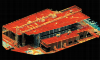

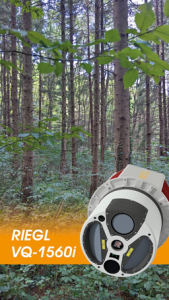



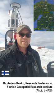


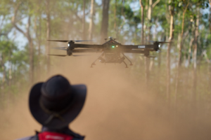

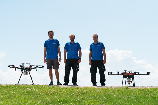




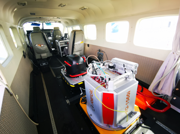
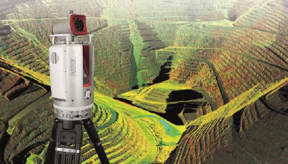



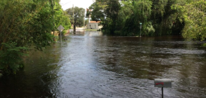



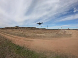
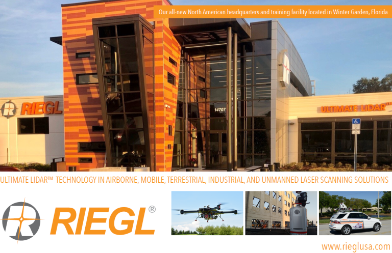


![[SCS] Estadio Nacional LiDAR [SCS] Estadio Nacional LiDAR](/wp-content/uploads/maxresdefault-6.jpg)


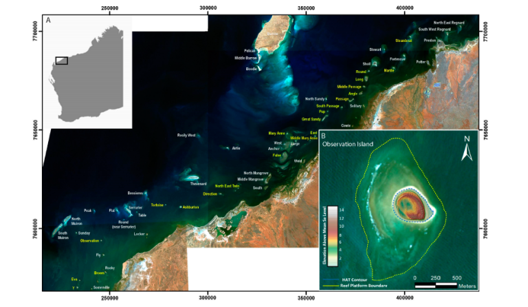

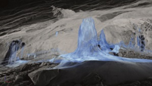









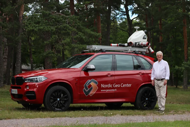



![[SCS] Estadio Nacional LiDAR [SCS] Estadio Nacional LiDAR](/wp-content/uploads/maxresdefault-7.jpg)
